Wildfire Alert Report
| Date: | 2023-08-10 |
|---|---|
| Time: | 09:41:30 |
| Production Date and Time: | 2023-08-10 09:45:35 UTC |
| Primary Instrument: | GOES-18 ABI |
| Wmo Spacecraft Id: | 665 |
| Location/orbit: | GEO |
| L1 File: | OR_ABI-L1b-RadC-M6C14_G18_s20232220941176_e20232220943549_c20232220944012.nc |
| L1 File(s) - Temporal | OR_ABI-L1b-RadC-M6C14_G18_s20232220936176_e20232220938549_c20232220939024.nc |
| Number Of Thermal Anomaly Alerts: | 1 |
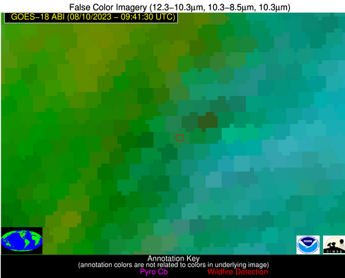
Possible Wildfire
| Basic Information | |
|---|---|
| State/Province(s) | MT |
| Country/Countries | USA |
| County/Locality(s) | Powder River County, MT |
| NWS WFO | Billings MT |
| Identification Method | Enhanced Contextual (Cloud) |
| Mean Object Date/Time | 2023-08-10 09:41:24UTC |
| Radiative Center (Lat, Lon): | 45.330000°, -105.300000° |
| Nearby Counties (meeting alert criteria): |
|
| Total Radiative Power Anomaly | n/a |
| Total Radiative Power | 70.73 MW |
| Map: | |
| Additional Information | |
| Alert Status | New Feature |
| Type of Event | Nominal Risk |
| Event Priority Ranking | 4 |
| Maximum Observed BT (3.9 um) | 278.76 K |
| Observed - Background BT (3.9 um) | 11.84 K |
| BT Anomaly (3.9 um) | 6.11 K |
| Maximum Observed - Clear RTM BT (3.9 um) | -8.32 K |
| Maximum Observed BTD (3.9-10/11/12 um) | 26.71 K |
| Observed - Background BTD (3.9-10/11/12 um) | 10.78 K |
| BTD Anomaly (3.9-10/11/12 um) | 5.67 K |
| Similar Pixel Count | 0 |
| BT Time Tendency (3.9 um) | 11.20 K |
| Image Interval | 5.00 minutes |
| Fraction of Surrounding LWIR Pixels that are Colder | 0.54 |
| Fraction of Surrounding Red Channel Pixels that are Brighter | 1.00 |
| Maximum Radiative Power | 70.73 MW |
| Maximum Radiative Power Uncertainty | 0.00 MW |
| Total Radiative Power Uncertainty | 0.00 MW |
| Mean Viewing Angle | 61.20° |
| Mean Solar Zenith Angle | 109.30° |
| Mean Glint Angle | 48.10° |
| Water Fraction | 0.00 |
| Total Pixel Area | 11.40 km2 |
| Latest Satellite Imagery: | |
| View all event imagery » | |


