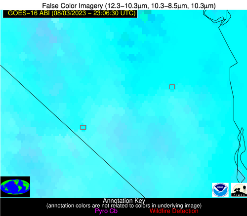
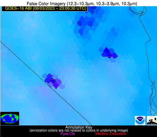
Wildfire Alert Report
| Date: | 2023-08-03 |
|---|---|
| Time: | 23:06:30 |
| Production Date and Time: | 2023-08-03 23:10:28 UTC |
| Primary Instrument: | GOES-16 ABI |
| Wmo Spacecraft Id: | 152 |
| Location/orbit: | GEO |
| L1 File: | OR_ABI-L1b-RadC-M6C14_G16_s20232152306175_e20232152308548_c20232152309033.nc |
| L1 File(s) - Temporal | OR_ABI-L1b-RadC-M6C14_G16_s20232152301175_e20232152303548_c20232152304027.nc |
| Number Of Thermal Anomaly Alerts: | 3 |
Possible Wildfire
| Basic Information | |
|---|---|
| State/Province(s) | AR |
| Country/Countries | USA |
| County/Locality(s) | Monroe County, AR |
| NWS WFO | Little Rock AR |
| Identification Method | Enhanced Contextual (Cloud) |
| Mean Object Date/Time | 2023-08-03 23:07:21UTC |
| Radiative Center (Lat, Lon): | 34.730000°, -91.130000° |
| Nearby Counties (meeting alert criteria): |
|
| Total Radiative Power Anomaly | n/a |
| Total Radiative Power | 394.31 MW |
| Map: | |
| Additional Information | |
| Alert Status | New Feature |
| Type of Event | Nominal Risk |
| Event Priority Ranking | 4 |
| Maximum Observed BT (3.9 um) | 335.45 K |
| Observed - Background BT (3.9 um) | 31.50 K |
| BT Anomaly (3.9 um) | 52.52 K |
| Maximum Observed - Clear RTM BT (3.9 um) | 32.37 K |
| Maximum Observed BTD (3.9-10/11/12 um) | 40.24 K |
| Observed - Background BTD (3.9-10/11/12 um) | 30.88 K |
| BTD Anomaly (3.9-10/11/12 um) | 42.50 K |
| Similar Pixel Count | 0 |
| BT Time Tendency (3.9 um) | 30.60 K |
| Image Interval | 5.00 minutes |
| Fraction of Surrounding LWIR Pixels that are Colder | 0.93 |
| Fraction of Surrounding Red Channel Pixels that are Brighter | 1.00 |
| Maximum Radiative Power | 193.31 MW |
| Maximum Radiative Power Uncertainty | 0.00 MW |
| Total Radiative Power Uncertainty | 0.00 MW |
| Mean Viewing Angle | 44.00° |
| Mean Solar Zenith Angle | 67.00° |
| Mean Glint Angle | 50.90° |
| Water Fraction | 0.00 |
| Total Pixel Area | 18.70 km2 |
| Latest Satellite Imagery: | |
| View all event imagery » | |
Possible Wildfire
| Basic Information | |
|---|---|
| State/Province(s) | NV |
| Country/Countries | USA |
| County/Locality(s) | Clark County, NV |
| NWS WFO | Las Vegas NV |
| Identification Method | Enhanced Contextual (Cloud) |
| Mean Object Date/Time | 2023-08-03 23:07:18UTC |
| Radiative Center (Lat, Lon): | 35.780000°, -114.960000° |
| Nearby Counties (meeting alert criteria): |
|
| Total Radiative Power Anomaly | n/a |
| Total Radiative Power | 1549.33 MW |
| Map: | |
| Additional Information | |
| Alert Status | New Feature |
| Type of Event | Solar panel |
| Event Priority Ranking | 5 |
| Maximum Observed BT (3.9 um) | 366.26 K |
| Observed - Background BT (3.9 um) | 49.29 K |
| BT Anomaly (3.9 um) | 19.82 K |
| Maximum Observed - Clear RTM BT (3.9 um) | 51.41 K |
| Maximum Observed BTD (3.9-10/11/12 um) | 58.39 K |
| Observed - Background BTD (3.9-10/11/12 um) | 48.06 K |
| BTD Anomaly (3.9-10/11/12 um) | 20.82 K |
| Similar Pixel Count | 0 |
| BT Time Tendency (3.9 um) | 31.20 K |
| Image Interval | 5.00 minutes |
| Fraction of Surrounding LWIR Pixels that are Colder | 0.71 |
| Fraction of Surrounding Red Channel Pixels that are Brighter | 0.00 |
| Maximum Radiative Power | 776.09 MW |
| Maximum Radiative Power Uncertainty | 0.00 MW |
| Total Radiative Power Uncertainty | 0.00 MW |
| Mean Viewing Angle | 59.20° |
| Mean Solar Zenith Angle | 47.60° |
| Mean Glint Angle | 36.30° |
| Water Fraction | 0.00 |
| Total Pixel Area | 44.10 km2 |
| Latest Satellite Imagery: | |
| View all event imagery » | |
Possible Wildfire
| Basic Information | |
|---|---|
| State/Province(s) | NV |
| Country/Countries | USA |
| County/Locality(s) | Clark County, NV |
| NWS WFO | Las Vegas NV |
| Identification Method | Enhanced Contextual (Cloud) |
| Mean Object Date/Time | 2023-08-03 23:07:18UTC |
| Radiative Center (Lat, Lon): | 35.620000°, -115.350000° |
| Nearby Counties (meeting alert criteria): |
|
| Total Radiative Power Anomaly | n/a |
| Total Radiative Power | 1809.34 MW |
| Map: | |
| Additional Information | |
| Alert Status | New Feature |
| Type of Event | Nominal Risk, Known Incident: YORK (LOW, tdiff=0.76979 days, PERIMETER) |
| Event Priority Ranking | 4 |
| Maximum Observed BT (3.9 um) | 372.67 K |
| Observed - Background BT (3.9 um) | 54.45 K |
| BT Anomaly (3.9 um) | 25.37 K |
| Maximum Observed - Clear RTM BT (3.9 um) | 57.84 K |
| Maximum Observed BTD (3.9-10/11/12 um) | 61.02 K |
| Observed - Background BTD (3.9-10/11/12 um) | 52.88 K |
| BTD Anomaly (3.9-10/11/12 um) | 66.18 K |
| Similar Pixel Count | 0 |
| BT Time Tendency (3.9 um) | 32.50 K |
| Image Interval | 5.00 minutes |
| Fraction of Surrounding LWIR Pixels that are Colder | 0.87 |
| Fraction of Surrounding Red Channel Pixels that are Brighter | 0.00 |
| Maximum Radiative Power | 933.10 MW |
| Maximum Radiative Power Uncertainty | 0.00 MW |
| Total Radiative Power Uncertainty | 0.00 MW |
| Mean Viewing Angle | 59.40° |
| Mean Solar Zenith Angle | 47.20° |
| Mean Glint Angle | 36.20° |
| Water Fraction | 0.00 |
| Total Pixel Area | 55.70 km2 |
| Latest Satellite Imagery: | |
| View all event imagery » | |


