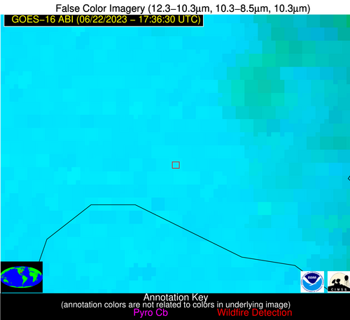
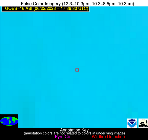
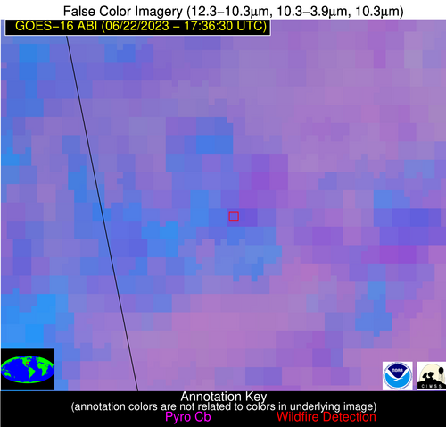
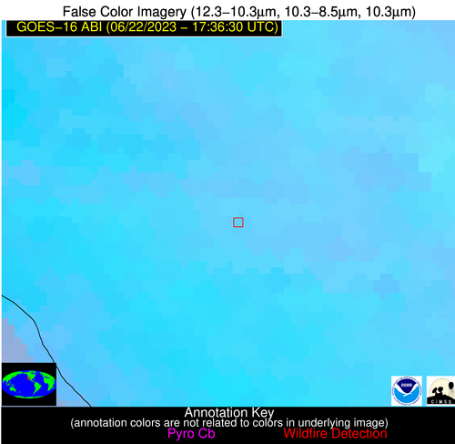
Wildfire Alert Report
| Date: | 2023-06-22 |
|---|---|
| Time: | 17:36:30 |
| Production Date and Time: | 2023-06-22 17:40:25 UTC |
| Primary Instrument: | GOES-16 ABI |
| Wmo Spacecraft Id: | 152 |
| Location/orbit: | GEO |
| L1 File: | OR_ABI-L1b-RadC-M6C14_G16_s20231731736186_e20231731738559_c20231731739047.nc |
| L1 File(s) - Temporal | OR_ABI-L1b-RadC-M6C14_G16_s20231731731186_e20231731733559_c20231731734048.nc |
| Number Of Thermal Anomaly Alerts: | 7 |
Possible Wildfire
| Basic Information | |
|---|---|
| State/Province(s) | IL |
| Country/Countries | USA |
| County/Locality(s) | Massac County, IL |
| NWS WFO | Paducah KY |
| Identification Method | Enhanced Contextual (Clear) |
| Mean Object Date/Time | 2023-06-22 17:36:52UTC |
| Radiative Center (Lat, Lon): | 37.310000°, -88.840000° |
| Nearby Counties (meeting alert criteria): |
|
| Total Radiative Power Anomaly | n/a |
| Total Radiative Power | 56.36 MW |
| Map: | |
| Additional Information | |
| Alert Status | New Feature |
| Type of Event | Nominal Risk |
| Event Priority Ranking | 4 |
| Maximum Observed BT (3.9 um) | 311.88 K |
| Observed - Background BT (3.9 um) | 6.61 K |
| BT Anomaly (3.9 um) | 4.56 K |
| Maximum Observed - Clear RTM BT (3.9 um) | 16.60 K |
| Maximum Observed BTD (3.9-10/11/12 um) | 19.82 K |
| Observed - Background BTD (3.9-10/11/12 um) | 5.33 K |
| BTD Anomaly (3.9-10/11/12 um) | 4.13 K |
| Similar Pixel Count | 23 |
| BT Time Tendency (3.9 um) | 1.70 K |
| Image Interval | 5.00 minutes |
| Fraction of Surrounding LWIR Pixels that are Colder | 1.00 |
| Fraction of Surrounding Red Channel Pixels that are Brighter | 0.75 |
| Maximum Radiative Power | 21.85 MW |
| Maximum Radiative Power Uncertainty | 0.00 MW |
| Total Radiative Power Uncertainty | 0.00 MW |
| Mean Viewing Angle | 45.80° |
| Mean Solar Zenith Angle | 14.50° |
| Mean Glint Angle | 60.30° |
| Water Fraction | 0.00 |
| Total Pixel Area | 19.30 km2 |
| Latest Satellite Imagery: | |
| View all event imagery » | |
Possible Wildfire
| Basic Information | |
|---|---|
| State/Province(s) | CA |
| Country/Countries | USA |
| County/Locality(s) | San Joaquin County, CA |
| NWS WFO | Sacramento CA |
| Identification Method | Enhanced Contextual (Clear) |
| Mean Object Date/Time | 2023-06-22 17:37:19UTC |
| Radiative Center (Lat, Lon): | 37.640000°, -121.520000° |
| Nearby Counties (meeting alert criteria): |
|
| Total Radiative Power Anomaly | n/a |
| Total Radiative Power | 361.87 MW |
| Map: | |
| Additional Information | |
| Alert Status | New Feature |
| Type of Event | Nominal Risk |
| Event Priority Ranking | 4 |
| Maximum Observed BT (3.9 um) | 316.16 K |
| Observed - Background BT (3.9 um) | 13.16 K |
| BT Anomaly (3.9 um) | 5.81 K |
| Maximum Observed - Clear RTM BT (3.9 um) | 17.23 K |
| Maximum Observed BTD (3.9-10/11/12 um) | 24.41 K |
| Observed - Background BTD (3.9-10/11/12 um) | 12.66 K |
| BTD Anomaly (3.9-10/11/12 um) | 12.04 K |
| Similar Pixel Count | 4 |
| BT Time Tendency (3.9 um) | 9.70 K |
| Image Interval | 5.00 minutes |
| Fraction of Surrounding LWIR Pixels that are Colder | 0.78 |
| Fraction of Surrounding Red Channel Pixels that are Brighter | 0.41 |
| Maximum Radiative Power | 96.17 MW |
| Maximum Radiative Power Uncertainty | 0.00 MW |
| Total Radiative Power Uncertainty | 0.00 MW |
| Mean Viewing Angle | 65.20° |
| Mean Solar Zenith Angle | 35.20° |
| Mean Glint Angle | 99.00° |
| Water Fraction | 0.00 |
| Total Pixel Area | 62.20 km2 |
| Latest Satellite Imagery: | |
| View all event imagery » | |
Possible Wildfire
| Basic Information | |
|---|---|
| State/Province(s) | CA |
| Country/Countries | USA |
| County/Locality(s) | Madera County, CA |
| NWS WFO | Hanford CA |
| Identification Method | Enhanced Contextual (Clear) |
| Mean Object Date/Time | 2023-06-22 17:37:19UTC |
| Radiative Center (Lat, Lon): | 37.000000°, -120.240000° |
| Nearby Counties (meeting alert criteria): |
|
| Total Radiative Power Anomaly | n/a |
| Total Radiative Power | 21.32 MW |
| Map: | |
| Additional Information | |
| Alert Status | New Feature |
| Type of Event | Nominal Risk |
| Event Priority Ranking | 4 |
| Maximum Observed BT (3.9 um) | 303.69 K |
| Observed - Background BT (3.9 um) | 2.00 K |
| BT Anomaly (3.9 um) | 1.35 K |
| Maximum Observed - Clear RTM BT (3.9 um) | 3.11 K |
| Maximum Observed BTD (3.9-10/11/12 um) | 13.03 K |
| Observed - Background BTD (3.9-10/11/12 um) | 2.83 K |
| BTD Anomaly (3.9-10/11/12 um) | 2.91 K |
| Similar Pixel Count | 25 |
| BT Time Tendency (3.9 um) | 1.30 K |
| Image Interval | 5.00 minutes |
| Fraction of Surrounding LWIR Pixels that are Colder | 0.12 |
| Fraction of Surrounding Red Channel Pixels that are Brighter | 1.00 |
| Maximum Radiative Power | 21.32 MW |
| Maximum Radiative Power Uncertainty | 0.00 MW |
| Total Radiative Power Uncertainty | 0.00 MW |
| Mean Viewing Angle | 63.80° |
| Mean Solar Zenith Angle | 34.00° |
| Mean Glint Angle | 96.40° |
| Water Fraction | 0.00 |
| Total Pixel Area | 14.30 km2 |
| Latest Satellite Imagery: | |
| View all event imagery » | |
Possible Wildfire
| Basic Information | |
|---|---|
| State/Province(s) | Unknown |
| Country/Countries | Unknown |
| County/Locality(s) | Unknown |
| NWS WFO | N/A |
| Identification Method | Enhanced Contextual (Clear) |
| Mean Object Date/Time | 2023-06-22 17:37:24UTC |
| Radiative Center (Lat, Lon): | 34.060000°, -71.860000° |
| Nearby Counties (meeting alert criteria): |
|
| Total Radiative Power Anomaly | n/a |
| Total Radiative Power | 6.06 MW |
| Map: | |
| Additional Information | |
| Alert Status | New Feature |
| Type of Event | Nominal Risk |
| Event Priority Ranking | 4 |
| Maximum Observed BT (3.9 um) | 298.22 K |
| Observed - Background BT (3.9 um) | 2.33 K |
| BT Anomaly (3.9 um) | 3.07 K |
| Maximum Observed - Clear RTM BT (3.9 um) | 3.17 K |
| Maximum Observed BTD (3.9-10/11/12 um) | 12.91 K |
| Observed - Background BTD (3.9-10/11/12 um) | 2.46 K |
| BTD Anomaly (3.9-10/11/12 um) | 2.66 K |
| Similar Pixel Count | 25 |
| BT Time Tendency (3.9 um) | 1.20 K |
| Image Interval | 5.00 minutes |
| Fraction of Surrounding LWIR Pixels that are Colder | 0.32 |
| Fraction of Surrounding Red Channel Pixels that are Brighter | 0.98 |
| Maximum Radiative Power | 6.06 MW |
| Maximum Radiative Power Uncertainty | 0.00 MW |
| Total Radiative Power Uncertainty | 0.00 MW |
| Mean Viewing Angle | 39.90° |
| Mean Solar Zenith Angle | 14.80° |
| Mean Glint Angle | 51.80° |
| Water Fraction | 1.00 |
| Total Pixel Area | 5.60 km2 |
| Latest Satellite Imagery: | |
| View all event imagery » | |
Possible Wildfire
| Basic Information | |
|---|---|
| State/Province(s) | GA |
| Country/Countries | USA |
| County/Locality(s) | Carroll County, GA |
| NWS WFO | Peachtree City GA |
| Identification Method | Enhanced Contextual (Clear) |
| Mean Object Date/Time | 2023-06-22 17:37:22UTC |
| Radiative Center (Lat, Lon): | 33.540000°, -85.130000° |
| Nearby Counties (meeting alert criteria): |
|
| Total Radiative Power Anomaly | n/a |
| Total Radiative Power | 12.17 MW |
| Map: | |
| Additional Information | |
| Alert Status | New Feature |
| Type of Event | Nominal Risk |
| Event Priority Ranking | 4 |
| Maximum Observed BT (3.9 um) | 303.91 K |
| Observed - Background BT (3.9 um) | 5.21 K |
| BT Anomaly (3.9 um) | 3.15 K |
| Maximum Observed - Clear RTM BT (3.9 um) | 14.98 K |
| Maximum Observed BTD (3.9-10/11/12 um) | 20.13 K |
| Observed - Background BTD (3.9-10/11/12 um) | 4.39 K |
| BTD Anomaly (3.9-10/11/12 um) | 3.79 K |
| Similar Pixel Count | 25 |
| BT Time Tendency (3.9 um) | 1.90 K |
| Image Interval | 5.00 minutes |
| Fraction of Surrounding LWIR Pixels that are Colder | 0.83 |
| Fraction of Surrounding Red Channel Pixels that are Brighter | 1.00 |
| Maximum Radiative Power | 12.17 MW |
| Maximum Radiative Power Uncertainty | 0.00 MW |
| Total Radiative Power Uncertainty | 0.00 MW |
| Mean Viewing Angle | 40.60° |
| Mean Solar Zenith Angle | 10.10° |
| Mean Glint Angle | 50.60° |
| Water Fraction | 0.00 |
| Total Pixel Area | 5.70 km2 |
| Latest Satellite Imagery: | |
| View all event imagery » | |
Possible Wildfire
| Basic Information | |
|---|---|
| State/Province(s) | Unknown |
| Country/Countries | Mexico |
| County/Locality(s) | Mexico |
| NWS WFO | N/A |
| Identification Method | Enhanced Contextual (Clear) |
| Mean Object Date/Time | 2023-06-22 17:37:19UTC |
| Radiative Center (Lat, Lon): | 31.550000°, -116.230000° |
| Nearby Counties (meeting alert criteria): |
|
| Total Radiative Power Anomaly | n/a |
| Total Radiative Power | 36.00 MW |
| Map: | |
| Additional Information | |
| Alert Status | New Feature |
| Type of Event | Nominal Risk |
| Event Priority Ranking | 4 |
| Maximum Observed BT (3.9 um) | 314.04 K |
| Observed - Background BT (3.9 um) | 4.71 K |
| BT Anomaly (3.9 um) | 3.04 K |
| Maximum Observed - Clear RTM BT (3.9 um) | 5.82 K |
| Maximum Observed BTD (3.9-10/11/12 um) | 12.79 K |
| Observed - Background BTD (3.9-10/11/12 um) | 4.28 K |
| BTD Anomaly (3.9-10/11/12 um) | 4.86 K |
| Similar Pixel Count | 4 |
| BT Time Tendency (3.9 um) | 3.40 K |
| Image Interval | 5.00 minutes |
| Fraction of Surrounding LWIR Pixels that are Colder | 0.71 |
| Fraction of Surrounding Red Channel Pixels that are Brighter | 0.95 |
| Maximum Radiative Power | 36.00 MW |
| Maximum Radiative Power Uncertainty | 0.00 MW |
| Total Radiative Power Uncertainty | 0.00 MW |
| Mean Viewing Angle | 57.60° |
| Mean Solar Zenith Angle | 29.80° |
| Mean Glint Angle | 85.40° |
| Water Fraction | 0.00 |
| Total Pixel Area | 10.30 km2 |
| Latest Satellite Imagery: | |
| View all event imagery » | |
Possible Wildfire
| Basic Information | |
|---|---|
| State/Province(s) | Unknown |
| Country/Countries | Mexico |
| County/Locality(s) | Mexico |
| NWS WFO | N/A |
| Identification Method | Enhanced Contextual (Cloud) |
| Mean Object Date/Time | 2023-06-22 17:37:20UTC |
| Radiative Center (Lat, Lon): | 30.880000°, -107.420000° |
| Nearby Counties (meeting alert criteria): |
|
| Total Radiative Power Anomaly | n/a |
| Total Radiative Power | 565.21 MW |
| Map: | |
| Additional Information | |
| Alert Status | New Feature |
| Type of Event | Nominal Risk |
| Event Priority Ranking | 4 |
| Maximum Observed BT (3.9 um) | 345.87 K |
| Observed - Background BT (3.9 um) | 20.74 K |
| BT Anomaly (3.9 um) | 13.83 K |
| Maximum Observed - Clear RTM BT (3.9 um) | 25.27 K |
| Maximum Observed BTD (3.9-10/11/12 um) | 35.48 K |
| Observed - Background BTD (3.9-10/11/12 um) | 21.68 K |
| BTD Anomaly (3.9-10/11/12 um) | 28.23 K |
| Similar Pixel Count | 0 |
| BT Time Tendency (3.9 um) | 23.70 K |
| Image Interval | 5.00 minutes |
| Fraction of Surrounding LWIR Pixels that are Colder | 0.12 |
| Fraction of Surrounding Red Channel Pixels that are Brighter | 0.88 |
| Maximum Radiative Power | 212.33 MW |
| Maximum Radiative Power Uncertainty | 0.00 MW |
| Total Radiative Power Uncertainty | 0.00 MW |
| Mean Viewing Angle | 50.40° |
| Mean Solar Zenith Angle | 22.30° |
| Mean Glint Angle | 71.00° |
| Water Fraction | 0.00 |
| Total Pixel Area | 30.80 km2 |
| Latest Satellite Imagery: | |
| View all event imagery » | |
