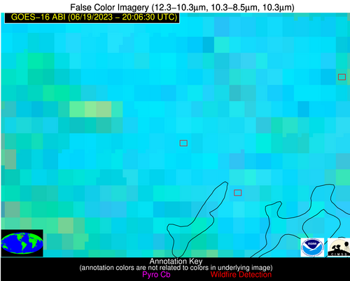
Wildfire Alert Report
| Date: | 2023-06-19 |
|---|---|
| Time: | 20:06:30 |
| Production Date and Time: | 2023-06-19 20:10:33 UTC |
| Primary Instrument: | GOES-16 ABI |
| Wmo Spacecraft Id: | 152 |
| Location/orbit: | GEO |
| L1 File: | OR_ABI-L1b-RadC-M6C14_G16_s20231702006182_e20231702008555_c20231702009048.nc |
| L1 File(s) - Temporal | OR_ABI-L1b-RadC-M6C14_G16_s20231702001182_e20231702003555_c20231702004034.nc |
| Number Of Thermal Anomaly Alerts: | 3 |
Possible Wildfire
| Basic Information | |
|---|---|
| State/Province(s) | Unknown |
| Country/Countries | Canada |
| County/Locality(s) | Canada |
| NWS WFO | N/A |
| Identification Method | Enhanced Contextual (Clear) |
| Mean Object Date/Time | 2023-06-19 20:06:23UTC |
| Radiative Center (Lat, Lon): | 48.740000°, -76.150000° |
| Nearby Counties (meeting alert criteria): |
|
| Total Radiative Power Anomaly | n/a |
| Total Radiative Power | 22.46 MW |
| Map: | |
| Additional Information | |
| Alert Status | New Feature |
| Type of Event | Nominal Risk |
| Event Priority Ranking | 4 |
| Maximum Observed BT (3.9 um) | 307.04 K |
| Observed - Background BT (3.9 um) | 6.35 K |
| BT Anomaly (3.9 um) | 1.80 K |
| Maximum Observed - Clear RTM BT (3.9 um) | 13.73 K |
| Maximum Observed BTD (3.9-10/11/12 um) | 18.00 K |
| Observed - Background BTD (3.9-10/11/12 um) | 6.02 K |
| BTD Anomaly (3.9-10/11/12 um) | 1.83 K |
| Similar Pixel Count | 12 |
| BT Time Tendency (3.9 um) | 3.30 K |
| Image Interval | 5.00 minutes |
| Fraction of Surrounding LWIR Pixels that are Colder | 0.77 |
| Fraction of Surrounding Red Channel Pixels that are Brighter | 0.92 |
| Maximum Radiative Power | 22.46 MW |
| Maximum Radiative Power Uncertainty | 0.00 MW |
| Total Radiative Power Uncertainty | 0.00 MW |
| Mean Viewing Angle | 56.20° |
| Mean Solar Zenith Angle | 43.50° |
| Mean Glint Angle | 76.70° |
| Water Fraction | 0.00 |
| Total Pixel Area | 8.20 km2 |
| Latest Satellite Imagery: | |
| View all event imagery » | |
Possible Wildfire
| Basic Information | |
|---|---|
| State/Province(s) | MO |
| Country/Countries | USA |
| County/Locality(s) | Vernon County, MO |
| NWS WFO | Springfield MO |
| Identification Method | Enhanced Contextual (Cloud) |
| Mean Object Date/Time | 2023-06-19 20:06:51UTC |
| Radiative Center (Lat, Lon): | 38.010000°, -94.520000° |
| Nearby Counties (meeting alert criteria): |
|
| Total Radiative Power Anomaly | n/a |
| Total Radiative Power | 219.55 MW |
| Map: | |
| Additional Information | |
| Alert Status | New Feature |
| Type of Event | Nominal Risk |
| Event Priority Ranking | 4 |
| Maximum Observed BT (3.9 um) | 319.83 K |
| Observed - Background BT (3.9 um) | 14.51 K |
| BT Anomaly (3.9 um) | 10.76 K |
| Maximum Observed - Clear RTM BT (3.9 um) | 17.74 K |
| Maximum Observed BTD (3.9-10/11/12 um) | 23.50 K |
| Observed - Background BTD (3.9-10/11/12 um) | 14.35 K |
| BTD Anomaly (3.9-10/11/12 um) | 14.07 K |
| Similar Pixel Count | 0 |
| BT Time Tendency (3.9 um) | 11.20 K |
| Image Interval | 5.00 minutes |
| Fraction of Surrounding LWIR Pixels that are Colder | 0.62 |
| Fraction of Surrounding Red Channel Pixels that are Brighter | 1.00 |
| Maximum Radiative Power | 73.24 MW |
| Maximum Radiative Power Uncertainty | 0.00 MW |
| Total Radiative Power Uncertainty | 0.00 MW |
| Mean Viewing Angle | 48.70° |
| Mean Solar Zenith Angle | 27.20° |
| Mean Glint Angle | 51.90° |
| Water Fraction | 0.00 |
| Total Pixel Area | 28.10 km2 |
| Latest Satellite Imagery: | |
| View all event imagery » | |
Possible Wildfire
| Basic Information | |
|---|---|
| State/Province(s) | MO |
| Country/Countries | USA |
| County/Locality(s) | Stoddard County, MO |
| NWS WFO | Paducah KY |
| Identification Method | Enhanced Contextual (Clear) |
| Mean Object Date/Time | 2023-06-19 20:06:52UTC |
| Radiative Center (Lat, Lon): | 36.950000°, -89.740000° |
| Nearby Counties (meeting alert criteria): |
|
| Total Radiative Power Anomaly | n/a |
| Total Radiative Power | 65.70 MW |
| Map: | |
| Additional Information | |
| Alert Status | New Feature |
| Type of Event | Nominal Risk |
| Event Priority Ranking | 4 |
| Maximum Observed BT (3.9 um) | 313.47 K |
| Observed - Background BT (3.9 um) | 9.17 K |
| BT Anomaly (3.9 um) | 5.39 K |
| Maximum Observed - Clear RTM BT (3.9 um) | 15.61 K |
| Maximum Observed BTD (3.9-10/11/12 um) | 24.04 K |
| Observed - Background BTD (3.9-10/11/12 um) | 8.83 K |
| BTD Anomaly (3.9-10/11/12 um) | 6.87 K |
| Similar Pixel Count | 7 |
| BT Time Tendency (3.9 um) | 6.80 K |
| Image Interval | 5.00 minutes |
| Fraction of Surrounding LWIR Pixels that are Colder | 0.64 |
| Fraction of Surrounding Red Channel Pixels that are Brighter | 0.40 |
| Maximum Radiative Power | 39.51 MW |
| Maximum Radiative Power Uncertainty | 0.00 MW |
| Total Radiative Power Uncertainty | 0.00 MW |
| Mean Viewing Angle | 45.70° |
| Mean Solar Zenith Angle | 30.30° |
| Mean Glint Angle | 50.20° |
| Water Fraction | 0.00 |
| Total Pixel Area | 12.90 km2 |
| Latest Satellite Imagery: | |
| View all event imagery » | |


