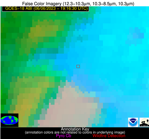
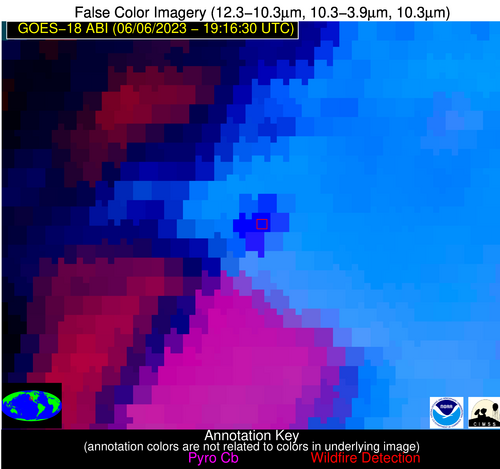
Wildfire Alert Report
| Date: | 2023-06-06 |
|---|---|
| Time: | 19:16:30 |
| Production Date and Time: | 2023-06-06 19:20:25 UTC |
| Primary Instrument: | GOES-18 ABI |
| Wmo Spacecraft Id: | 665 |
| Location/orbit: | GEO |
| L1 File: | OR_ABI-L1b-RadC-M6C14_G18_s20231571916191_e20231571918564_c20231571919044.nc |
| L1 File(s) - Temporal | OR_ABI-L1b-RadC-M6C14_G18_s20231571911191_e20231571913564_c20231571914030.nc |
| Number Of Thermal Anomaly Alerts: | 3 |
Possible Wildfire
| Basic Information | |
|---|---|
| State/Province(s) | Unknown |
| Country/Countries | Canada |
| County/Locality(s) | Canada |
| NWS WFO | N/A |
| Identification Method | Enhanced Contextual (Clear) |
| Mean Object Date/Time | 2023-06-06 19:16:24UTC |
| Radiative Center (Lat, Lon): | 50.270000°, -121.320000° |
| Nearby Counties (meeting alert criteria): |
|
| Total Radiative Power Anomaly | n/a |
| Total Radiative Power | 3.79 MW |
| Map: | |
| Additional Information | |
| Alert Status | New Feature |
| Type of Event | Nominal Risk |
| Event Priority Ranking | 4 |
| Maximum Observed BT (3.9 um) | 307.11 K |
| Observed - Background BT (3.9 um) | 3.29 K |
| BT Anomaly (3.9 um) | 1.69 K |
| Maximum Observed - Clear RTM BT (3.9 um) | 13.24 K |
| Maximum Observed BTD (3.9-10/11/12 um) | 7.98 K |
| Observed - Background BTD (3.9-10/11/12 um) | 1.21 K |
| BTD Anomaly (3.9-10/11/12 um) | 1.59 K |
| Similar Pixel Count | 22 |
| BT Time Tendency (3.9 um) | 1.00 K |
| Image Interval | 5.00 minutes |
| Fraction of Surrounding LWIR Pixels that are Colder | 0.79 |
| Fraction of Surrounding Red Channel Pixels that are Brighter | 1.00 |
| Maximum Radiative Power | 3.79 MW |
| Maximum Radiative Power Uncertainty | 0.00 MW |
| Total Radiative Power Uncertainty | 0.00 MW |
| Mean Viewing Angle | 59.90° |
| Mean Solar Zenith Angle | 29.20° |
| Mean Glint Angle | 82.60° |
| Water Fraction | 0.00 |
| Total Pixel Area | 9.60 km2 |
| Latest Satellite Imagery: | |
| View all event imagery » | |
Possible Wildfire
| Basic Information | |
|---|---|
| State/Province(s) | MN |
| Country/Countries | USA |
| County/Locality(s) | Roseau County, MN |
| NWS WFO | Grand Forks ND |
| Identification Method | Enhanced Contextual (Clear) |
| Mean Object Date/Time | 2023-06-06 19:16:27UTC |
| Radiative Center (Lat, Lon): | 48.810000°, -96.150000° |
| Nearby Counties (meeting alert criteria): |
|
| Total Radiative Power Anomaly | n/a |
| Total Radiative Power | 47.59 MW |
| Map: | |
| Additional Information | |
| Alert Status | New Feature |
| Type of Event | Nominal Risk |
| Event Priority Ranking | 4 |
| Maximum Observed BT (3.9 um) | 308.59 K |
| Observed - Background BT (3.9 um) | 5.60 K |
| BT Anomaly (3.9 um) | 2.24 K |
| Maximum Observed - Clear RTM BT (3.9 um) | 16.10 K |
| Maximum Observed BTD (3.9-10/11/12 um) | 26.12 K |
| Observed - Background BTD (3.9-10/11/12 um) | 5.66 K |
| BTD Anomaly (3.9-10/11/12 um) | 2.88 K |
| Similar Pixel Count | 15 |
| BT Time Tendency (3.9 um) | 0.80 K |
| Image Interval | 5.00 minutes |
| Fraction of Surrounding LWIR Pixels that are Colder | 0.85 |
| Fraction of Surrounding Red Channel Pixels that are Brighter | 1.00 |
| Maximum Radiative Power | 47.59 MW |
| Maximum Radiative Power Uncertainty | 0.00 MW |
| Total Radiative Power Uncertainty | 0.00 MW |
| Mean Viewing Angle | 68.70° |
| Mean Solar Zenith Angle | 28.30° |
| Mean Glint Angle | 95.10° |
| Water Fraction | 0.00 |
| Total Pixel Area | 18.30 km2 |
| Latest Satellite Imagery: | |
| View all event imagery » | |
Possible Wildfire
| Basic Information | |
|---|---|
| State/Province(s) | CA |
| Country/Countries | USA |
| County/Locality(s) | Los Angeles County, CA |
| NWS WFO | Los Angeles/Oxnard CA |
| Identification Method | Enhanced Contextual (Cloud) |
| Mean Object Date/Time | 2023-06-06 19:17:25UTC |
| Radiative Center (Lat, Lon): | 34.700000°, -118.330000° |
| Nearby Counties (meeting alert criteria): |
|
| Total Radiative Power Anomaly | n/a |
| Total Radiative Power | 747.85 MW |
| Map: | |
| Additional Information | |
| Alert Status | New Feature |
| Type of Event | Solar panel |
| Event Priority Ranking | 5 |
| Maximum Observed BT (3.9 um) | 357.63 K |
| Observed - Background BT (3.9 um) | 45.72 K |
| BT Anomaly (3.9 um) | 12.45 K |
| Maximum Observed - Clear RTM BT (3.9 um) | 56.60 K |
| Maximum Observed BTD (3.9-10/11/12 um) | 63.61 K |
| Observed - Background BTD (3.9-10/11/12 um) | 47.25 K |
| BTD Anomaly (3.9-10/11/12 um) | 19.26 K |
| Similar Pixel Count | 0 |
| BT Time Tendency (3.9 um) | 46.60 K |
| Image Interval | 5.00 minutes |
| Fraction of Surrounding LWIR Pixels that are Colder | 0.71 |
| Fraction of Surrounding Red Channel Pixels that are Brighter | 0.00 |
| Maximum Radiative Power | 438.33 MW |
| Maximum Radiative Power Uncertainty | 0.00 MW |
| Total Radiative Power Uncertainty | 0.00 MW |
| Mean Viewing Angle | 45.20° |
| Mean Solar Zenith Angle | 14.30° |
| Mean Glint Angle | 52.50° |
| Water Fraction | 0.00 |
| Total Pixel Area | 25.70 km2 |
| Latest Satellite Imagery: | |
| View all event imagery » | |


