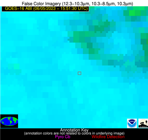
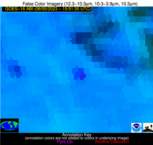
Wildfire Alert Report
| Date: | 2023-06-05 |
|---|---|
| Time: | 15:51:30 |
| Production Date and Time: | 2023-06-05 15:55:23 UTC |
| Primary Instrument: | GOES-16 ABI |
| Wmo Spacecraft Id: | 152 |
| Location/orbit: | GEO |
| L1 File: | OR_ABI-L1b-RadC-M6C14_G16_s20231561551179_e20231561553552_c20231561554046.nc |
| L1 File(s) - Temporal | OR_ABI-L1b-RadC-M6C14_G16_s20231561546179_e20231561548552_c20231561549040.nc |
| Number Of Thermal Anomaly Alerts: | 12 |
Possible Wildfire
| Basic Information | |
|---|---|
| State/Province(s) | Unknown |
| Country/Countries | Canada |
| County/Locality(s) | Canada |
| NWS WFO | N/A |
| Identification Method | Enhanced Contextual (Clear) |
| Mean Object Date/Time | 2023-06-05 15:51:20UTC |
| Radiative Center (Lat, Lon): | 51.460000°, -102.210000° |
| Nearby Counties (meeting alert criteria): |
|
| Total Radiative Power Anomaly | n/a |
| Total Radiative Power | 27.72 MW |
| Map: | |
| Additional Information | |
| Alert Status | New Feature |
| Type of Event | Nominal Risk |
| Event Priority Ranking | 4 |
| Maximum Observed BT (3.9 um) | 307.51 K |
| Observed - Background BT (3.9 um) | 5.21 K |
| BT Anomaly (3.9 um) | 3.37 K |
| Maximum Observed - Clear RTM BT (3.9 um) | 14.06 K |
| Maximum Observed BTD (3.9-10/11/12 um) | 23.96 K |
| Observed - Background BTD (3.9-10/11/12 um) | 4.37 K |
| BTD Anomaly (3.9-10/11/12 um) | 3.57 K |
| Similar Pixel Count | 25 |
| BT Time Tendency (3.9 um) | 3.80 K |
| Image Interval | 5.00 minutes |
| Fraction of Surrounding LWIR Pixels that are Colder | 0.97 |
| Fraction of Surrounding Red Channel Pixels that are Brighter | 1.00 |
| Maximum Radiative Power | 27.72 MW |
| Maximum Radiative Power Uncertainty | 0.00 MW |
| Total Radiative Power Uncertainty | 0.00 MW |
| Mean Viewing Angle | 64.50° |
| Mean Solar Zenith Angle | 44.40° |
| Mean Glint Angle | 102.90° |
| Water Fraction | 0.00 |
| Total Pixel Area | 12.70 km2 |
| Latest Satellite Imagery: | |
| View all event imagery » | |
Possible Wildfire
| Basic Information | |
|---|---|
| State/Province(s) | Unknown |
| Country/Countries | Canada |
| County/Locality(s) | Canada |
| NWS WFO | N/A |
| Identification Method | Enhanced Contextual (Clear) |
| Mean Object Date/Time | 2023-06-05 15:51:23UTC |
| Radiative Center (Lat, Lon): | 49.590000°, -68.470000° |
| Nearby Counties (meeting alert criteria): |
|
| Total Radiative Power Anomaly | n/a |
| Total Radiative Power | 273.01 MW |
| Map: | |
| Additional Information | |
| Alert Status | New Feature |
| Type of Event | Nominal Risk |
| Event Priority Ranking | 4 |
| Maximum Observed BT (3.9 um) | 316.78 K |
| Observed - Background BT (3.9 um) | 21.65 K |
| BT Anomaly (3.9 um) | 5.26 K |
| Maximum Observed - Clear RTM BT (3.9 um) | 26.93 K |
| Maximum Observed BTD (3.9-10/11/12 um) | 27.77 K |
| Observed - Background BTD (3.9-10/11/12 um) | 20.62 K |
| BTD Anomaly (3.9-10/11/12 um) | 5.25 K |
| Similar Pixel Count | 4 |
| BT Time Tendency (3.9 um) | 1.60 K |
| Image Interval | 5.00 minutes |
| Fraction of Surrounding LWIR Pixels that are Colder | 0.89 |
| Fraction of Surrounding Red Channel Pixels that are Brighter | 0.26 |
| Maximum Radiative Power | 106.12 MW |
| Maximum Radiative Power Uncertainty | 0.00 MW |
| Total Radiative Power Uncertainty | 0.00 MW |
| Mean Viewing Angle | 57.60° |
| Mean Solar Zenith Angle | 28.30° |
| Mean Glint Angle | 83.00° |
| Water Fraction | 0.20 |
| Total Pixel Area | 34.30 km2 |
| Latest Satellite Imagery: | |
| View all event imagery » | |
Possible Wildfire
| Basic Information | |
|---|---|
| State/Province(s) | Unknown |
| Country/Countries | Canada |
| County/Locality(s) | Canada |
| NWS WFO | N/A |
| Identification Method | Enhanced Contextual (Cloud) |
| Mean Object Date/Time | 2023-06-05 15:51:23UTC |
| Radiative Center (Lat, Lon): | 49.540000°, -69.700000° |
| Nearby Counties (meeting alert criteria): |
|
| Total Radiative Power Anomaly | n/a |
| Total Radiative Power | 237.93 MW |
| Map: | |
| Additional Information | |
| Alert Status | New Feature |
| Type of Event | Nominal Risk |
| Event Priority Ranking | 4 |
| Maximum Observed BT (3.9 um) | 314.31 K |
| Observed - Background BT (3.9 um) | 25.79 K |
| BT Anomaly (3.9 um) | 18.14 K |
| Maximum Observed - Clear RTM BT (3.9 um) | 26.12 K |
| Maximum Observed BTD (3.9-10/11/12 um) | 40.01 K |
| Observed - Background BTD (3.9-10/11/12 um) | 25.36 K |
| BTD Anomaly (3.9-10/11/12 um) | 21.49 K |
| Similar Pixel Count | 0 |
| BT Time Tendency (3.9 um) | 10.70 K |
| Image Interval | 5.00 minutes |
| Fraction of Surrounding LWIR Pixels that are Colder | 0.94 |
| Fraction of Surrounding Red Channel Pixels that are Brighter | 0.55 |
| Maximum Radiative Power | 143.27 MW |
| Maximum Radiative Power Uncertainty | 0.00 MW |
| Total Radiative Power Uncertainty | 0.00 MW |
| Mean Viewing Angle | 57.30° |
| Mean Solar Zenith Angle | 28.50° |
| Mean Glint Angle | 82.80° |
| Water Fraction | 0.00 |
| Total Pixel Area | 17.00 km2 |
| Latest Satellite Imagery: | |
| View all event imagery » | |
Possible Wildfire
| Basic Information | |
|---|---|
| State/Province(s) | Unknown |
| Country/Countries | Canada |
| County/Locality(s) | Canada |
| NWS WFO | N/A |
| Identification Method | Enhanced Contextual (Clear) |
| Mean Object Date/Time | 2023-06-05 15:51:23UTC |
| Radiative Center (Lat, Lon): | 48.700000°, -74.170000° |
| Nearby Counties (meeting alert criteria): |
|
| Total Radiative Power Anomaly | n/a |
| Total Radiative Power | 21.98 MW |
| Map: | |
| Additional Information | |
| Alert Status | New Feature |
| Type of Event | Nominal Risk |
| Event Priority Ranking | 4 |
| Maximum Observed BT (3.9 um) | 300.30 K |
| Observed - Background BT (3.9 um) | 5.44 K |
| BT Anomaly (3.9 um) | 10.15 K |
| Maximum Observed - Clear RTM BT (3.9 um) | 12.35 K |
| Maximum Observed BTD (3.9-10/11/12 um) | 12.21 K |
| Observed - Background BTD (3.9-10/11/12 um) | 3.35 K |
| BTD Anomaly (3.9-10/11/12 um) | 8.62 K |
| Similar Pixel Count | 14 |
| BT Time Tendency (3.9 um) | 0.40 K |
| Image Interval | 5.00 minutes |
| Fraction of Surrounding LWIR Pixels that are Colder | 1.00 |
| Fraction of Surrounding Red Channel Pixels that are Brighter | 1.00 |
| Maximum Radiative Power | 21.98 MW |
| Maximum Radiative Power Uncertainty | 0.00 MW |
| Total Radiative Power Uncertainty | 0.00 MW |
| Mean Viewing Angle | 56.20° |
| Mean Solar Zenith Angle | 29.10° |
| Mean Glint Angle | 81.60° |
| Water Fraction | 0.00 |
| Total Pixel Area | 8.20 km2 |
| Latest Satellite Imagery: | |
| View all event imagery » | |
Possible Wildfire
| Basic Information | |
|---|---|
| State/Province(s) | Unknown |
| Country/Countries | Canada |
| County/Locality(s) | Canada |
| NWS WFO | N/A |
| Identification Method | Enhanced Contextual (Clear) |
| Mean Object Date/Time | 2023-06-05 15:51:22UTC |
| Radiative Center (Lat, Lon): | 46.640000°, -82.250000° |
| Nearby Counties (meeting alert criteria): |
|
| Total Radiative Power Anomaly | n/a |
| Total Radiative Power | 8.68 MW |
| Map: | |
| Additional Information | |
| Alert Status | New Feature |
| Type of Event | Nominal Risk |
| Event Priority Ranking | 4 |
| Maximum Observed BT (3.9 um) | 298.93 K |
| Observed - Background BT (3.9 um) | 4.03 K |
| BT Anomaly (3.9 um) | 4.80 K |
| Maximum Observed - Clear RTM BT (3.9 um) | 7.28 K |
| Maximum Observed BTD (3.9-10/11/12 um) | 8.62 K |
| Observed - Background BTD (3.9-10/11/12 um) | 3.22 K |
| BTD Anomaly (3.9-10/11/12 um) | 7.30 K |
| Similar Pixel Count | 9 |
| BT Time Tendency (3.9 um) | 0.60 K |
| Image Interval | 5.00 minutes |
| Fraction of Surrounding LWIR Pixels that are Colder | 0.93 |
| Fraction of Surrounding Red Channel Pixels that are Brighter | 1.00 |
| Maximum Radiative Power | 8.68 MW |
| Maximum Radiative Power Uncertainty | 0.00 MW |
| Total Radiative Power Uncertainty | 0.00 MW |
| Mean Viewing Angle | 54.40° |
| Mean Solar Zenith Angle | 30.90° |
| Mean Glint Angle | 80.40° |
| Water Fraction | 0.00 |
| Total Pixel Area | 7.80 km2 |
| Latest Satellite Imagery: | |
| View all event imagery » | |
Possible Wildfire
| Basic Information | |
|---|---|
| State/Province(s) | MI |
| Country/Countries | USA |
| County/Locality(s) | Montmorency County, MI |
| NWS WFO | Gaylord MI |
| Identification Method | Enhanced Contextual (Clear) |
| Mean Object Date/Time | 2023-06-05 15:51:22UTC |
| Radiative Center (Lat, Lon): | 45.150000°, -83.920000° |
| Nearby Counties (meeting alert criteria): |
|
| Total Radiative Power Anomaly | n/a |
| Total Radiative Power | 20.47 MW |
| Map: | |
| Additional Information | |
| Alert Status | New Feature |
| Type of Event | Nominal Risk |
| Event Priority Ranking | 4 |
| Maximum Observed BT (3.9 um) | 302.32 K |
| Observed - Background BT (3.9 um) | 4.96 K |
| BT Anomaly (3.9 um) | 4.40 K |
| Maximum Observed - Clear RTM BT (3.9 um) | 10.94 K |
| Maximum Observed BTD (3.9-10/11/12 um) | 12.44 K |
| Observed - Background BTD (3.9-10/11/12 um) | 3.70 K |
| BTD Anomaly (3.9-10/11/12 um) | 4.74 K |
| Similar Pixel Count | 19 |
| BT Time Tendency (3.9 um) | 0.40 K |
| Image Interval | 5.00 minutes |
| Fraction of Surrounding LWIR Pixels that are Colder | 1.00 |
| Fraction of Surrounding Red Channel Pixels that are Brighter | 1.00 |
| Maximum Radiative Power | 10.02 MW |
| Maximum Radiative Power Uncertainty | 0.00 MW |
| Total Radiative Power Uncertainty | 0.00 MW |
| Mean Viewing Angle | 53.00° |
| Mean Solar Zenith Angle | 30.80° |
| Mean Glint Angle | 78.60° |
| Water Fraction | 0.00 |
| Total Pixel Area | 22.70 km2 |
| Latest Satellite Imagery: | |
| View all event imagery » | |
Possible Wildfire
| Basic Information | |
|---|---|
| State/Province(s) | SD |
| Country/Countries | USA |
| County/Locality(s) | Tripp County, SD |
| NWS WFO | Rapid City SD |
| Identification Method | Enhanced Contextual (Clear) |
| Mean Object Date/Time | 2023-06-05 15:51:20UTC |
| Radiative Center (Lat, Lon): | 43.550000°, -100.030000° |
| Nearby Counties (meeting alert criteria): |
|
| Total Radiative Power Anomaly | n/a |
| Total Radiative Power | 4.01 MW |
| Map: | |
| Additional Information | |
| Alert Status | New Feature |
| Type of Event | Nominal Risk |
| Event Priority Ranking | 4 |
| Maximum Observed BT (3.9 um) | 306.09 K |
| Observed - Background BT (3.9 um) | 4.09 K |
| BT Anomaly (3.9 um) | 2.45 K |
| Maximum Observed - Clear RTM BT (3.9 um) | 10.76 K |
| Maximum Observed BTD (3.9-10/11/12 um) | 14.92 K |
| Observed - Background BTD (3.9-10/11/12 um) | 2.84 K |
| BTD Anomaly (3.9-10/11/12 um) | 2.51 K |
| Similar Pixel Count | 15 |
| BT Time Tendency (3.9 um) | 0.80 K |
| Image Interval | 5.00 minutes |
| Fraction of Surrounding LWIR Pixels that are Colder | 0.95 |
| Fraction of Surrounding Red Channel Pixels that are Brighter | 1.00 |
| Maximum Radiative Power | 4.01 MW |
| Maximum Radiative Power Uncertainty | 0.00 MW |
| Total Radiative Power Uncertainty | 0.00 MW |
| Mean Viewing Angle | 56.40° |
| Mean Solar Zenith Angle | 40.20° |
| Mean Glint Angle | 90.00° |
| Water Fraction | 0.00 |
| Total Pixel Area | 9.10 km2 |
| Latest Satellite Imagery: | |
| View all event imagery » | |
Possible Wildfire
| Basic Information | |
|---|---|
| State/Province(s) | OK |
| Country/Countries | USA |
| County/Locality(s) | Major County, OK |
| NWS WFO | Norman OK |
| Identification Method | Enhanced Contextual (Clear) |
| Mean Object Date/Time | 2023-06-05 15:52:20UTC |
| Radiative Center (Lat, Lon): | 36.170000°, -98.730000° |
| Nearby Counties (meeting alert criteria): |
|
| Total Radiative Power Anomaly | n/a |
| Total Radiative Power | 36.75 MW |
| Map: | |
| Additional Information | |
| Alert Status | New Feature |
| Type of Event | Nominal Risk |
| Event Priority Ranking | 4 |
| Maximum Observed BT (3.9 um) | 307.04 K |
| Observed - Background BT (3.9 um) | 4.71 K |
| BT Anomaly (3.9 um) | 5.49 K |
| Maximum Observed - Clear RTM BT (3.9 um) | 11.87 K |
| Maximum Observed BTD (3.9-10/11/12 um) | 13.99 K |
| Observed - Background BTD (3.9-10/11/12 um) | 4.34 K |
| BTD Anomaly (3.9-10/11/12 um) | 7.28 K |
| Similar Pixel Count | 17 |
| BT Time Tendency (3.9 um) | 1.30 K |
| Image Interval | 5.00 minutes |
| Fraction of Surrounding LWIR Pixels that are Colder | 0.81 |
| Fraction of Surrounding Red Channel Pixels that are Brighter | 1.00 |
| Maximum Radiative Power | 18.87 MW |
| Maximum Radiative Power Uncertainty | 0.00 MW |
| Total Radiative Power Uncertainty | 0.00 MW |
| Mean Viewing Angle | 49.00° |
| Mean Solar Zenith Angle | 37.50° |
| Mean Glint Angle | 79.20° |
| Water Fraction | 0.00 |
| Total Pixel Area | 14.40 km2 |
| Latest Satellite Imagery: | |
| View all event imagery » | |
Possible Wildfire
| Basic Information | |
|---|---|
| State/Province(s) | NC |
| Country/Countries | USA |
| County/Locality(s) | Greene County, NC |
| NWS WFO | Newport/Morehead City NC |
| Identification Method | Enhanced Contextual (Clear) |
| Mean Object Date/Time | 2023-06-05 15:52:22UTC |
| Radiative Center (Lat, Lon): | 35.510000°, -77.510000° |
| Nearby Counties (meeting alert criteria): |
|
| Total Radiative Power Anomaly | n/a |
| Total Radiative Power | 49.00 MW |
| Map: | |
| Additional Information | |
| Alert Status | New Feature |
| Type of Event | Nominal Risk |
| Event Priority Ranking | 4 |
| Maximum Observed BT (3.9 um) | 311.97 K |
| Observed - Background BT (3.9 um) | 7.14 K |
| BT Anomaly (3.9 um) | 4.77 K |
| Maximum Observed - Clear RTM BT (3.9 um) | 18.22 K |
| Maximum Observed BTD (3.9-10/11/12 um) | 16.94 K |
| Observed - Background BTD (3.9-10/11/12 um) | 7.56 K |
| BTD Anomaly (3.9-10/11/12 um) | 9.53 K |
| Similar Pixel Count | 5 |
| BT Time Tendency (3.9 um) | 6.60 K |
| Image Interval | 5.00 minutes |
| Fraction of Surrounding LWIR Pixels that are Colder | 0.29 |
| Fraction of Surrounding Red Channel Pixels that are Brighter | 1.00 |
| Maximum Radiative Power | 28.25 MW |
| Maximum Radiative Power Uncertainty | 0.00 MW |
| Total Radiative Power Uncertainty | 0.00 MW |
| Mean Viewing Angle | 41.50° |
| Mean Solar Zenith Angle | 21.20° |
| Mean Glint Angle | 56.30° |
| Water Fraction | 0.00 |
| Total Pixel Area | 11.50 km2 |
| Latest Satellite Imagery: | |
| View all event imagery » | |
Possible Wildfire
| Basic Information | |
|---|---|
| State/Province(s) | NC |
| Country/Countries | USA |
| County/Locality(s) | Sampson County, NC |
| NWS WFO | Raleigh NC |
| Identification Method | Enhanced Contextual (Cloud) |
| Mean Object Date/Time | 2023-06-05 15:52:22UTC |
| Radiative Center (Lat, Lon): | 35.140000°, -78.320000° |
| Nearby Counties (meeting alert criteria): |
|
| Total Radiative Power Anomaly | n/a |
| Total Radiative Power | 122.27 MW |
| Map: | |
| Additional Information | |
| Alert Status | New Feature |
| Type of Event | Nominal Risk |
| Event Priority Ranking | 4 |
| Maximum Observed BT (3.9 um) | 321.83 K |
| Observed - Background BT (3.9 um) | 15.87 K |
| BT Anomaly (3.9 um) | 11.19 K |
| Maximum Observed - Clear RTM BT (3.9 um) | 25.75 K |
| Maximum Observed BTD (3.9-10/11/12 um) | 25.13 K |
| Observed - Background BTD (3.9-10/11/12 um) | 15.12 K |
| BTD Anomaly (3.9-10/11/12 um) | 16.88 K |
| Similar Pixel Count | 0 |
| BT Time Tendency (3.9 um) | 14.50 K |
| Image Interval | 5.00 minutes |
| Fraction of Surrounding LWIR Pixels that are Colder | 0.81 |
| Fraction of Surrounding Red Channel Pixels that are Brighter | 1.00 |
| Maximum Radiative Power | 68.03 MW |
| Maximum Radiative Power Uncertainty | 0.00 MW |
| Total Radiative Power Uncertainty | 0.00 MW |
| Mean Viewing Angle | 41.10° |
| Mean Solar Zenith Angle | 21.50° |
| Mean Glint Angle | 56.10° |
| Water Fraction | 0.00 |
| Total Pixel Area | 11.50 km2 |
| Latest Satellite Imagery: | |
| View all event imagery » | |
Possible Wildfire
| Basic Information | |
|---|---|
| State/Province(s) | AR |
| Country/Countries | USA |
| County/Locality(s) | Arkansas County, AR |
| NWS WFO | Little Rock AR |
| Identification Method | Enhanced Contextual (Cloud) |
| Mean Object Date/Time | 2023-06-05 15:52:21UTC |
| Radiative Center (Lat, Lon): | 34.490000°, -91.580000° |
| Nearby Counties (meeting alert criteria): |
|
| Total Radiative Power Anomaly | n/a |
| Total Radiative Power | 168.29 MW |
| Map: | |
| Additional Information | |
| Alert Status | New Feature |
| Type of Event | Nominal Risk |
| Event Priority Ranking | 4 |
| Maximum Observed BT (3.9 um) | 323.89 K |
| Observed - Background BT (3.9 um) | 15.57 K |
| BT Anomaly (3.9 um) | 8.67 K |
| Maximum Observed - Clear RTM BT (3.9 um) | 25.99 K |
| Maximum Observed BTD (3.9-10/11/12 um) | 31.32 K |
| Observed - Background BTD (3.9-10/11/12 um) | 14.65 K |
| BTD Anomaly (3.9-10/11/12 um) | 9.43 K |
| Similar Pixel Count | 0 |
| BT Time Tendency (3.9 um) | 5.20 K |
| Image Interval | 5.00 minutes |
| Fraction of Surrounding LWIR Pixels that are Colder | 0.95 |
| Fraction of Surrounding Red Channel Pixels that are Brighter | 0.62 |
| Maximum Radiative Power | 76.45 MW |
| Maximum Radiative Power Uncertainty | 0.00 MW |
| Total Radiative Power Uncertainty | 0.00 MW |
| Mean Viewing Angle | 44.00° |
| Mean Solar Zenith Angle | 31.40° |
| Mean Glint Angle | 67.90° |
| Water Fraction | 0.00 |
| Total Pixel Area | 18.70 km2 |
| Latest Satellite Imagery: | |
| View all event imagery » | |
Possible Wildfire
| Basic Information | |
|---|---|
| State/Province(s) | AL |
| Country/Countries | USA |
| County/Locality(s) | Marengo County, AL |
| NWS WFO | Birmingham AL |
| Identification Method | Enhanced Contextual (Clear) |
| Mean Object Date/Time | 2023-06-05 15:52:21UTC |
| Radiative Center (Lat, Lon): | 32.450000°, -87.650000° |
| Nearby Counties (meeting alert criteria): |
|
| Total Radiative Power Anomaly | n/a |
| Total Radiative Power | 14.28 MW |
| Map: | |
| Additional Information | |
| Alert Status | New Feature |
| Type of Event | Nominal Risk |
| Event Priority Ranking | 4 |
| Maximum Observed BT (3.9 um) | 307.99 K |
| Observed - Background BT (3.9 um) | 5.42 K |
| BT Anomaly (3.9 um) | 3.75 K |
| Maximum Observed - Clear RTM BT (3.9 um) | 10.80 K |
| Maximum Observed BTD (3.9-10/11/12 um) | 17.37 K |
| Observed - Background BTD (3.9-10/11/12 um) | 4.25 K |
| BTD Anomaly (3.9-10/11/12 um) | 3.21 K |
| Similar Pixel Count | 25 |
| BT Time Tendency (3.9 um) | 1.10 K |
| Image Interval | 5.00 minutes |
| Fraction of Surrounding LWIR Pixels that are Colder | 0.94 |
| Fraction of Surrounding Red Channel Pixels that are Brighter | 1.00 |
| Maximum Radiative Power | 14.28 MW |
| Maximum Radiative Power Uncertainty | 0.00 MW |
| Total Radiative Power Uncertainty | 0.00 MW |
| Mean Viewing Angle | 40.30° |
| Mean Solar Zenith Angle | 27.70° |
| Mean Glint Angle | 60.10° |
| Water Fraction | 0.00 |
| Total Pixel Area | 5.70 km2 |
| Latest Satellite Imagery: | |
| View all event imagery » | |

