Please consider accessing NGFS detections and satellite imagery through the NOAA/NESDIS Wildland Fire Data Portal: https://fire.data.nesdis.noaa.gov/map/
Wildfire Notification
Aid: 993707
Notification Type: Possible Wildfire
Date: 2025-03-26 15:00:55
Show details ▲▼
| Basic Information | |
|---|---|
| State/Province(s) | SC |
| Country/Countries | United States |
| County/Locality(s) | Greenville County, SC |
| NWS WFO | Greenville-Spartanburg SC |
| Identification Method | Enhanced Contextual (Cloud) |
| Mean Object Date/Time | 2025-03-26 15:01:01UTC |
| Radiative Center (Lat, Lon): | 35.080276°, -82.702225° |
| Nearby Counties (meeting notification criteria): |
|
| Total Radiative Power Anomaly | n/a |
| Total Radiative Power | 842.00 MW |
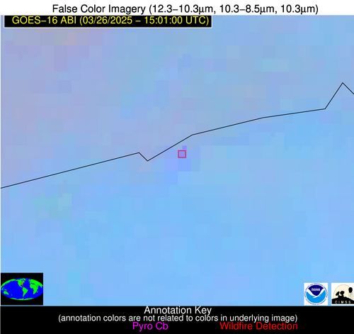
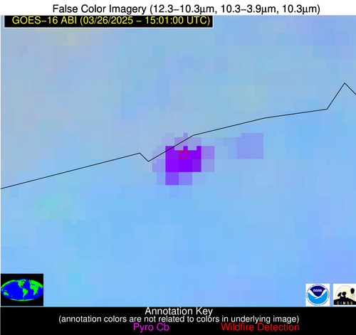
| Map: | |
| Additional Information | |
| Notification Status | New Feature |
| Type of Event | Elevated SPC Risk, Known Incident: TABLE ROCK (HIGH, tdiff=0.56273 days, Perimeter) |
| Event Priority Ranking | 3 |
| Maximum Observed BT (3.9 um) | 343.00 K |
| Observed - Background BT (3.9 um) | 48.82 K |
| BT Anomaly (3.9 um) | 27.43 K |
| Maximum Observed - Clear RTM BT (3.9 um) | 59.97 K |
| Maximum Observed BTD (3.9-10/11/12 um) | 52.24 K |
| Observed - Background BTD (3.9-10/11/12 um) | 46.36 K |
| BTD Anomaly (3.9-10/11/12 um) | 55.57 K |
| Similar Pixel Count | 0 |
| BT Time Tendency (3.9 um) | -999.00 K |
| Image Interval | -999.00 minutes |
| Fraction of Surrounding LWIR Pixels that are Colder | 1.00 |
| Fraction of Surrounding Red Channel Pixels that are Brighter | 0.27 |
| Maximum Radiative Power | 333.55 MW |
| Maximum Radiative Power Uncertainty | 0.00 MW |
| Total Radiative Power Uncertainty | 0.00 MW |
| Mean Viewing Angle | 41.60° |
| Mean Solar Zenith Angle | 49.20° |
| Mean Glint Angle | 82.80° |
| Water Fraction | 0.00 |
| Total Pixel Area | 37.50 km2 |
| Latest Satellite Imagery: | |