Please consider accessing NGFS detections and satellite imagery through the NOAA/NESDIS Wildland Fire Data Portal: https://fire.data.nesdis.noaa.gov/map/
Wildfire Notification
Aid: 895544
Notification Type: Possible Wildfire
Date: 2025-01-06 23:56:17
Show details ▲▼
| Basic Information | |
|---|---|
| State/Province(s) | SD |
| Country/Countries | USA |
| County/Locality(s) | Harding County, SD |
| NWS WFO | Rapid City SD |
| Identification Method | Enhanced Contextual (Bias) |
| Mean Object Date/Time | 2025-01-06 23:56:20UTC |
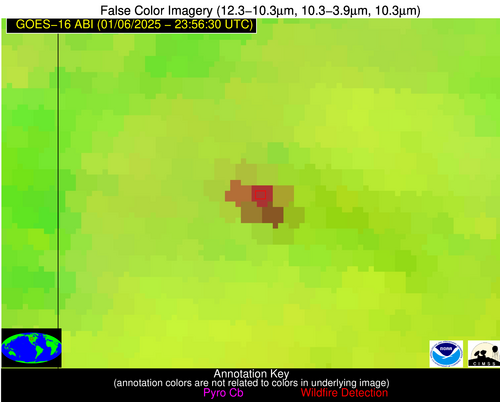
| Radiative Center (Lat, Lon): | 45.370000°, -103.720000° |
| Nearby Counties (meeting notification criteria): |
|
| Total Radiative Power Anomaly | n/a |
| Total Radiative Power | 90.05 MW |
| Map: | |
| Additional Information | |
| Notification Status | New Feature |
| Type of Event | Nominal Risk, Known Incident: EAST SHORT PINES PILES RX (HIGH, tdiff=0.13721 days, POINT) |
| Event Priority Ranking | 4 |
| Maximum Observed BT (3.9 um) | 276.11 K |
| Observed - Background BT (3.9 um) | 24.07 K |
| BT Anomaly (3.9 um) | 13.06 K |
| Maximum Observed - Clear RTM BT (3.9 um) | 19.66 K |
| Maximum Observed BTD (3.9-10/11/12 um) | 23.93 K |
| Observed - Background BTD (3.9-10/11/12 um) | 24.60 K |
| BTD Anomaly (3.9-10/11/12 um) | 20.54 K |
| Similar Pixel Count | 0 |
| BT Time Tendency (3.9 um) | 14.70 K |
| Image Interval | 5.00 minutes |
| Fraction of Surrounding LWIR Pixels that are Colder | 0.35 |
| Fraction of Surrounding Red Channel Pixels that are Brighter | 1.00 |
| Maximum Radiative Power | 54.81 MW |
| Maximum Radiative Power Uncertainty | 0.00 MW |
| Total Radiative Power Uncertainty | 0.00 MW |
| Mean Viewing Angle | 59.70° |
| Mean Solar Zenith Angle | 95.20° |
| Mean Glint Angle | 83.60° |
| Water Fraction | 0.00 |
| Total Pixel Area | 52.40 km2 |
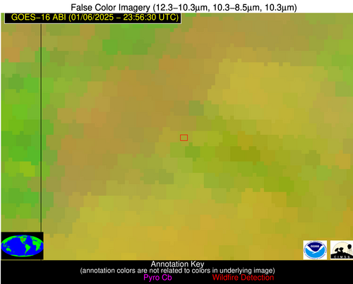
| Latest Satellite Imagery: | |