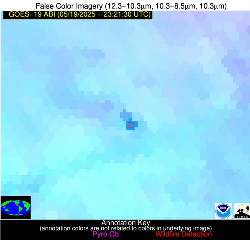
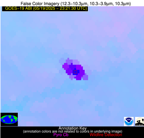
Please consider accessing NGFS detections and satellite imagery through the NOAA/NESDIS Wildland Fire Data Portal: https://fire.data.nesdis.noaa.gov/map/
Wildfire Notification
Aid: 1051523
Notification Type: Possible Wildfire
Date: 2025-05-19 23:21:17
Show details ▲▼
| Basic Information | |
|---|---|
| State/Province(s) | AZ |
| Country/Countries | United States |
| County/Locality(s) | Yuma County, AZ |
| NWS WFO | Phoenix AZ |
| Identification Method | Enhanced Contextual (Bias) |
| Mean Object Date/Time | 2025-05-19 23:22:18UTC |
| Radiative Center (Lat, Lon): | 32.968334°, -113.493332° |
| Nearby Counties (meeting notification criteria): |
|
| Total Radiative Power Anomaly | n/a |
| Total Radiative Power | 5784.49 MW |
| Map: | |
| Additional Information | |
| Notification Status | New Feature |
| Type of Event | Elevated SPC Risk (Detection is near: Solar panel (database + spectral)) |
| Event Priority Ranking | 3 |
| Maximum Observed BT (3.9 um) | 401.79 K |
| Observed - Background BT (3.9 um) | 86.91 K |
| BT Anomaly (3.9 um) | 81.35 K |
| Maximum Observed - Clear RTM BT (3.9 um) | 94.27 K |
| Maximum Observed BTD (3.9-10/11/12 um) | 91.04 K |
| Observed - Background BTD (3.9-10/11/12 um) | 85.40 K |
| BTD Anomaly (3.9-10/11/12 um) | 150.15 K |
| Similar Pixel Count | 0 |
| BT Time Tendency (3.9 um) | 79.70 K |
| Image Interval | 5.00 minutes |
| Fraction of Surrounding LWIR Pixels that are Colder | 1.00 |
| Fraction of Surrounding Red Channel Pixels that are Brighter | 0.00 |
| Maximum Radiative Power | 2040.19 MW |
| Maximum Radiative Power Uncertainty | 0.00 MW |
| Total Radiative Power Uncertainty | 0.00 MW |
| Mean Viewing Angle | 56.30° |
| Mean Solar Zenith Angle | 52.90° |
| Mean Glint Angle | 27.80° |
| Water Fraction | 0.00 |
| Total Pixel Area | 79.30 km2 |
| Latest Satellite Imagery: | |