MODIS Imagery in AWIPS IIInstructions for AWIPS II InstallationSpace Science and Engineering Center
|
|
| Project members: Scott Bachmeier, Russ Dengel, Jordan Gerth, Scott Lindstrom, Jerrold Robaidek, Kathy Strabala, Steve Wanzong | |
| The Space Science and Engineering Center is not continuously staffed. Consequently, data outages and processing issues may result. The products should be considered non-operational. |
Weather Forecast Offices which wish to be test sites for future upgrades and phases should contact Jordan Gerth.
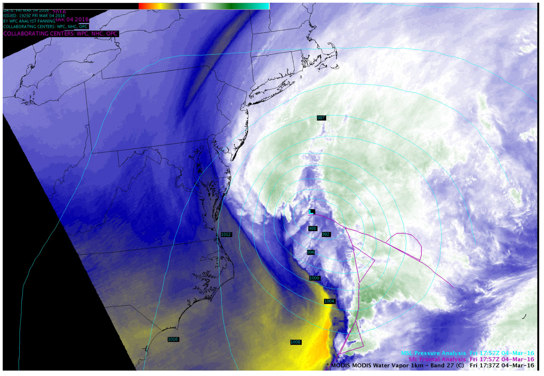
"There are different MODIS algorithms for cloud masking that are implemented depending on whether the detection is occurring are over land, desert, coast, deep water, etc. The deep water algorithm employs some tests which include a 3x3 pixel spatial variability test. This cannot be applied if there is not a 3x3 pixel deep water scene. Ultimately, a different set of tests are applied in this transition zone resulting in the stripe denoting the transition area. Since cloud detection is different and less complex during the day, this stripe should not appear on any daytime passes.."...Kathy Strabala
Announcements
This data is provided as part of the GOES-R Proving Ground. For assistance and suggestions on obtaining and using the data in AWIPS, please contact Jordan Gerth.
These files are subject to change as the software evolves.
Acquiring Data at a Central Region, Eastern Region, or Southern Region WFO
Required AWIPS II Configurations
These files are subject to change as the software evolves.
LDAD/Processing Configurations
Perform the following actions to configure your Local Data Acquisition and Dissemination (LDAD) server.
In /data/fxa/LDAD/data as user ldad on server px2:
- Append to LDADinfo.txt
In /awips/ldad/bin as ldad on px2:
- Add preProcessMODIS.pl and assign executable permissions
- Execute "stopLDAD.sh;startLDAD.csh" to restart the LDAD service
In /awips2/edex/data/utility/ as user awips on dx3 or dx4, where LLL is the WFO identifier:
- Append to edex_static/site/LLL/satellite/regionalsat/creatingEntities.xml
- Append to edex_static/site/LLL/satellite/physicalElements.xml
- EAST CONUS: Append to edex_static/site/LLL/distribution/geocat_modis_econus_regionalsat.xml
- WEST CONUS: Append to edex_static/site/LLL/distribution/geocat_modis_wconus_regionalsat.xml
- ALASKA: Append to edex_static/site/LLL/distribution/geocat_modis_alaska_regionalsat.xml
Select one of the four "regionalSatImagery*.xml" option that matches your region
- EAST CONUS: Append to cave_static/site/LLL/menus/satellite/regionalsat/regionalSatImagery.xml
- WEST CONUS: Append to cave_static/site/LLL/menus/satellite/regionalsat/regionalSatImagery.xml
- ALASKA: Append to cave_static/site/LLL/menus/satellite/regionalsat/regionalSatImagery.xml
- Append to common_static/site/LLL/styleRules/satelliteImageryStyleRules.xml
- Add custom modis*.cmap to common_static/site/LLL/colormaps/
Screenshots
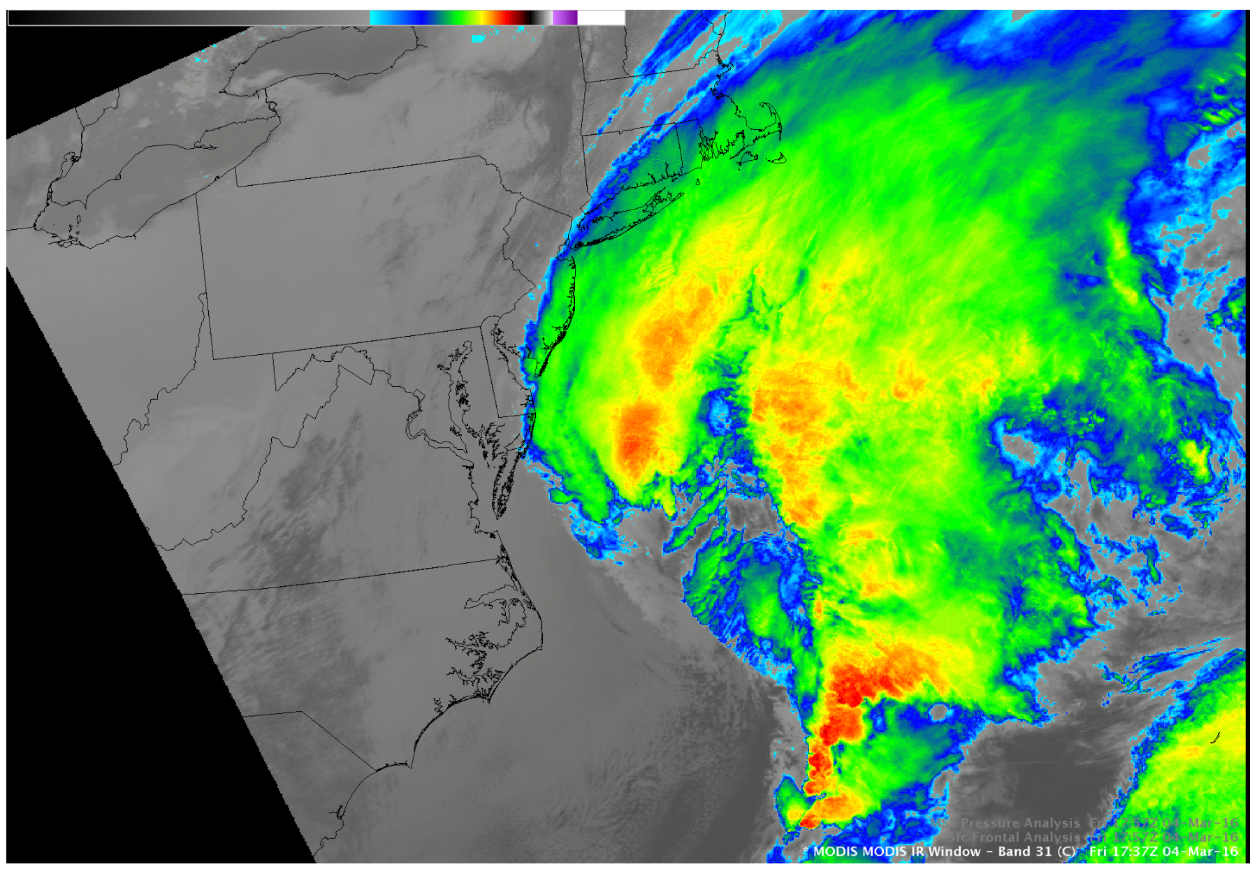
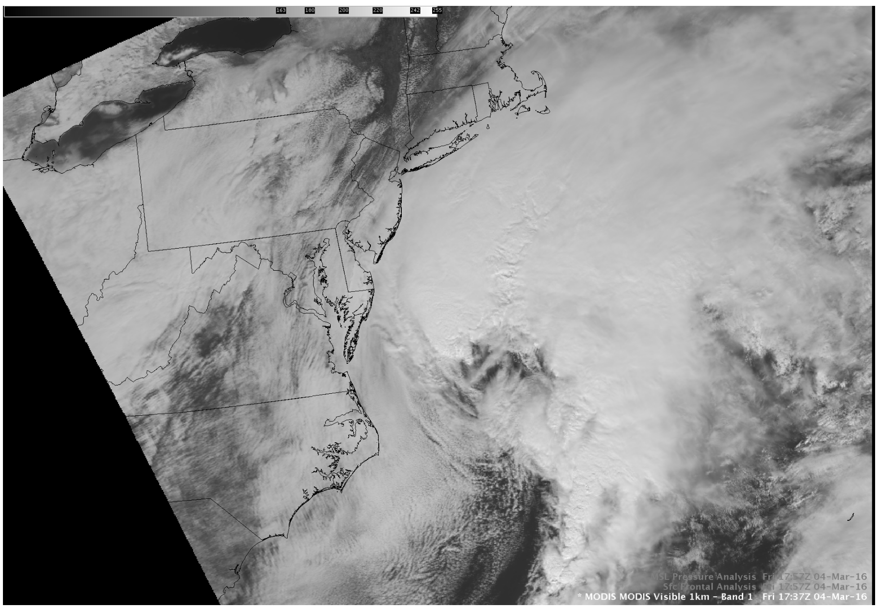
Courtesy of Scott Bachmeier & Kaba Bah (contact)
Last updated May 10, 2016