The upwelling radiation sensed by a satellite sensor is governed by a) emission from the earth's surface transmitted through the atmosphere and b) emission from the atmospheric layers transmitted through the outer layers of the atmosphere.
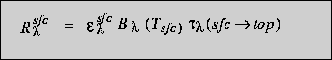
The surface contribution to the upwelling radiation sensed at the top of the atmosphere for wavelength lambda is a product of the surface emissivity, the Planck function at the surface temperature, and the vertical transmittance through the depth of the atmosphere. This is written as:
The transmittance of upwelling radiation through the atmosphere is diminished exponentially with increasing path length,
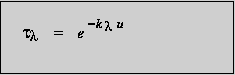
where k is the absorption coefficient of the atmosphere and u is the density weighted path length.
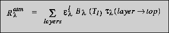
The formulation for a discrete atmospheric layer is similar to that for the surface contribution except that the appropriate layer emissivity, Planck function at layer temperature , and vertical transmittance would be used. The contribution for all atmospheric layers is then,
The radiative transfer equation combines the surface and atmospheric contributions and for an infinitely layered atmosphere can be written:
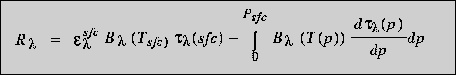
The term
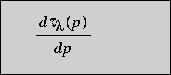
in the radiative transfer equation is known as a weighting function. The weighting function, the derivative of transmittance with respect to height (pressure), specifies the relative contribution each atmospheric layer makes to the radiation emitted to space and thereby determines those regions of the atmosphere which are sensed from space at this wavelength. Sounding is accomplished with a group of spectral bands selected to detect radiation emitted from successively lower layers of the atmosphere.
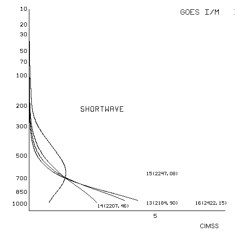
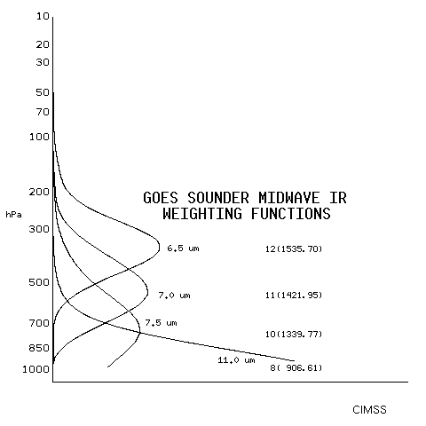
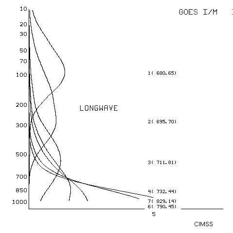
The GOES-8 sounder weighting functions are presented in the following imagery grouped by wavelength:
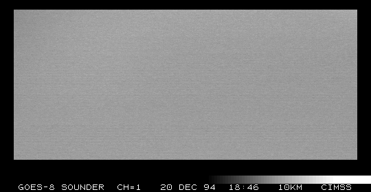
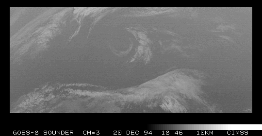
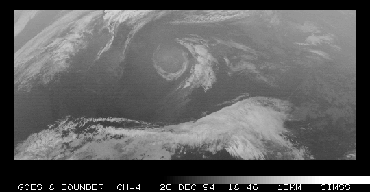
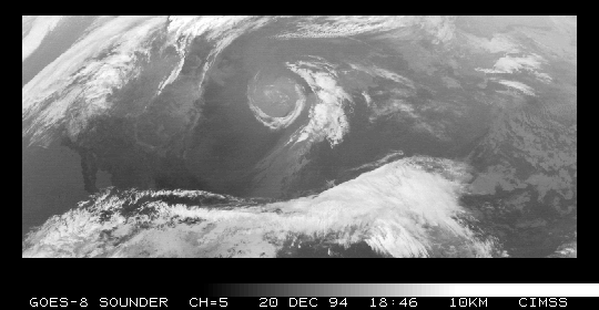
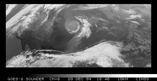
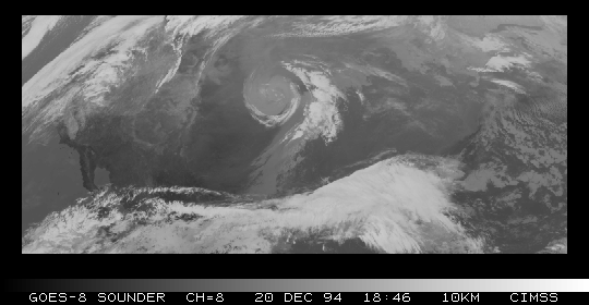
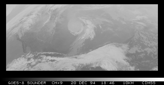
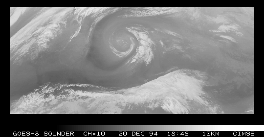
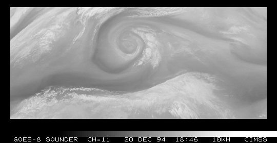
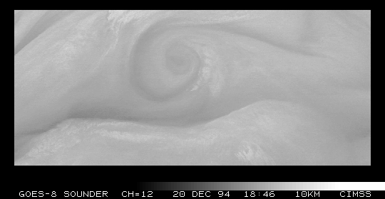
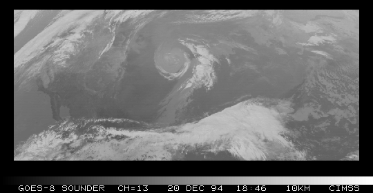
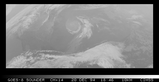
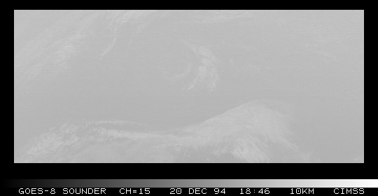
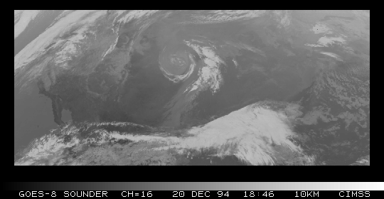
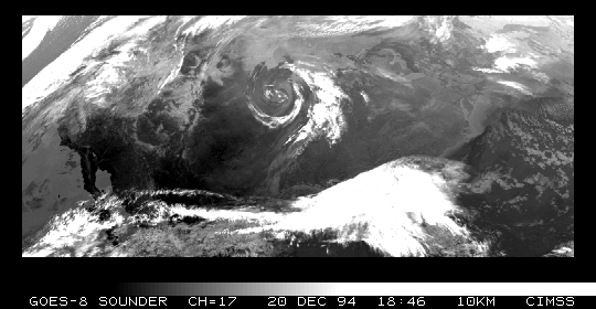
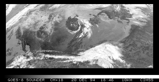
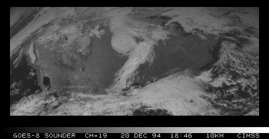
The following images demonstrate the response of each GOES-8 sounder spectral band to upwelling radiation detected at 1846 UTC on 20 December 94:
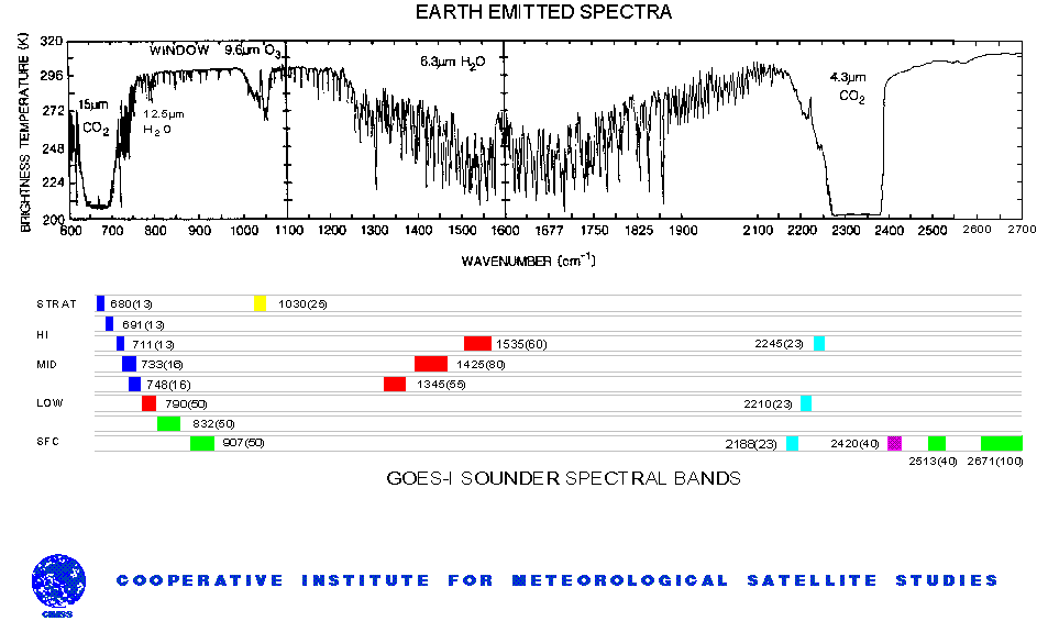
This figure shows the GOES-8 sounder spectral bands together with depiction of the earth-emitted spectra; the carbon dioxide (CO2), moisture (H20), and ozone (O3) absorption bands are indicated. Around the broader CO2 and H20 absorption bands, vertical profiles of atmospheric parameters can be derived. Sampling the center of the absorption band yields radiation from the upper levels of the atmosphere (e.g., radiation from below has already been absorbed by the atmospheric gas). Sampling away from the center of the absorption band yields radiation from successively lower levels of the atmosphere. In the wings of the absorption band are the windows that view to the bottom of the atmosphere. Thus, as a spectral band is moved toward the center of the absorption band, the radiation brightness temperature decreases due to the decrease of temperature with altitude in the lower atmosphere. GOES-8 selection of spectral bands in and around the CO2 and H20 absorbing bands is designed to yield information about the vertical structure of atmospheric temperature and moisture.
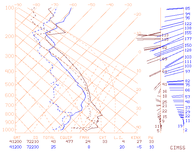
Because the concentration of CO2 is nearly uniform in the atmosphere, the weighting functions specific to the CO2 absorbing bands show little variation with location. However, water vapor concentrations vary greatly from one location to another. The non-uniform concentration of water vapor in the atmosphere will cause the weighting functions specific to the H2O absorbing bands to vary by location. This effect can be demonstrated by selecting two locations in different airmasses. Station 72210 (Tampa, Florida) is relatively warm and moist compared to station 72230 (Central Alabama). The impact on the water vapor specific weighting functions caused by the variation of moisture is evident. The radiances yielded by the H2O absorbing bands in the drier atmosphere will correspond to levels closer to the surface than those for the more moist atmosphere.
Vertical temperature profiles from sounder radiance measurements are produced at 40 pressure levels from 1000 to 0.1 mb using a physical retrieval algorithm that solves for surface skin temperature, atmospheric temperature, and atmospheric moisture simultaneously. Also, estimates of surface emissivity, cloud-top pressure, and cloud amount are obtained as by-products. The retrieval begins with a first-guess temperature profile that is obtained from a space-time interpolation of fields provided by NWS forecast models. Hourly surface observations and sea surface temperature from AVHRR help provide surface boundary information. Soundings are produced from a 5 x 5 array of FOVs whenever nine or more FOVs are determined to be either clear or contaminated by "low cloud."
Vertical moisture (mixing ratio--hence, specific humidity) profiles are obtained in the simultaneous retrieval and are provided at the same levels as temperature up to 300 mb. Since the radiance measurements respond to the total integrated moisture above a particular pressure level, the specific humidity is a differentiated quantity rather than an absolute retrieval. Layer means of either temperature or moisture can also be derived. Layered precipitable water can be integrated from retrievals of specific humidity; three layers (1000-900 mb, 900-700 mb, and 700-300 mb) and the total atmospheric column precipitable water are provided as output products and are put into the standard archive.
A retrieval is based on modifying the surface temperature and atmospheric temperature/moisture profiles in a manner such that brightness temperatures calculated agree with those observed from the satellite, within some uncertainty estimate, for the sounding spectral bands.
In the GOES-8 system we begin with an NWS forecast, interpolated in time and space to the location of the satellite measurement. The difference between the observation and the "forward calculation" from the forecast represents the information available in the observation.
It is found in practice that there are generally bias errors associated with the comparison of observation and the forward calculation. These may be due to calibration error, uncertainties in the filter functions, or imprecision in the transmittance model used in the forward calculation. Consequently, prior to calculating a retrieval, bias error for each band is subtracted from the observation. Estimates of the bias error are obtained by examining ensembles of colocated observations and forward calculations where the atmospheric state is well know (i.e. in the vicinity of radiosondes).
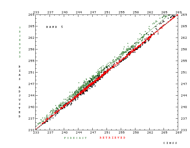
Bias error, its correction, and the information content of band 5 (749 wavenumbers) is plotted for a single time period over the continental U.S. Band 5 is a longwave band sampling the lower troposphere. It is sensitive to both temperature and water vapor in the atmosphere, and also "sees" the surface, especially in high terrain. Each point in the figure represents a cloud-cleared average of 5 x 5 fields-of-view, the resolution (approximately 50 km) at which temperature and moisture retrievals are made.
The scatter plot in green is a comparison of the GOES-8 observations with radiance temperatures calculated from the interpolated NMC forecast. The points are distributed more or less randomly around a "best fit" line. The latter, inasmuch as it does not pass through the corners of the plot, represents the bias ( about 1.5K) error.
The function of the bias correction is to remove the offest of the green line and also to correct the slope. The points plotted in black show the result of the bias adjustment. The best fit line is now the diagonal, and the variance in the original sample, which is the real signal, is retained. The final part of the retrieval is correct the forecast to match the bias adjusted observation. The success of this step is shown by the red points which demonstrate the reduction in scatter with respect to the black (or green) points. For this case the standard deviation has been reduced from 0.55 K to 0.21 K. A further reduction is computationally possible, but the algorithm is adjusted to fit no closer than anticipated uncertainty associated with the measurement and the physics of the radiative transfer calculations.
It should be noted that this case is typical in showing only minor error in the forecast, and the rms change to the forecast 700 hPa temperature and dewpoint for the retrievals shown here is 1.0 K and 5.2 K respectively.