Hands-on Forecast: 8 April 2019
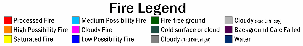
It's April 8, 2019, and you have to assemble a forecast that gives a national overview highlighting any interesting large scale systems, as well as a specific forecast for that evening for southwest Missouri. The radar is down, the model data is missing, but you do have 10 hour loops of ABI data from 10-20 UTC that day as well as the ABI fire product over Kansas (though they didn't give you a map, something you intend to discuss with your vendor at a later time) and the true color image product. You're also dismayed that you don't even have the other RGB imagery to look at.
Loops of ABI bands, true color product, and fires product: (links to mp4s)
Band 1
Band 2
Band 3
Band 4
Band 5
Band 6
Band 7
Band 8
Band 9
Band 10
Band 11
Band 12
Band 13
Band 14
Band 15
Band 16
True color loop
Fires loop, legend below