24-26 October 1997 Winter Storm

General Storm Evolution | Daily Highlights | Location of Heavy Snow Areas


General Storm Evolution

GOES-8 water vapor

GOES-8 water vapor / ETA 500 hPa heights

(6-hourly Java animation)

GOES-8 water vapor

GOES-8 water vapor

(3-hourly Java animation)

Vis5D images and animations of CRAS model fields are available from the U.S. Air Force Academy

A preliminary analysis of the Blizzard of '97 can be found at the National Weather Service Office in Pueblo, CO


Daily Highlights:

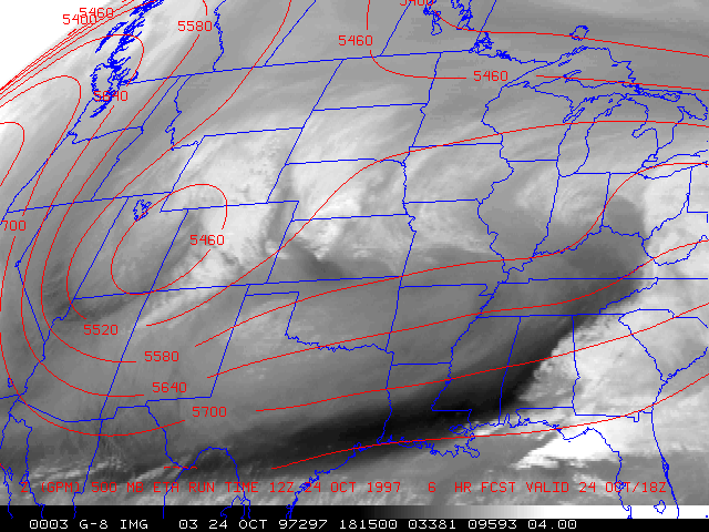
Friday 24 October 1997

18:00 UTC GOES-8: Visible | IR | Water Vapor | Precipitable Water | Lifted Index

A shortwave trough and associated strong lobe of vorticity over Idaho began to dive southeastward toward the central Rockies, aided by a 70-80 m s-1 jet core moving into the Pacific Northwest region. As this trough developed into a closed low over Utah, strong upper-level diffluence/divergence in the east and northeast quadrant of the low enhanced upward vertical motion and cloud and precipitation development over central Colorado and southern Wyoming. At the surface, arctic air began to surge southward across eastern Wyoming and Colorado. Diabatic cooling within this deepening upslope flow regime allowed precipitation to change from rain to snow.

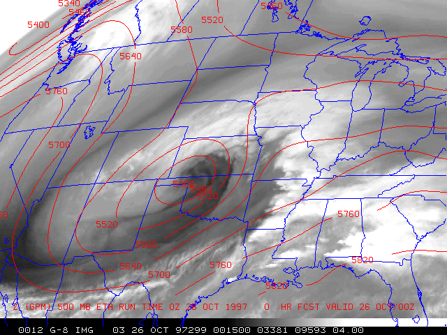
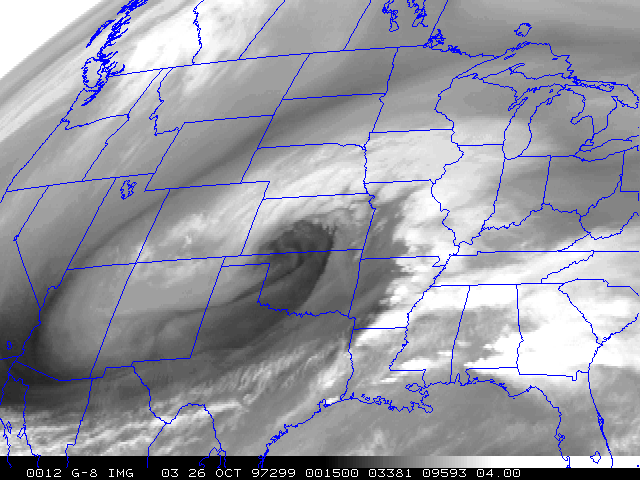
Another leading shortwave trough ahead of the main system was moving across Nebraska late in the day, giving that area their initial round of heavy snow.

Saturday 25 October 1997

18:00 UTC GOES-8: Visible | IR | Water Vapor | Precipitable Water | Lifted Index

Visible image Java animation (courtesy of the Storm Prediction Center)

The upper low began to stall over northern New Mexico. With the persistent strong upslope flow and upper-level deformation zone remaining focused over eastern Colorado and the adjacent High Plains, snowfall rates of 1-2 inches per hour were common over large portions of that region. Increasing pressure gradient between the arctic high over the northern Plains and the deepening low over the southern Plains led to strong winds and significant blowing and drifting snow. The storm began to tap low-level moisture from the Gulf of Mexico, which then wrapped around the northern portion of the storm and into the cold air, producing embedded convection which enhanced snowfall rates over Kansas and Nebraska.

Sunday 26 October 1997

18:00 UTC GOES-8: Visible | IR | Water Vapor | Precipitable Water | Lifted Index

The upper low peaked in intensity and became vertically stacked as it began moving out across the southern Plains and eventually accelerating toward the Great Lakes region. Conditions gradually improved over Colorado as the strongest dynamics shifted to the central Plains. The increased forward speed of the system led to lesser snow accumulations, but localized areas of heavy snow occurred in conjunction with elevated convection over parts of Iowa, Wisconsin and Michigan.


Location of Heavy Snow Areas -- IR Enhancement Curves

25 Oct GOES-8 IR with CC curve

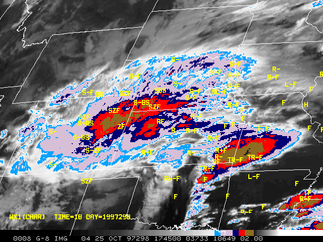
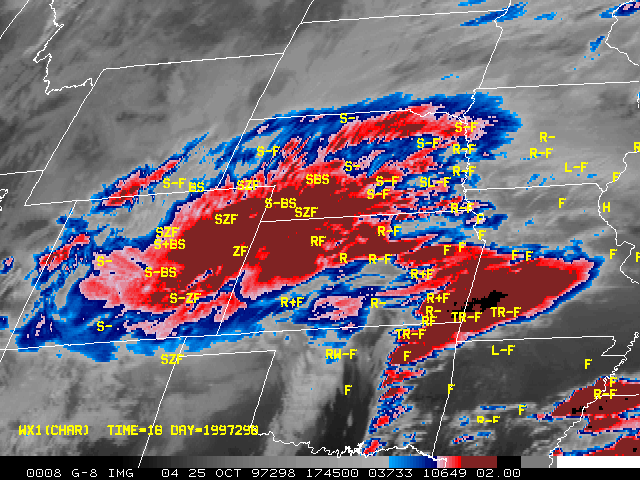
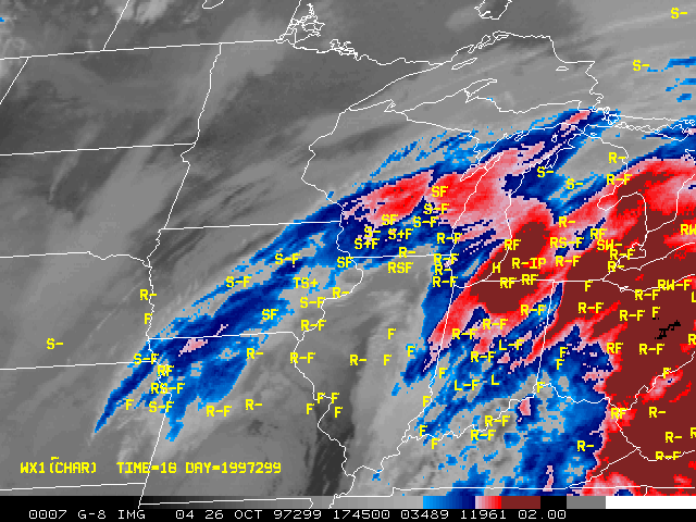
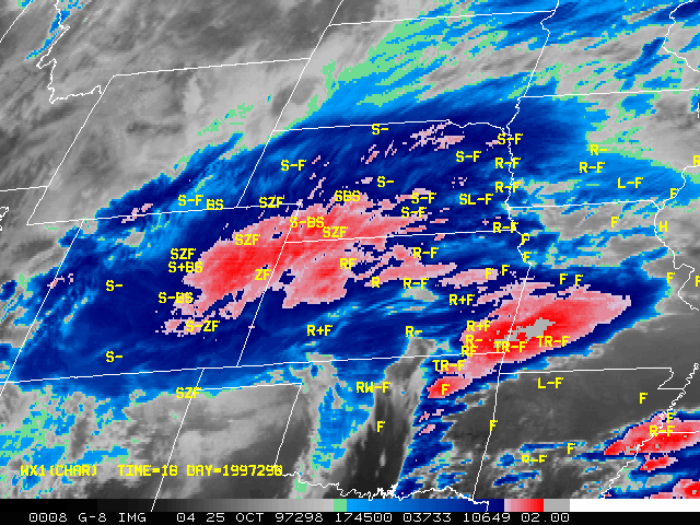
25 Oct GOES-8 IR (CC curve)
Image centered on Hill City KS
Java animation

26 Oct GOES-8 IR with CC curve

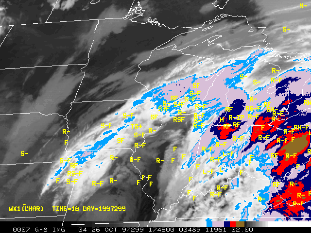
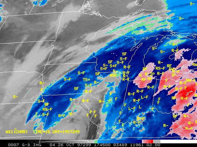
26 Oct GOES-8 IR (CC curve)
Image centered on Dubuque IA
Java animation

25 Oct GOES-8 with CE curve

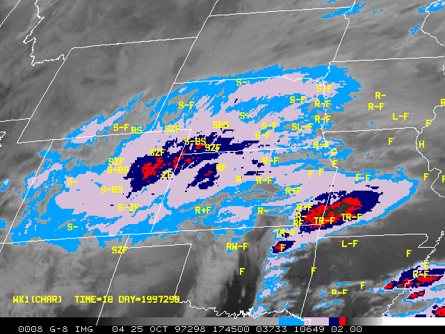
25 Oct GOES-8 IR (CE curve)
Image centered on Hill City KS
Java animation

26 Oct GOES-8 IR with CE curve

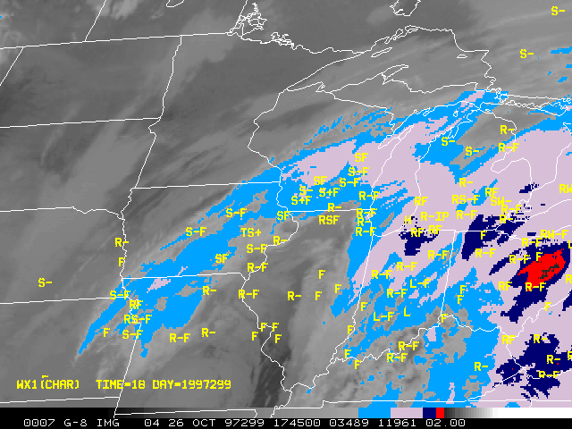
26 Oct GOES-8 IR (CE curve)
Image centered on Dubuque IA
Java animation

25 Oct GOES-8 IR with DD curve

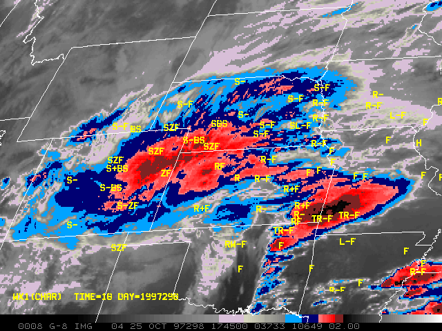
25 Oct GOES-8 IR (DD curve)
Image centered on Hill City KS
Java animation

26 Oct GOES-8 IR with DD curve

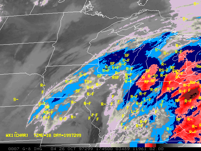
26 Oct GOES-8 IR (DD curve)
Image centered on Dubuque IA
Java animation

25 Oct GOES-8 IR with EC curve

25 Oct GOES-8 IR (EC curve)
Image centered on Hill City KS
Java animation

26 Oct GOES-8 IR with EC curve

26 Oct GOES-8 IR (EC curve)
Image centered on Dubuque IA
Java animation

25 Oct GOES-8 IR with MB curve

25 Oct GOES-8 IR (MB curve)
Image centered on Hill City KS
Java animation

26 Oct GOES-8 IR with MB curve

26 Oct GOES-8 IR (MB curve)
Image centered on Dubuque IA
Java animation


General Storm Evolution | Daily Highlights | Location of Heavy Snow Areas


Back to the 26-27 October 1997 snow cover page