|
|
|
|
|
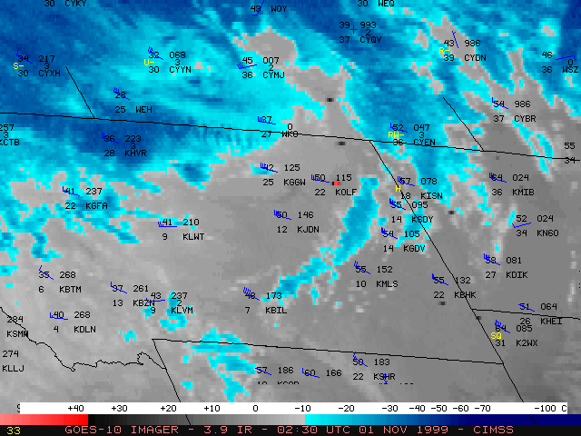
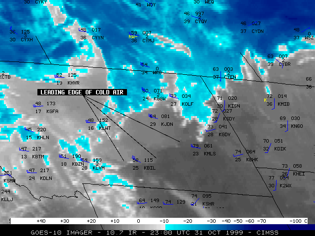
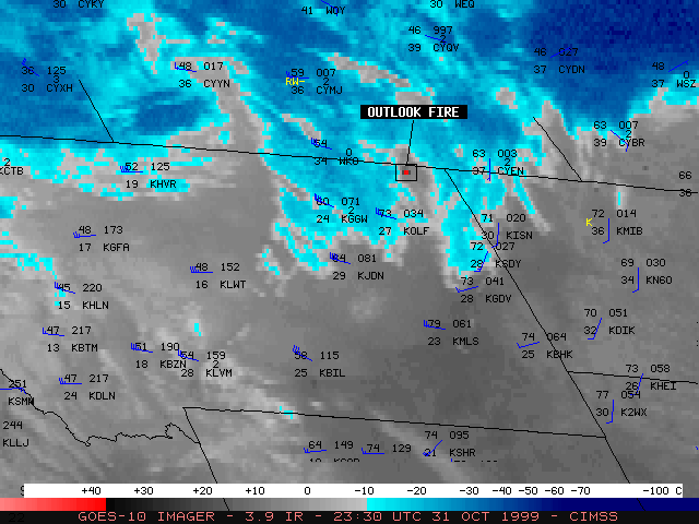
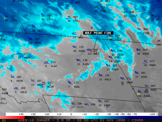
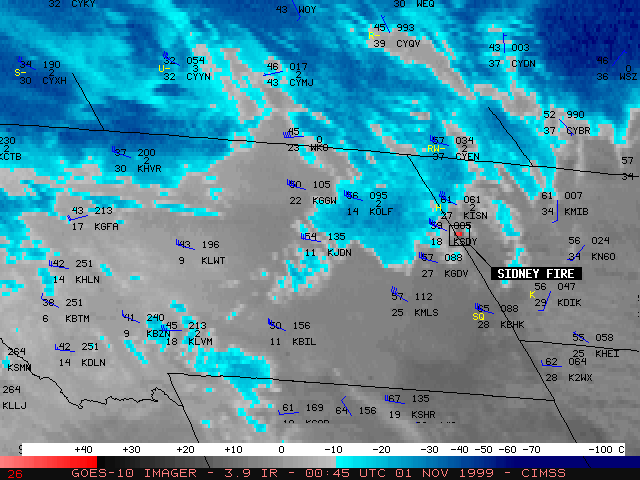
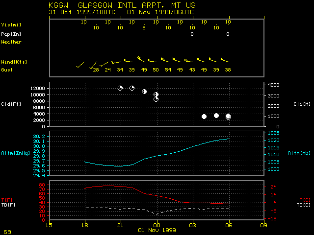
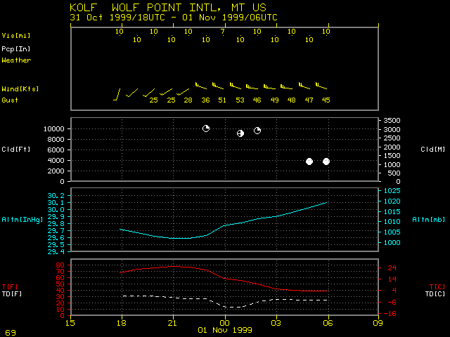
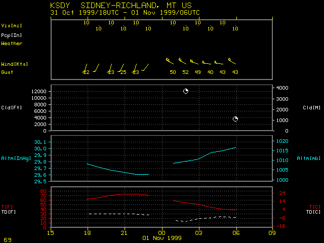
NOAA GOES-10 3.9 micrometer shortwave InfraRed (IR) imagery (above, left) shows several "hot spots" (black to red enhancement) from fires burning across parts of Montana and North Dakota during the late evening/early morning on 31 October/01 November 1999. Strong winds (40-50 mph, with gusts over 60 mph) following a cold frontal passage helped these fires to spread rapidly (in some cases, power line arcing due to these high winds even initated some of the fires). Three notable fires occurred near Outlook, Wolf Point, and Sidney in Montana. GOES-10 10.7 micrometer longwave IR imagery (above, right) has a similar enhancement, and helps to show the leading edge of the cold air (light gray enhancement) associated with the frontal passage. Time series of observations from Glasgow, Wolf Point, and Sidney in Montana show the dramatic wind shift and temperature change as the cold front moved through the region.
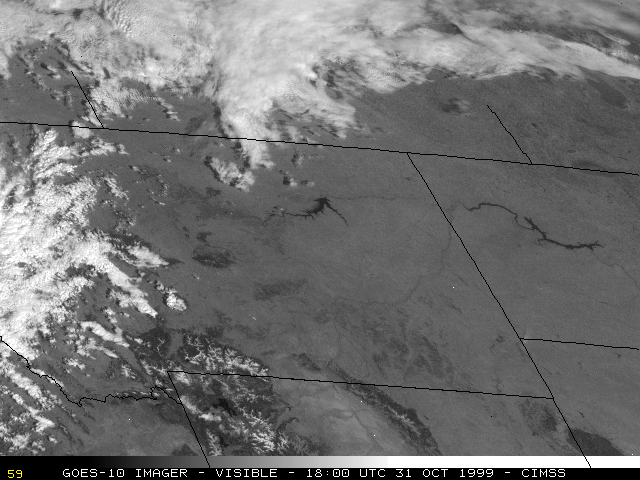
The following day, GOES-10 visible imagery (below) revealed a large burn scar which extended southeastward across the Little Missouri National Grassland in North Dakota (this fire started near Sidney in Montana).
|

|
(- Fade between 31 October and 01 November visible images -)
