|
|
|
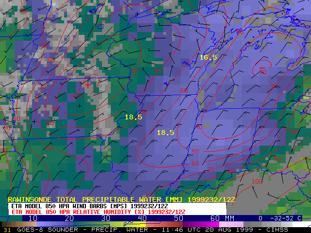
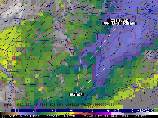
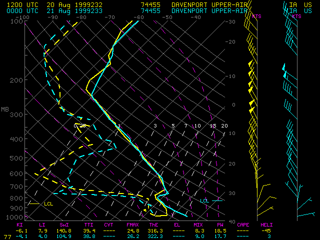
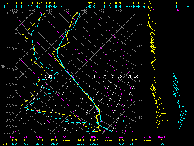
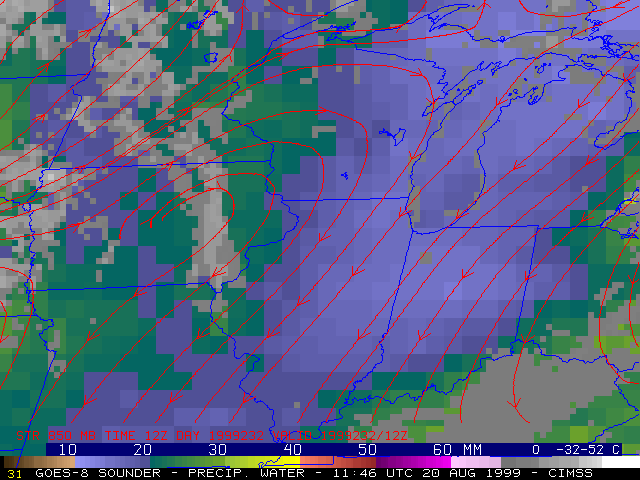
NOAA GOES-8 sounder Precipitable Water (PW) imagery (above) shows that a large pool of relatively dry air (PW less than 20 mm, blue enhancement) was in place across the western Great Lakes region on 20 August 1999. During the late morning and afternoon hours, GOES-8 visible and sounder PW imagery (below) shows that an elongated moist plume (PW greater than 20 mm, green enhancement) and associated band of cumulus clouds formed across Illinois within this dry pocket of air. Cumulus formation was suppressed on either side of this moist plume, and the sounder PW imagery showed that the dry air (PW less than 20 mm, blue enhancement) remained in place over these cloud-free areas during the entire day.
|
|
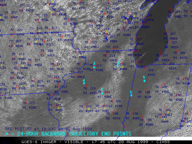
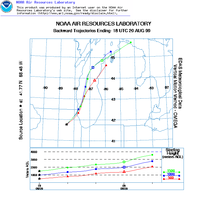
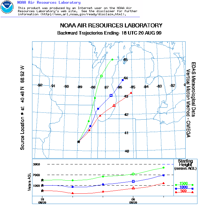
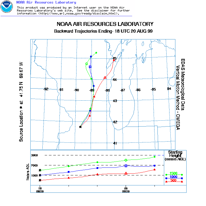
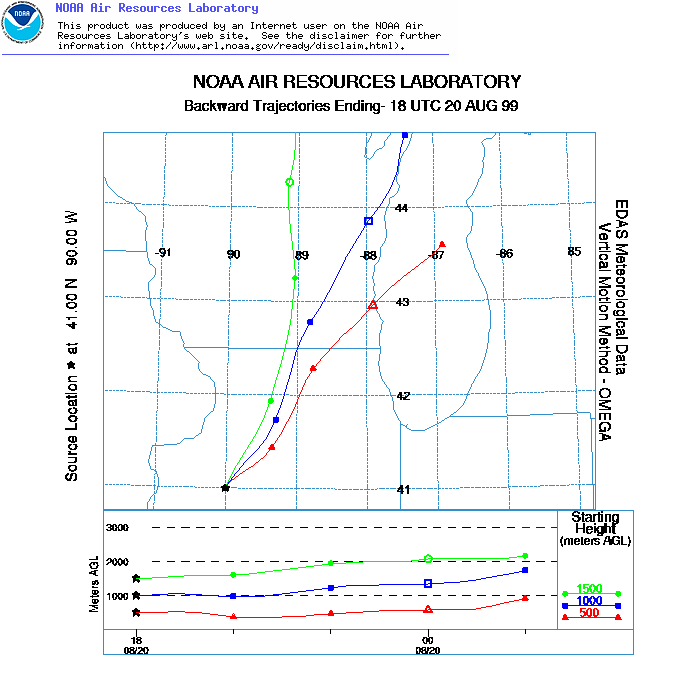
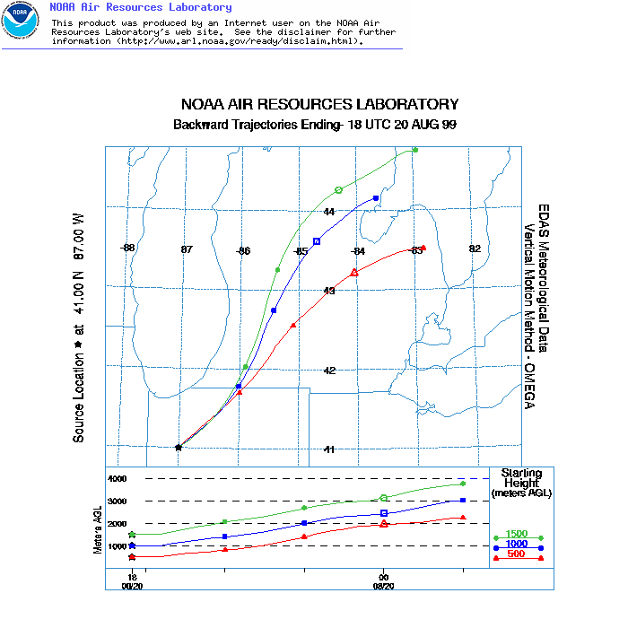
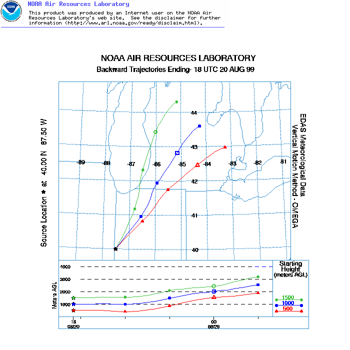
With a low-level ridge of high pressure in place over Iowa and Wisconsin, the flow within the boundary layer over Illinois was northeasterly during this period, so some of this air was moving across Lake Michigan into northeastern Illinois. 24-hour backward air mass trajectories ending at Point 1 and Point 2 within the cloudy plume verify that this air experienced a significant fetch across Lake Michigan, where it likely acquired additional moisture in the boundary layer. Trajectories ending at Point 3, Point 4, Point 5, and Point 6 within the clear region immediately west and east of the moist plume showed a transport path that was mostly over land, which helped this air maintain its lower PW values.
|
|
|
