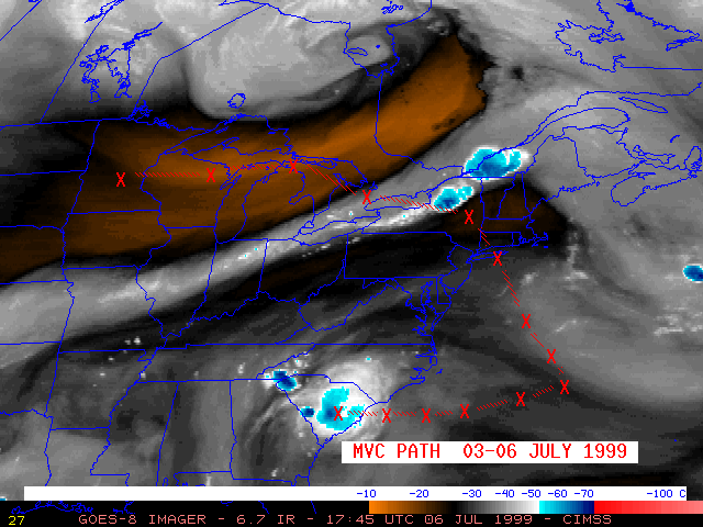
06 July 1999 -- Mesoscale Vorticity Center Over the Carolinas
GOES-8 water vapor (03 July) |
|
|
GOES-8 water vapor (03 July) |
|
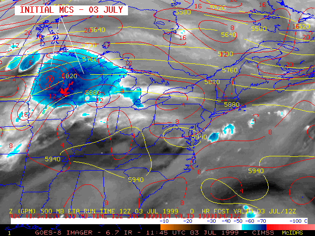
A westward-moving Mesoscale Vorticity Center (MVC)1 approached the coast of North and South Carolina early in the day on 06 July 1999. Strong convection developed as this feature moved inland, producing large hail (up to 1.75 inches in diameter), damaging winds, and heavy rain (2.36 inches in South Carolina, and 2.13 inches in North Carolina). It appears as if this middle-tropospheric cyclonic circulation feature may have been a remnant of a mesocale convectively generated vortex (MCV)2 produced by a strong mesoscale convective system that moved eastward across the Great Lakes region and New England on 03-04 July; on 05-06 July, this circulation moved southward and then westward across the Atlantic Ocean, around the periphery of a large ridge of high pressure that was responsible for an early July heat wave across much of the eastern U.S.
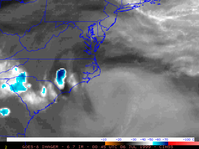
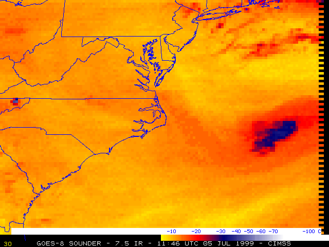
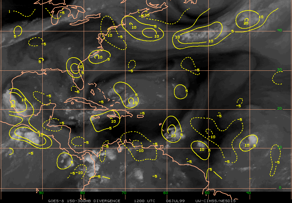
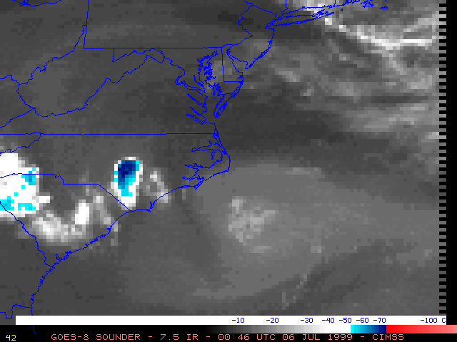
NOAA GOES-8 6.7 micrometer InfraRed ("water vapor") imagery (above) shows the development and motion of the convective system across the northeastern U.S., followed by the westward propagation of the MVC circulation as it turned back toward the southeast U.S. coast. Numerical models handled this feature poorly -- note the placement of 500 hPa vorticily centers on the Eta model analyses as the MVC moved westward toward the Carolinas. Closer views using the GOES-8 imager 6.7 micrometer IR and GOES-8 Sounder 7.5 micrometer IR (below) show sustained cyclonic circulation over the Atlantic, with the Sounder imagery indicating more of a "closed" nature to the circulation. GOES-8 water vapor wind upper level divergence increased across the Carolina coast region as the MVC began to move inland, indicating synoptic scale upward vertical motion favorable for convective development across that area.
|
|
|
|
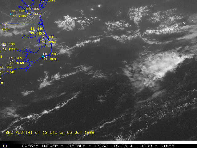
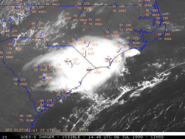
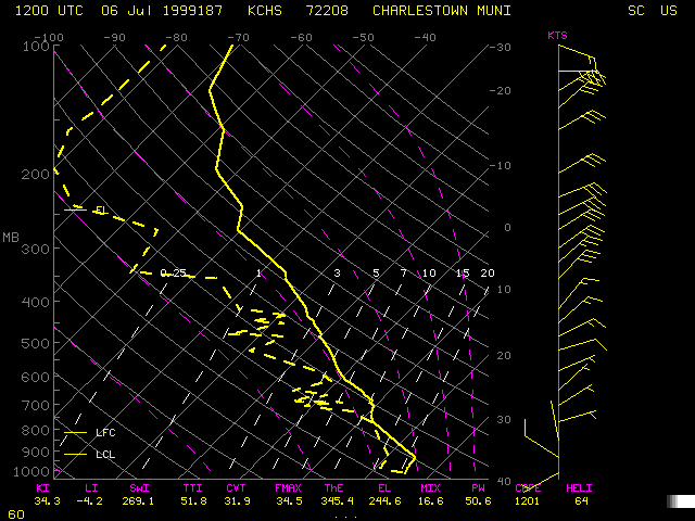
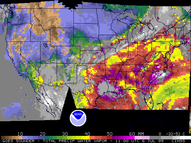
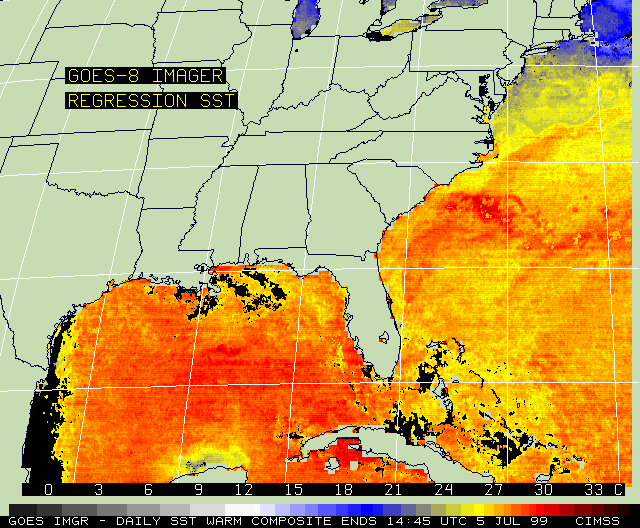
The cyclonic circulation of clouds within the MVC was also evident on GOES-8 visible imagery as it moved across the Atlantic on 05 July (above left). During this time, the feature was moving over the Gulf Stream, where higher sea surface temperatures of 26-28 C may have helped to provide a flux of water vapor and sensible heat into the system. As the feature approached the coast, the mid-level energy interacted with the very moist and unstable air mass that was in place across the Carolinas, and strong convection rapidly developed (above right). A rawinsonde profile from Charleston SC (below left) showed a very moist air mass with a total precipitable water (PW) value of 51 mm; GOES Sounder PW imagery (below right) indicated that values of 50 mm and above were common across much of the eastern Carolinas. This moisture helped to fuel the convection that developed as the MVC moved inland.
|
|
References:
1 Mesoscale vorticity centers induced by mesoscale convective complexes, Johnston, E.C., Preprints, Ninth Conf. on Weather Forecasting and Analysis, Seattle, WA, Amer. Meteor. Soc, pp 196-200 (1982).2 Midlevel cyclonic vorticies generated by mesoscale convective systems, Bartels, D.L., and R.A. Maddox, Mon. Wea. Rev., 119, pp 104-118 (1991).
