29 March 1999 -- GOES-8 Imager Visible
Stratospheric Intrusion Over Southern Wisconsin?
(this 10-image Java animation sequence will take a minute or two to load...)
(this 10-image Java animation sequence will take a minute or two to load...)
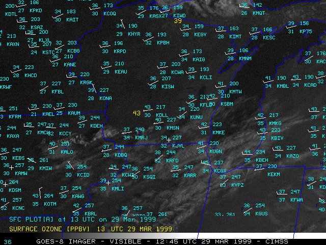
This loop of GOES-8 visible imagery with hourly surface reports shows the dry air and lack of cloudiness across southern Wisconsin on 29 March 1999. Surface dew points dropped as low as +5 F (11% relative humidity) at Milwaukee (KMKE), +7 F (12% relative humidity) at Madison (KMSN) and +9 F (14% relative humidty) at Baraboo/Wisconsin Dells (KDLL) during the afternoon hours.
Hourly surface ozone reports from Devils Lake (southern Wisconsin) and Trout Lake (northern Wisconsin) are plotted in yellow. Note that the increase in ozone at Devils Lake (from 43 ppbv at 14 UTC to 55 ppbv at 21 UTC) corresponded to the decrease in dew point (from 28 F at 14 UTC to 9 F at 21 UTC). Levels of NOx also dropped to 0 pptv during this period. The low dew points, elevated ozone, and low NOx concentrations recorded across southern Wisconsin suggest that some of this air could have been stratospheric in nature, transported downward in the wake of the passing upper level jet streak/shortwave.
