02 November 1998 -- Nocturnal Fog and Stratus Over the Northern Plains
|
|
- Interactive 10.7 micron longwave IR and 3.9 micron shortwave IR comparison -
|
|
|
- Interactive 10.7 micron longwave IR and 3.9 micron shortwave IR comparison -
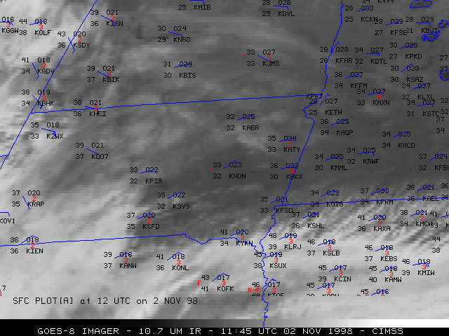
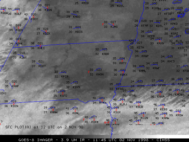
Fog and stratus formed over parts of the Northern Plains during the overnight hours on 02 November 1998. NOAA GOES-8 10.7 micron longwave InfraRed (IR) and 3.9 micron shortwave IR imagery (above) show the superior ability of the 3.9 micron product to detect low cloud and fog features (even beneath the thin cirrus cloudiness that was overspreading the southern portion of the region).
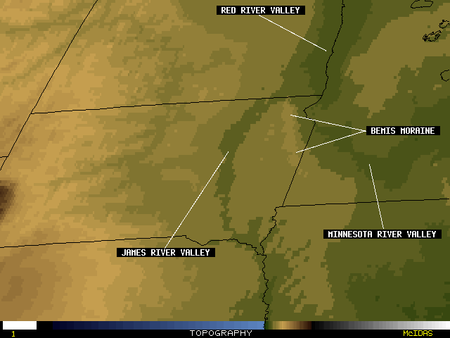
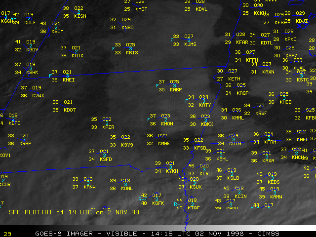
The GOES-8 fog/stratus product is shown below, along with an image of the topography of the region. This fog/stratus product (created by taking the difference between 10.7 and 3.9 micron IR brightness temperatures) does an even better job at highlighting the motion and areal extent of the low cloud features. The concave shape of the eastern edge of the low cloudiness across southwestern Minnesota/northeastern South Dakota/southeastern North Dakota is due to the topography of that area. The easterly component of the surface winds created a subtle upslope flow situation, which played a role in the formation stratus and fog in the nearly saturated air mass that was moving in from Minnesota. A GOES-8 visible image shortly after sunrise shows the coverage of the low clouds and fog across the eastern Dakotas and parts of Minnesota.

|
|
- Interactive fog/stratus product and topography comparison -
