02 September 1998 -- Fires in Idaho and Montana
|
|
- Interactive visible and 3.9 micron shortwave IR comparison -
|
|
|
- Interactive visible and 3.9 micron shortwave IR comparison -
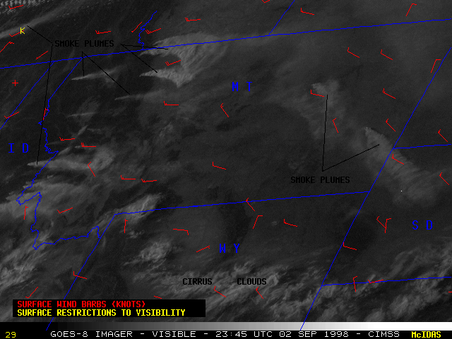
The combination of high temperatures, low dewpoints, and gusty winds allowed several wildfires to burn out of control over parts of Idaho and Montana on 02 September 1998. NOAA GOES-8 visible imagery (above right) shows the thick smoke plumes from these fires, which fan out eastward and southeastward with time. A ridge of high pressure was in place over the central Rocky Mountains, producing the westerly and northwesterly winds at the surface and in the lower troposphere.
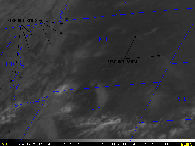
GOES-8 3.9 micron shortwave InfraRed (IR) imagery (above right) reveals the location of several "hot spots" (dark pixels) associated with the source regions of the major fires. A few fires can be seen to flare up during the time period of the above IR loop (these hot spots suddenly appear in western and northwestern Montana). Also note that some hot spots are evident in the shortwave IR imagery before a smoke plume can be seen in the corresponding visible imagery.
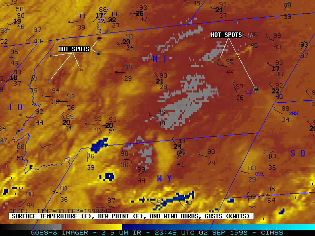
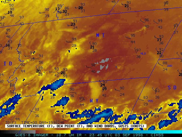
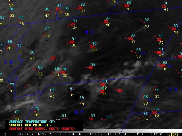
GOES-8 3.9 micron shortwave IR (below left) and 10.7 micron longwave IR (below right) show the thermal effects of some of the major smoke plumes. These enhanced hourly IR images also display surface reports of temperature and dew point (F), as well as the surface wind barbs and gusts (knots). Note how the large smoke plume which originates over extreme eastern Montana (near Miles City MT, station identifier MLS) eventually drifts southeastward into northwestern South Dakota (over Buffalo SD, station identifer 2WX). The surface temperature at Buffalo is seen to cool from the mid 90's F down to 88 F at 23:45 UTC (5:45 PM local time), while surrounding stations remained in the 90's. After sunset, Buffalo's temperature was similar to that at surrounding stations (76 F at 01:45 UTC or 7:45 PM local time), but then remained steady at 73 F for the next two hours (02:45-03:45 UTC, or 8:45-9:45 PM local time) while surrounding stations became cooler.
Smoke is typically transparent to thermal radiation at these wavelengths, so the effects noted on Buffalo's surface temperature while under the smoke plume (cooling due to reduced solar heating before sunset, then steady after sunset while surrounding stations experienced radiative cooling) imply that a significant amount of water vapor was present within this plume. The satellite sensed this water vapor as a cooler feature against the warmer land background during daylight hours, but the "plume signal" was lost after sunset when the land surface began to cool by radiation [note: Custer SD (station OV1) was cooler than surrounding stations and located within a region of cooler (more yellow) IR enhancement due to the high elevation of this station (1700 m or 5100 feet) in the Black Hills]. The 3.9 micron IR hot spot from this fire remained after sunset, although it was less pronounced after 01:45 UTC (7:45 PM local time).
|
|
- Interactive visible and 10.7 micron longwave IR comparison -
