02 June 1998 -- Wet Ground Over Iowa, Illinois, and Indiana

|

|
|
|
|
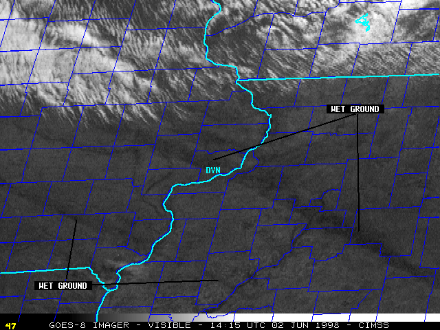
Convection during the early morning hours left well-defined swaths of wet ground over parts of Iowa, Illinois, and Indiana on 02 June 1998. NOAA GOES-8 visible and 3.9 micron shortwave InfraRed imagery (above) show the northwest-southeast orientation of these wet ground features -- the wet ground appears darker in the visible imagery, while in the 3.9 micron IR imagery these features appear cooler (lighter gray enhancement). An early-morning 3.7 micron IR NOAA-12 AVHRR image also shows the wet ground (and the convection which produced the largest swath).
The Quad Cities, Iowa WSR-88D Storm Total Precipitation is shown below, along with a magnified GOES-8 visible image with county outlines. Note how the location and orientation of the elongated dark features on the visible image corresponds well with that of the radar-derived precipitation features.

Quad Cities, Iowa
|
|
