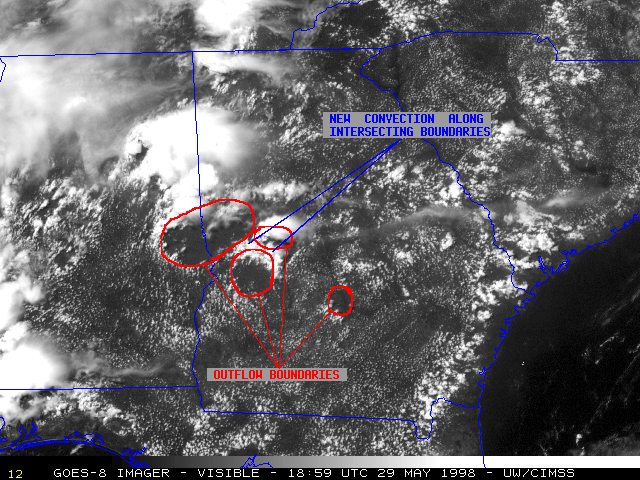
29 May 1998 -- Convection Along Intersecting Outflow Boundaries
|
|
|
The atmosphere was moist and unstable over Alabama, Georgia, and much of the southeastern U.S. on 29 May 1998. As daytime heating further destabilized the atmosphere, isolated pulse-type thunderstorms formed over west central Georgia after around 17:00 UTC. Outflow boundaries from these short-lived storms were evident on NOAA GOES-8 rapid scan operations (RSO) visible imagery (above). New convection can be seen forming along the intersection of these earlier outflow boundaries, and this new convection was more organized and long-lived than the preceeding storms.
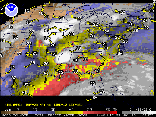
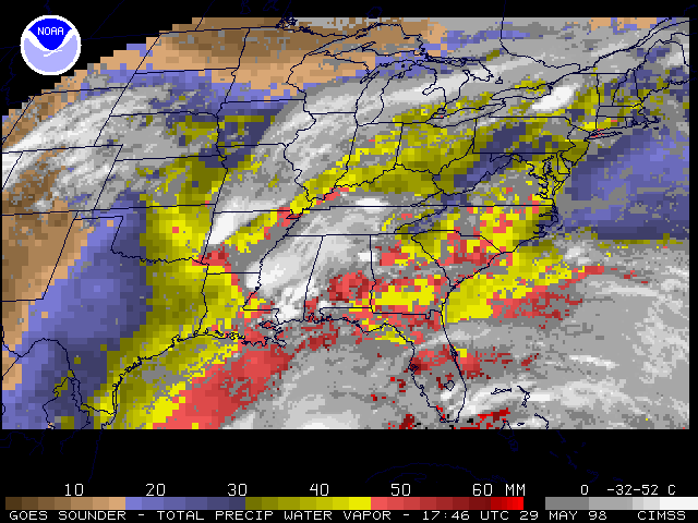
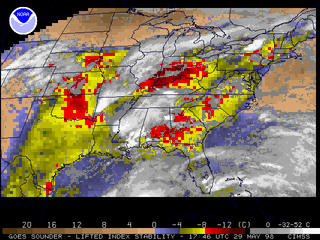
GOES-8 sounder total precipitable water (PW) from 11:46 UTC that morning shows the abundant moisture across that region -- values of 40-50 mm were widespread, and the Atlanta/Peachtree City GA rawinsonde profile indicated 39 mm of precipitable water. By 17:46 UTC, GOES-8 sounder-derived precipitable water and lifted index (LI) showed the moist (greater than 45 mm PW) and unstable (LI less than -8 C) nature of the afternoon atmosphere.
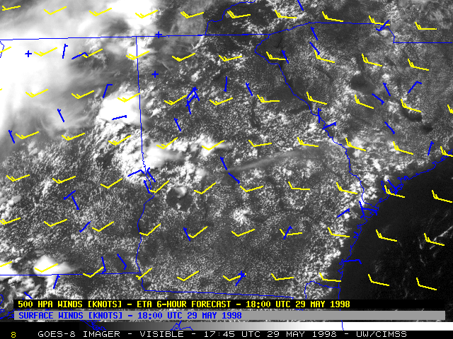
Wind speeds at the surface and within the middle troposphere were very light (generally 10-15 knots or less) across the region at 18:00 UTC. This led to slow movement of the convective cells, and nearly circular outflow boundaries within the weak flow regime.