Asian Dust Over the Pacific Ocean
22-24 April 1998
|
|
|
|
|
|
|
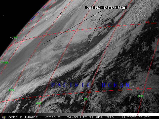
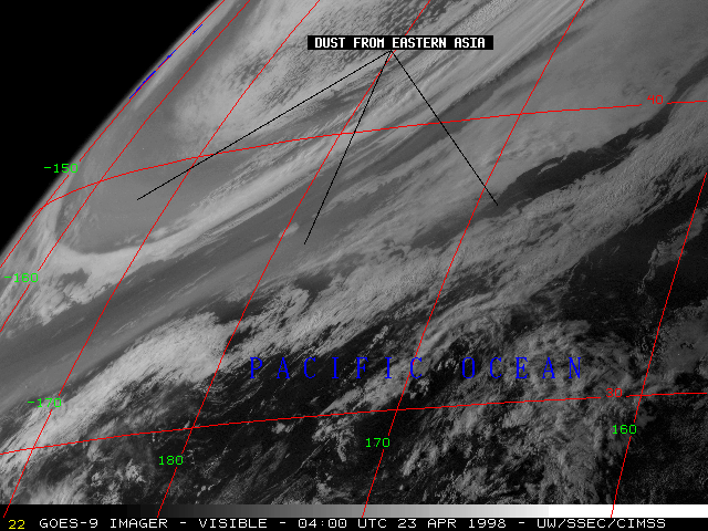
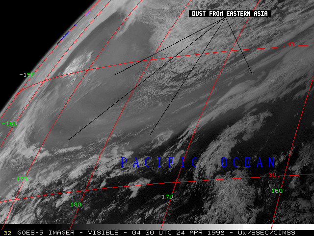
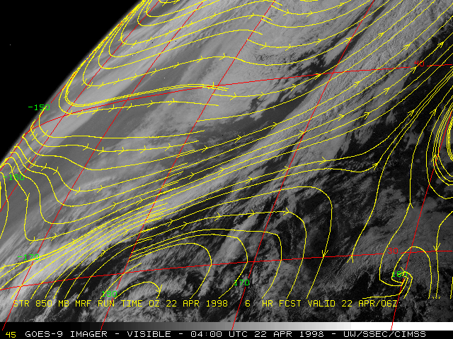
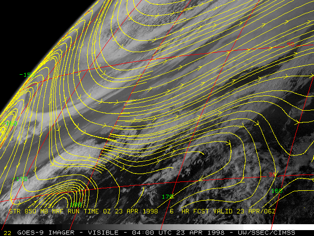
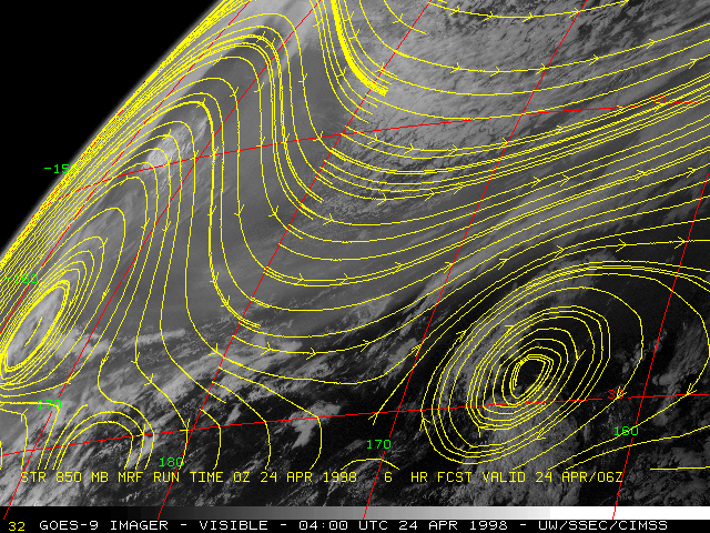
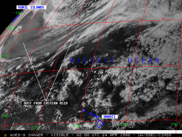
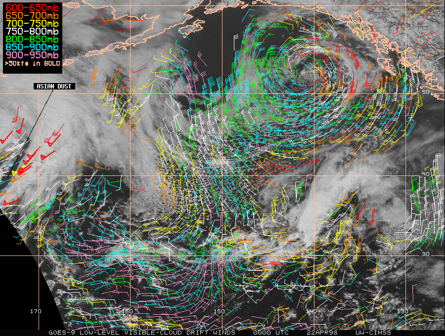
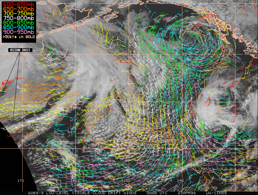
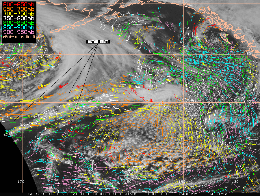
A major dust storm affected parts of the Xinjiang region of northwestern China on 18-19 April 1998. Several days later, large areas of airborne dust were evident on GOES-9 visible imagery (above) over the central North Pacific Ocean (between Japan and Hawaii). The hazy appearance of the dust is enhanced by forward scattering late in the day over this particular region. As the parent storm system moved from eastern Asia toward the Bering Sea, dust was transported 7000-8000 km (4000-5000 miles) from its source region by the strong flow of cyclonically-curved westerly winds within the southern quadrant of the cyclone. CIMSS low-level visible cloud drift winds (22 April | 23 April | 24 April) show wind speeds as high as 50-65 knots within the 600-700 hPa layer in the region of the advancing dust cloud.
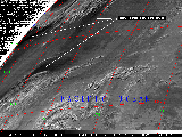
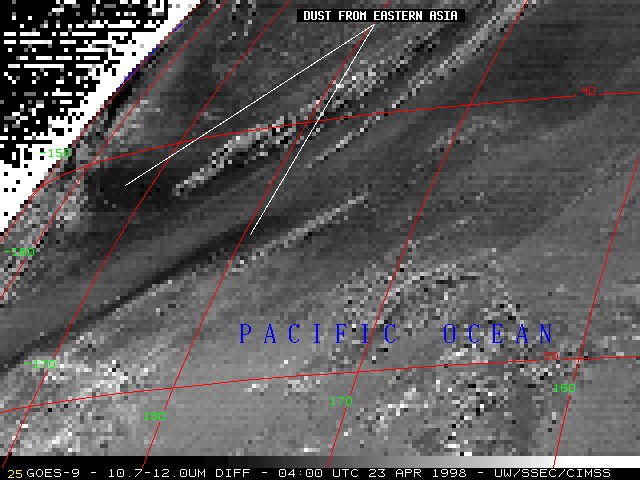
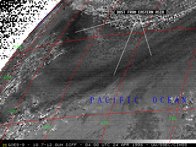
The Asian dust is also apparent on GOES-9 "split window" InfraRed (IR) difference images (below). This difference product is created by subtracting the 12.0 micron IR brightness temperatures from the 10.7 micron IR brightness temperatures -- darker shades represent a negative difference. A negative difference (warmer 12.0 micron brightness temperature) results from absorption (and subsequent emission) of outgoing 12.0 micron thermal radiation by the silicate aerosols which compose the dust cloud. A high silicate concentration implies a sandy aerosol source region, which in this case was likely the Gobi Desert region of China.
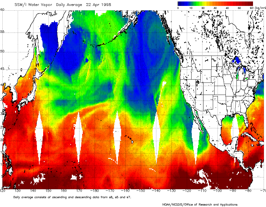
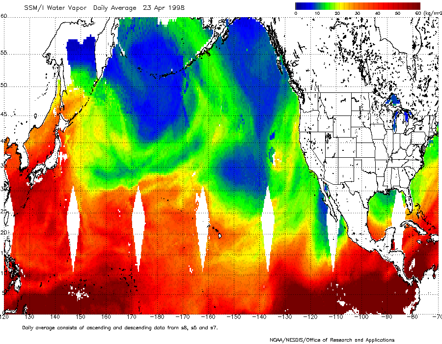
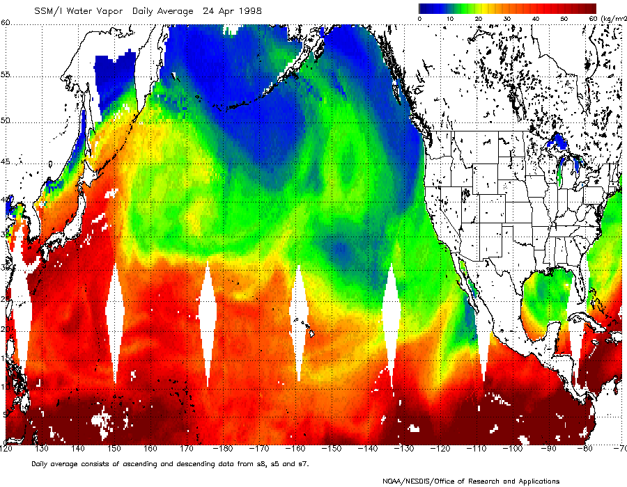
The areal coverage of dust appears larger in the visible imagery than that indicated by the IR difference product imagery. It can be implied that the darkest areas on the IR difference images represent the highest concentrations of suspended dust particulate (maximum dust optical depth) within the more widespread dust cloud. DMSP SSM/I water vapor composites for 22 April, 23 April and 24 April show that the dust-laden air mass was relatively dry (daily average of 20 kg/m2 or less of total precipitable water vapor); therefore, the variability in the dust signatures is not likely due to "contamination" from 12.0 micron absorption by gradients in the low-level water vapor.
Long-range transport of Asian dust across the North Pacific Ocean is common during the Northern Hemisphere winter and spring seasons. A similar phenomenon occurs with Saharan dust over the Atlantic Ocean. The use of GOES imagery to monitor the transport of dust can be helpful to advise aviation interests of potential visibility hazards; this imagery is also of value to atmospheric chemistry and climate studies.
|
|
|
23 April | 24 April | 25 April | 26 April | 27 April | 28 April