22 April 1998 -- Fires in Minnesota
|
|
Interactive comparison of visible and shortwave IR images (Java animation)
|
|
|
Interactive comparison of visible and shortwave IR images (Java animation)
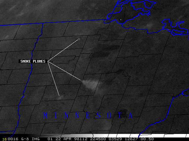
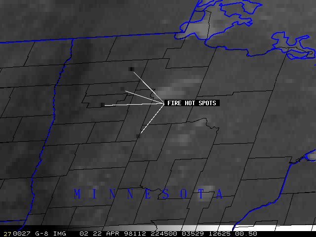
Several fires were burning in northern Minnesota on the afternoon of 22 April 1998. The GOES-8 visible and 3.9 micron shortwave IR imagery above show the locations of the fire "hot spots", along with their associated smoke plumes which drifted southeastward. County outlines are shown in black.
Note how most of the black "hot spots" are fairly short-lived, and appear in only a few successive IR images. The smoke plumes from these fires are also small and short-lived. The long-duration hot spot (which also produced the large smoke plume that fanned out across 2 counties) is located at Itasca State Park (the source of the Mississippi River); this fire was a 3500-acre controlled burn set by Department of Natural Resources officials.