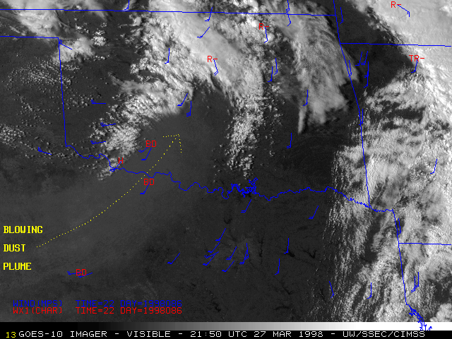
27 March 1998 -- GOES-10 0.65 Micron Visible Imagery
Blowing Dust Over Oklahoma and Texas
|
|
|
GOES-10 0.65 micron visible imagery (from the GOES-10 Science and Operations Test) shows a blowing dust plume moving across northern Texas into southcentral Oklahoma. Wind barbs (blue) show the surface wind direction and speed (meters per second), and surface weather reports are plotted in red (BD = blowing dust; H = haze; R = rain; TR = thunderstorm with rain). Surface visibility was restricted to 4-6 miles within the dust plume. Note how the blowing dust acts to suppress the formation of low-level cumulus clouds across Oklahoma.
According to media reports, the strong surface winds responsible for the blowing dust also downed powerlines and damaged structures across Oklahoma.