24 November 1997 -- Precursors of a West Coast Precipitation Event
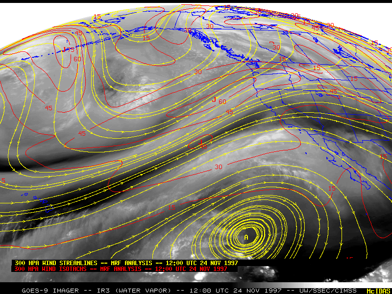
GOES-9 water vapor image with 300 hPa streamlines/wind speeds |
|
|
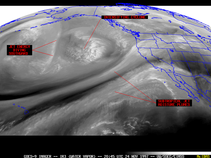
GOES-9 water vapor image with 300 hPa streamlines/wind speeds |
|
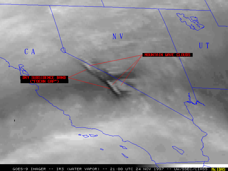
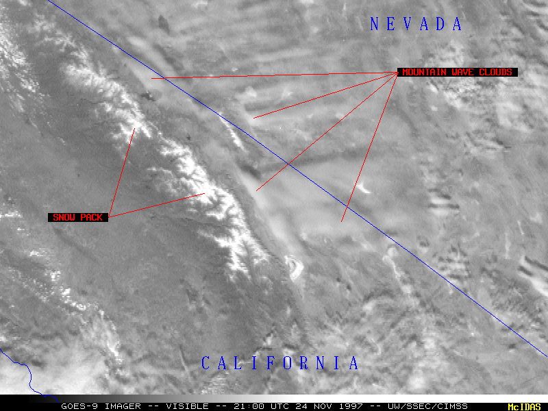
GOES-9 infrared channel 3 (water vapor) imagery (above) revealed the precursors of a significant precipitation event which developed across parts of California and the western U.S.. A trough of low pressure was intensifying in the Gulf of Alaska on 24 November 1997. Significant jet energy could be seen diving southward along the western portion of the developing cyclone, signalling a slow eastward movement of the system until this jet rounded the base of the low. South of this developing cyclone, two distinct plumes of upper-tropospheric moisture and clouds could be seen streaming northeastward from Hawaii toward the California and Oregon coast. As the intensifying low moved closer to the West Coast and continued to tap moisture with a tropical connection, moderate to heavy precipitation fell across parts of the western U.S.
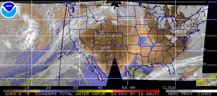
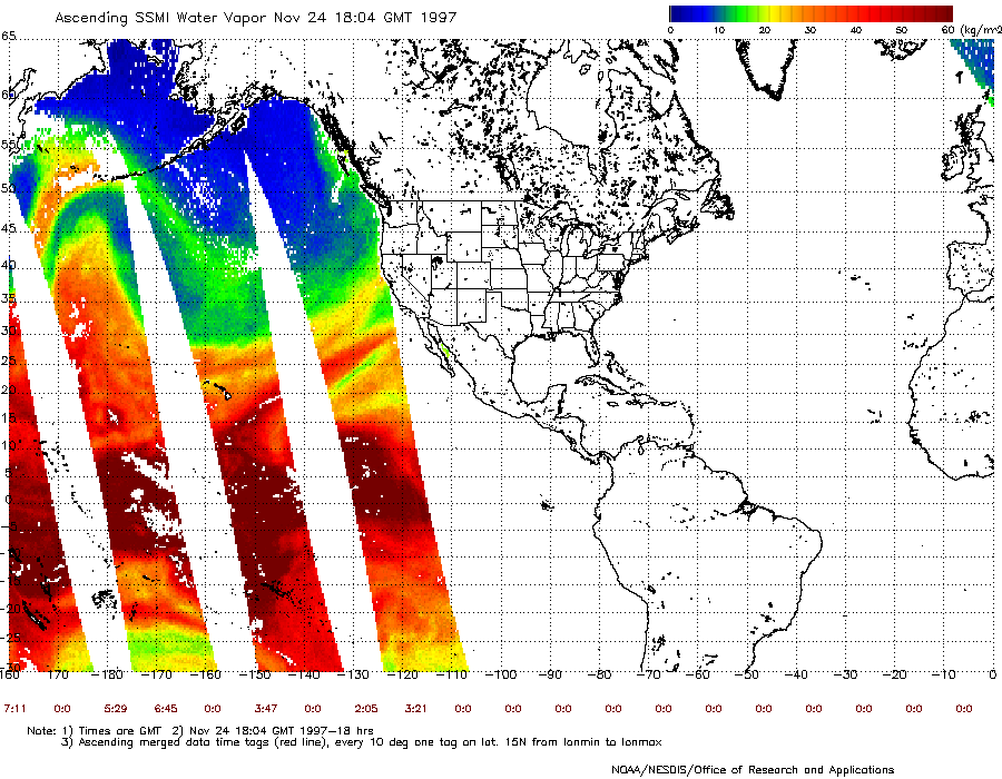
GOES sounder as well as DMSP SSM/I total precipitable water (below) confirmed the presence of increasing tropospheric moisture within the long fetch of these subtropical plumes.[DMSP SSM/I image courtesy of the NOAA/NESDIS/ORA Ocean Physical Processes Team]
|
|
|
|