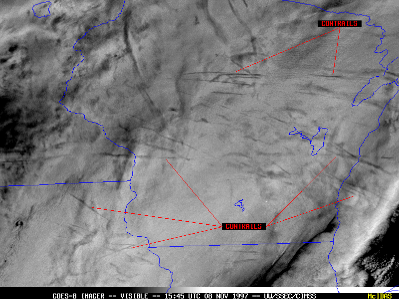
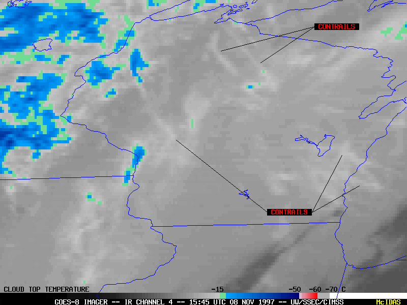
The orientation of many of the contrails suggests that they were left by aircraft flying to/from Minneapolis, Detroit or Chicago. The GOES-8 infrared (IR) channel 4 image (below left) shows satellite-detected brightness temperatures warmer than -15 C, implying a rather low altitude (below about 15,000 feet). This relatively "warm" contrail temperature results from the thin nature of the contrail cloud -- these features are opaque to "warmer" thermal radiation emitted from the earth and clouds below, so the satellite-sensed contrail temperature is somewhat higher.
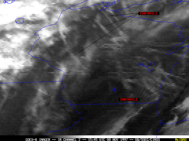
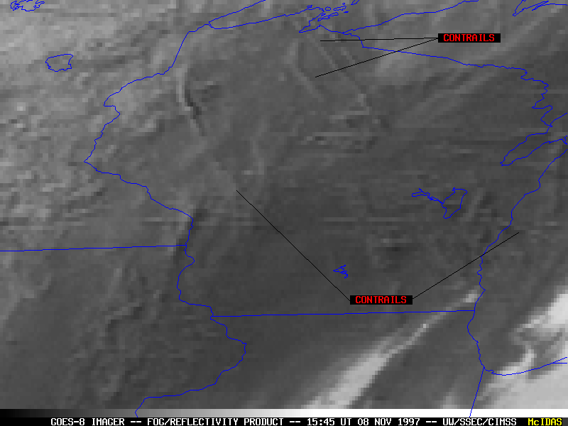
The GOES-8 IR channel 2 image (below center) and IR reflectivity product (channel 4 - channel 2, below right) shows colder brightness temperatures and lower reflectivities than the underlying water-droplet-based stratus deck, indicating that the contrails are high altitude ice-crystal-based features.
Back to The GOES Gallery