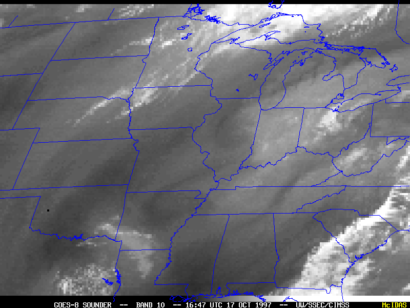
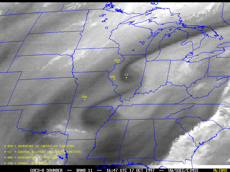
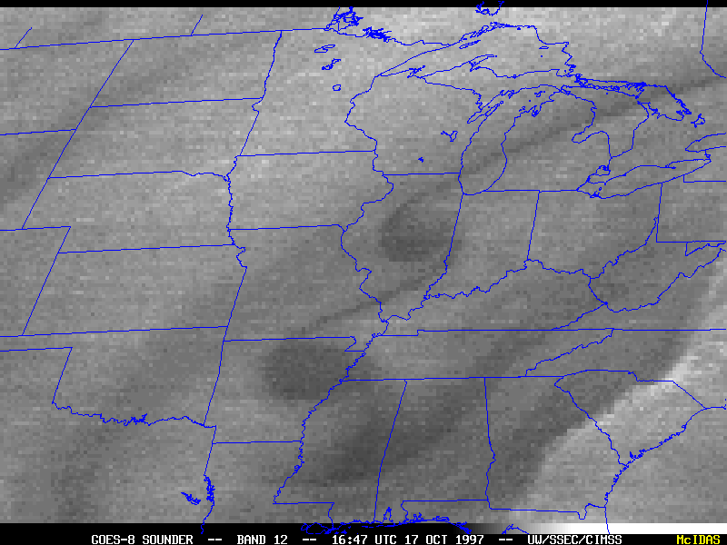
A pair of cyclonic shear vortices formed over the Ohio and Mississippi valley
region on 17 October 1997. The images above are from the GOES-8 sounder midwave "moisture" bands (band 10 = 7.4 micron, band 11 =
7.0 micron, band 12 = 6.5 micron wavelength). The weighting functions (Davenport, Iowa | central Illinois) for these three bands peak at different altitudes, allowing a better estimate to be made of the height of features seen in the water vapor imagery. The cyclonic shear vortices are better-defined in sounder bands 11 and
12, indicating that they are middle to upper-tropospheric features (located between the 600 and 400 hPa levels).
These mesoscale wave features propagated to the southwest as they amplified and developed into closed cyclonic circulations embedded within the northeasterly synoptic-scale flow. Wind streamline and isotach analyses from the ETA model (12 UTC | 18 UTC) indicated that cyclonic speed shear existed between the 20-25 m s-1 mid-level jet streak (located just northwest of the waves) and the 5 m s-1 wind speeds along the trough axis (just southeast of the waves). This speed shear likely played a key role in the initiation and maintenance of these vorticies.
NOAA Wind Profiler data from Winchester, IL (WNC) show that mid-tropospheric winds were light and variable as the first wave began to form over the region (06-09 UTC). The second wave had developed into a more organized cyclonic circulation by the time it moved over the profiler site (18-20 UTC), and wind speeds above 6 km were apparently enhanced with the approach and passage of this feature. Similarly, profiler data from Conway, MO (CNW) indicated enhanced wind speeds aloft with the passage of the well-developed leading vortex (10-14 UTC). The effects of these mesoscale features on the mid-tropospheric wind fields might be of interest to aviation concerns.