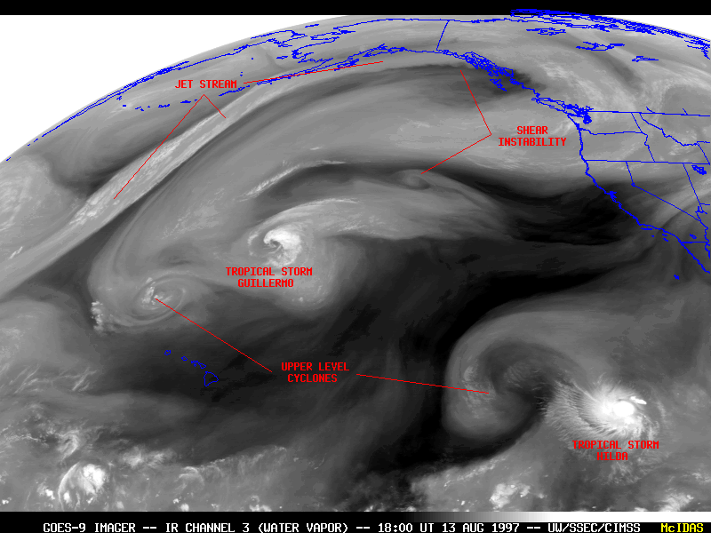
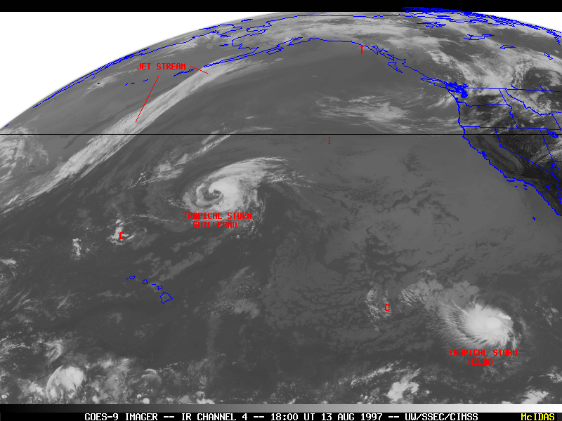
GOES-9 imager infrared (IR) channel 3 (water vapor) and IR channel 4 products showed a wide variety of features over the eastern North Pacific Ocean on 13 August 1997. Deep convection associated with tropical storms Guillermo and Hilda were evident on both IR channels. Of particular interest were two upper level cyclonic circulation centers and two regions of shear instability near the axis of jet streaks -- features that were readily identifiable on water vapor imagery but were not apparent on IR channel 4 imagery.
The cyclonic circulation to the northwest of Tropical Storm Hilda was important because of its effect on the development and motion of the storm. Due to the close proximity of this upper level circulation to that of Hilda, wind shear was unfavorable for the rapid development of the tropical system.
A distinct plume of water vapor and high clouds associated with an active jet stream can be seen arcing northeastward toward the southern coast of Alaska. Wind streamline and isotach analyses overlaid on the water vapor and IR channel 4 images reveal that the jet was curving around the western and northern periphery of an anticyclone centered over the Gulf of Alaska. A core of wind speeds in excess of 60 m s-1 was located over southeastern Alaska.
The southern edge of this jet was marked by a sharp discontiuity on the water vapor imagery. An animation shows that this boundary was smooth along the right rear "entrance region" of the jet, but small perturbations developed just south of the core and also along the right front "exit region" of the jet speed maximum. Such a water vapor signature is sometimes seen along anticyclonically-curving jet stream segments, and can indicate regions of moderate to severe turbulence induced by shear instability at high altitudes. The Anchorage National Weather Service highlighted the region along the southeast Alaska coast as having a risk of moderate high altitude turbulence.
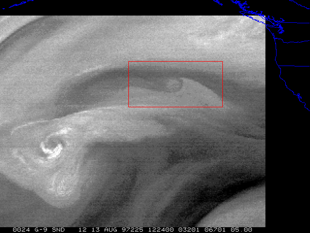
Another jet streak was moving westward along the southern periphery of the Gulf of Alaska anticyclone. The same animation reveals that a wave-like feature developed along the deformation zone just south of this second jet circulation. This feature could not be detected using conventional IR channel 4 imagery. As with the shear instability noted above over the Gulf of Alaska, this type of satellite signature is sometimes associated with high altitude turbulence.
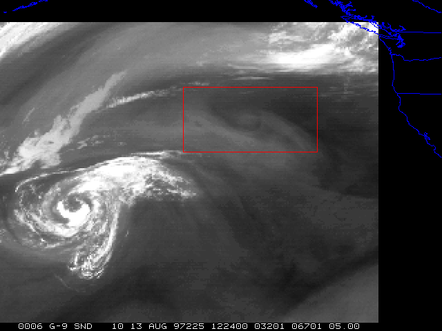
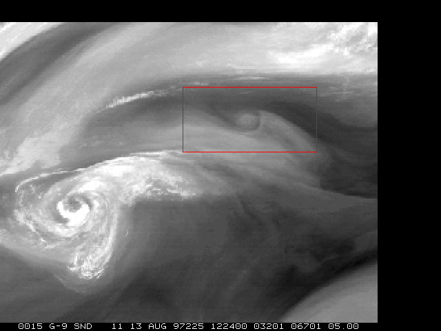
The images below are from the GOES-9 sounder midwave "moisture" bands (band 10 = 7.4 micron, band 11 = 7.0 micron, band 12 = 6.5 micron wavelength). The weighting functions for these bands peak at different altitudes, allowing a better estimate to be made of the height of features seen in the water vapor imagery. The wave-like circulation which propagated westward along the deformation zone is better-defined in bands 11 and 12, indicating that it is indeed a middle to upper-tropospheric feature (likely the 600 hPa level and above).