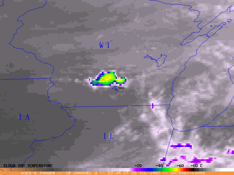
Early evening convection developed very rapidly along a residual outflow boundary left behind by thunderstorms over southern Wisconsin during the morning of 25 July 1997. GOES-8 sounder data indicated that precipitable water was abundant (greater than 50 mm) across southwestern Wisconsin at 23:46 UT, and a NW-SE oriented axis of lifted indices around -8 was apparent along the outflow boundary. Surface dewpoint temperatures were very high (mid
70's to mid 80's F), another indicator of the latent instability of the air mass.
Southern Wisconsin was
beneath the right rear quadrant (right entrance region) of an upper level jet streak, where
upper-level divergence induced synoptic-scale upward vertical motion. An environment of strong vertical wind shear developed as surface winds became southeasterly in the vicinity of Madison while middle and upper level winds were from the west-northwest.
The Storm Prediction Center issued a Tornado Watch at 00:27 UT (7:27 PM CDT) for southern Wisconsin and northern Illinois, and the Milwaukee-Sullivan NWS forecast office issued the first Tornado Warning at 00:31 UT (7:31 PM CDT).
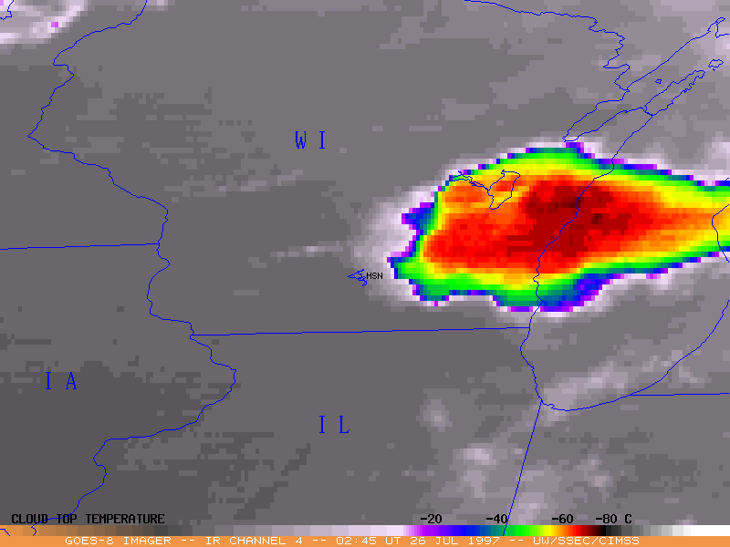
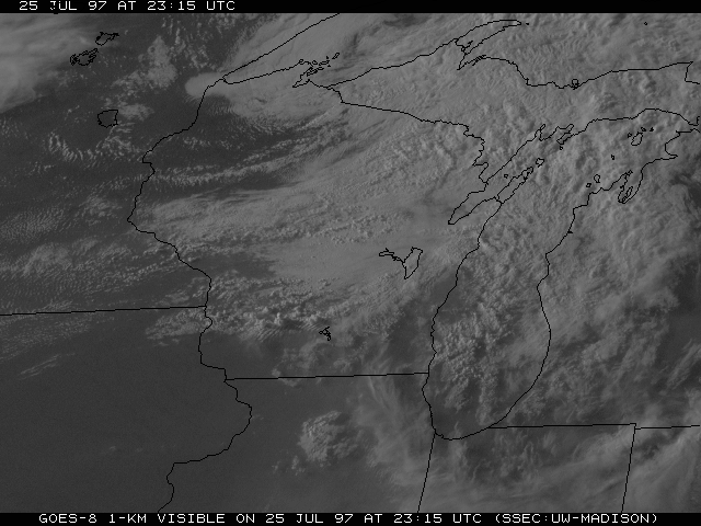
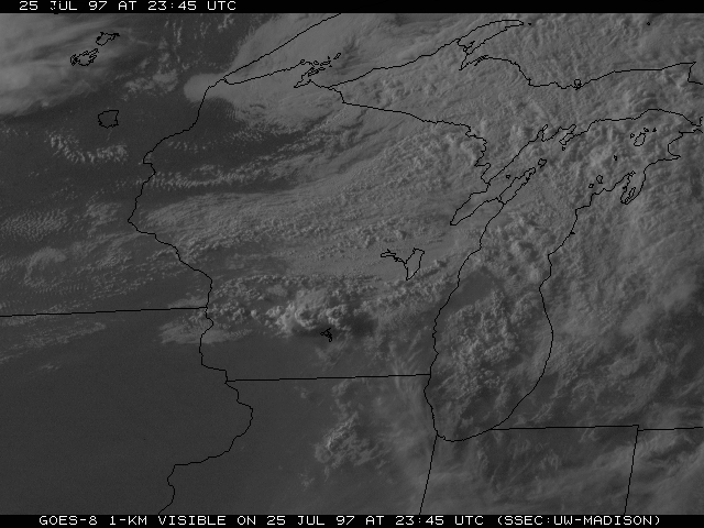
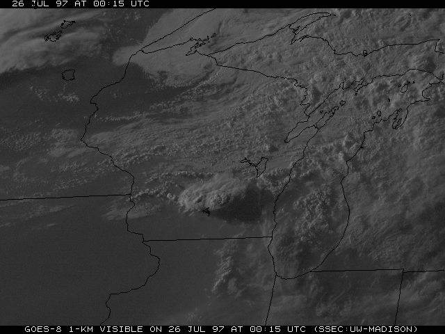
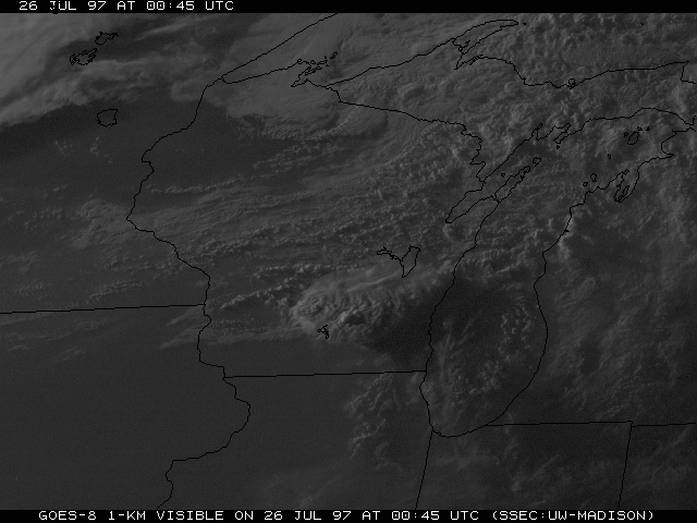
An animation of GOES-8 visible imagery shows the rapid development of the convection from 23:15 UT on 25 July to 00:45 UT on 26 July (6:15 PM to 7:45 PM CDT). At 23:15 UT, two distinct convective towers were evident just northwest of Madison. By 23:45 UT, overshooting tops were apparent as the anvil of the supercell began to take shape. At 00:15 UT (prior to the first tornado reports) the most vigorous of the overshooting cloud tops appeared to be just northeast of Madison. The 00:45 image shows the supercell around the time of the first of the two confirmed tornadoes.