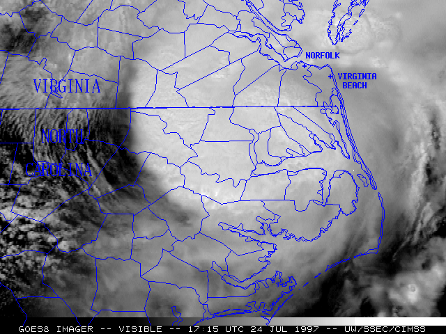
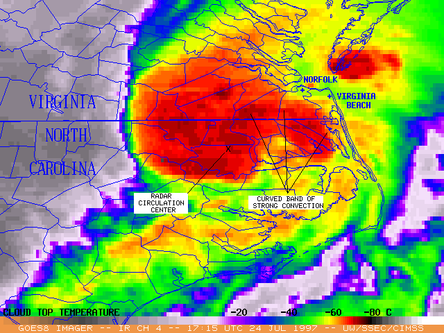
After making landfall near Mobile, Alabama on 19 July 1997, the remnants of Hurricane Danny moved slowly northeastward across Alabama, Georgia and the Carolinas during the following 5 days. On 24 July a well-defined low-level circulation center could be identified on WSR-88D radar [animation] as the disturbance moved across northeastern North Carolina. An environment of strong low-level winds (60 knots at 5000 ft/1.5 km) with high directional and speed shear existed around this circulation center, and precipitable water was abundant across the region.
The GOES-8 imagery and animations above show a curved convective band that developed over extreme northeastern North Carolina into extreme southeastern Virginia, just to the northeast of the circulation center. There were several reports of weak tornadoes and waterspouts around the Norfolk/Virginia Beach metropolitan area between 17:25 and 19:40 UT (two of these tornadoes were confirmed by the Wakefield VA NWS Office). Several locations around the region reported high winds, with gusts in excess of 60 mph (27 m s1-). Satellite-derived 24-hour rainfall estimates show a swath of 2-5 inch amounts to the north of the track of the low-level circulation center.
The area of low pressure associated with Danny's remnants maintained tropical characteristics during the inland trek, and the Tropical Prediction Center began re-issuing advisories on Tropical Storm Danny as it emerged over the Atlantic just off the Virginia coast (NOAA-14 AVHRR image). For some image examples of Danny, see the CIMSS Tropical Cyclones page.