|
|
|
|
|
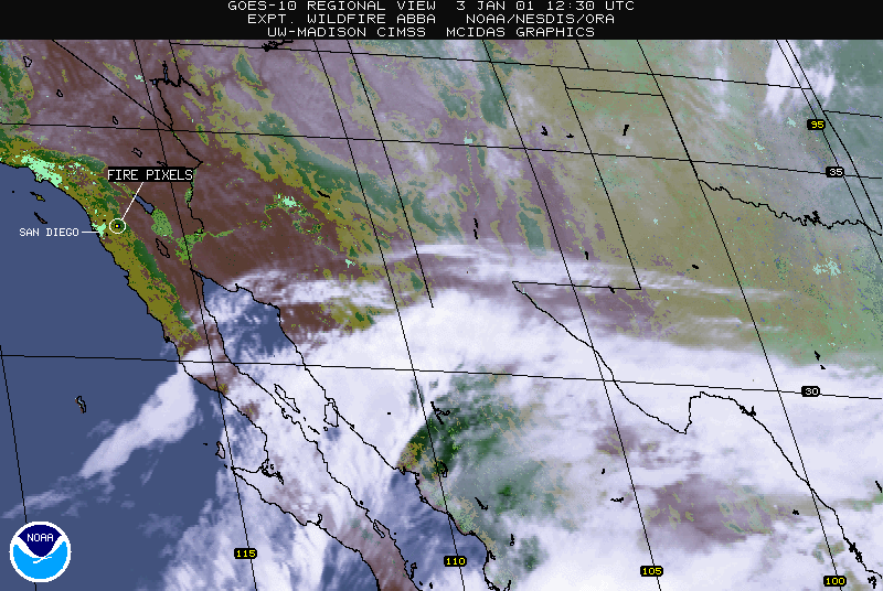
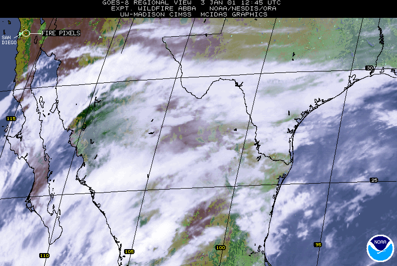
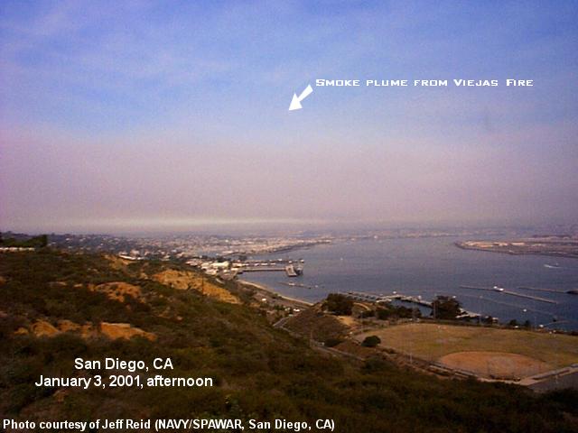
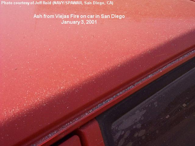
A large wildfire in San Diego County began early in the day (around 12:00 UTC or 4:00 AM Pacific time) on 03 January 2001 near the Viejas Indian Reservation, located in the Cleveland National Forest just east of San Diego, CA. The coverage of the fire quickly grew to a size exceeding 5000 acres, fueled by strong Santa Ana winds which gusted as high as 65 MPH across parts of San Diego county during the day. Hundreds of people were evacuated from their homes, and several structures were lost to the fire. By the following day the fire had reached 10,000 acres in size. The experimental Wildfire Automated Biomass Burning Algorithm (ABBA) identified numerous fire pixels within minutes of the start of the blaze in both the NOAA GOES-10 imagery (above, left) and GOES-8 imagery (above, right).
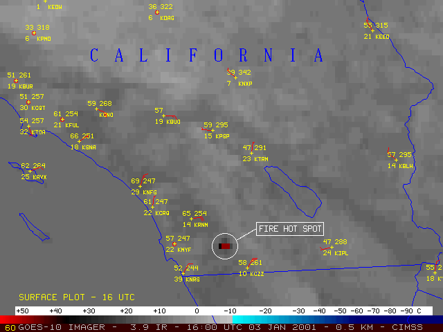
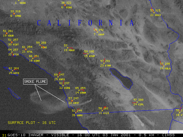
GOES-10 3.9 micrometer shortwave InfraRed (IR) and visible channel imagery (below) show a closer look at the region. The wildfire "hot spots" (black to red enhancement) are evident on the IR imagery, while the visible channel shows that the smoke plume from these fires was drifting westward over the San Diego CA region and out over the adjacent Pacific Ocean.
|
|
|
|
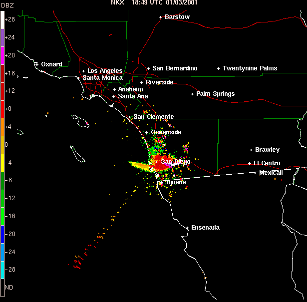
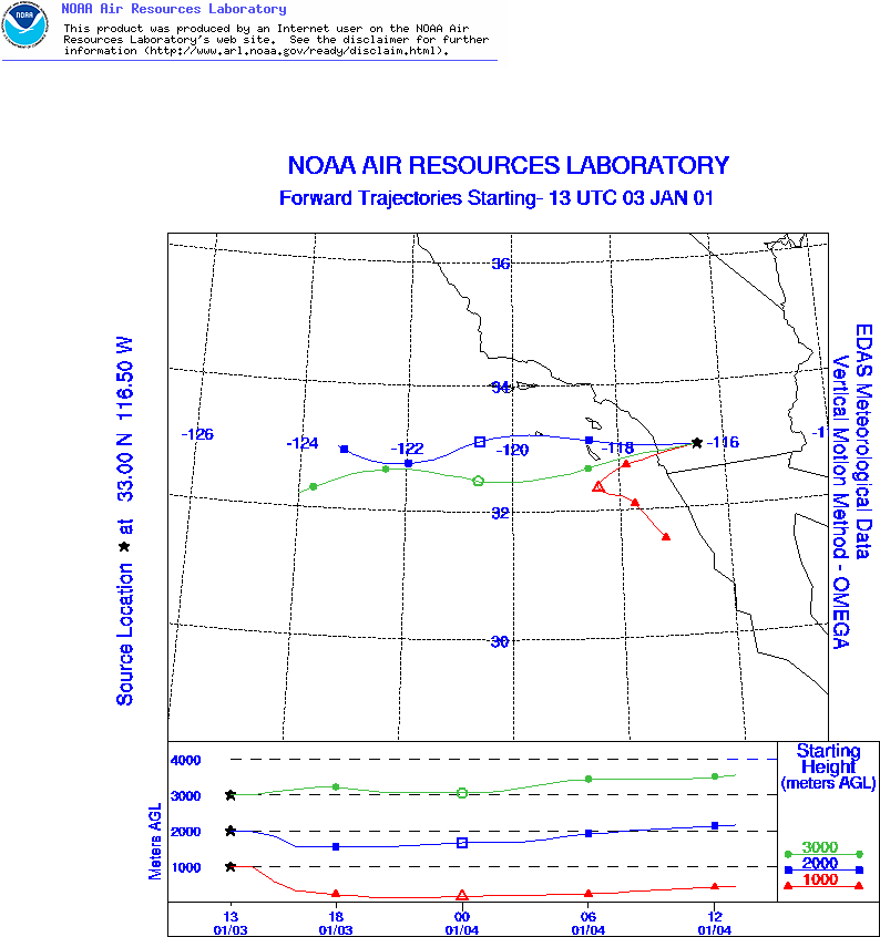
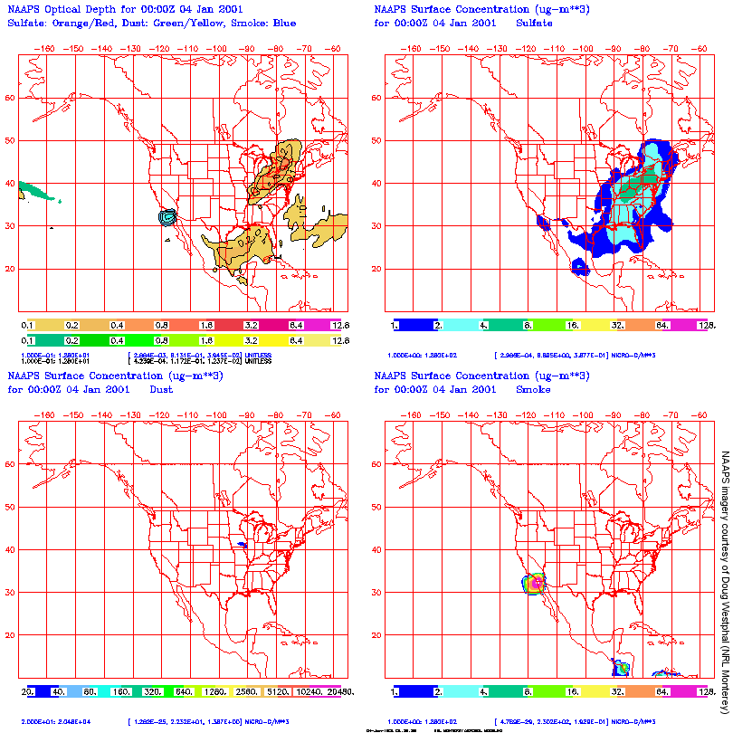
The smoke plume was also detected by the WSR-88D radar located near San Diego, CA (above, left). Air parcel trajectories from the NOAA Air Resources Laboratory HYSPLIT model (above, right) show the westward transport path above the 2km level. The Navy Aerosol Analysis and Prediction System (NAAPS) (below, courtesy of Doug Westphal) was used to predict the future trajectory of the smoke produced by the fire.
|
|
|


