|

|
|
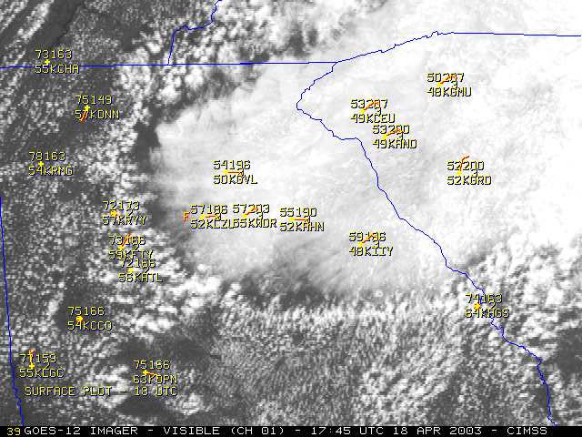
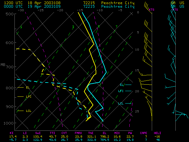
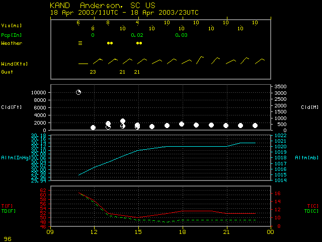
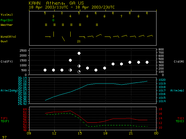
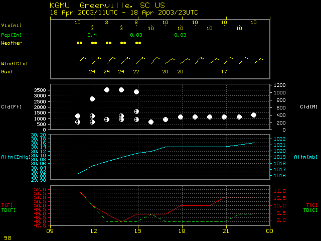
GOES-12 Rapid Scan Operations visible imagery shows some interesting cloud effects as a gravity current associated with a wedge of low-level cold air moved southwestward across northern Georgia on 18 April 2003. Subsidence in the immediate wake of the leading edge of the gravity current caused a rapid dissipation of cumulus clouds. Farther behind the leading edge, the pool of cold air remained deep and was capped by a subsidence inversion (Peachtree City GA rawinsonde data), which helped to sustain the fog and stratus over northeastern Georgia and southwestern South Carolina (and limit daytime heating -- note that the surface temperatures remained in the 50's F during the day at Anderson SC and Athens GA). Following the passage of the gravity current, easterly to northeasterly surface winds gusted as high as 21 knots at Athens GA, 23 knots at Anderson SC, and 24 knots at Greenville SC. Late afternoon convection was also enhanced along the southern edge of the boundary (in the vicinity of the South Carolina / Georgia border).
