
|
|
|
|
|
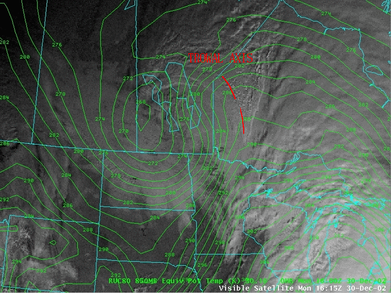
NOAA GOES-08 imagery (above, left) shows the evolution of a wedge-shaped cloud feature associated with a TRough Of Warm Air aLoft (TROWAL) over western Ontario and eastern Manitoba, part of an occluded cyclone moving across that area on 30 December 2002. The low sun angle during the winter season over Canada allows better illumination of the edges of this middle level cloud feature, which identifies the moist TROWAL air stream as it was ascending northward. Note that one location in western Ontario reports a brief period of sleet, and 2 other stations report freezing drizzle as the cloud wedge (and the associated layer of warm air aloft) moves overhead.
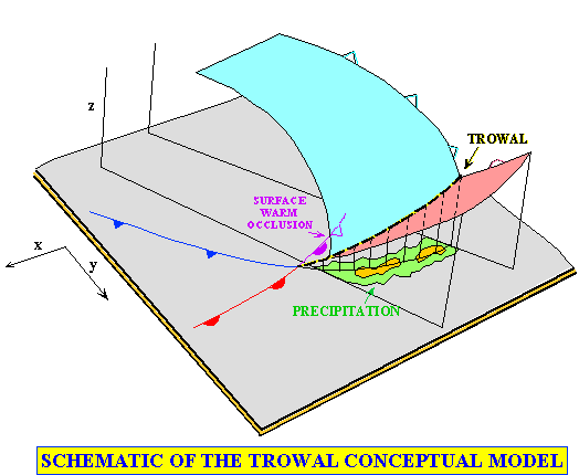
The location of the axis of the TROWAL is verified using equivialent potential temperature (theta-e) contours from the 80-km Rapid Update Cycle (RUC) model (above, right). Upward motion along the strongly sloping isentropic surfaces of the TROWAL (below) can result in areas of enhanced precipitation in an otherwise benign-looking occluded system. Brief periods of moderate snow were reported over parts of Manitoba (near the northwestern edge of the TROWAL axis).
|
Martin, J. E., 1998a: The structure and evolution of a continental winter cyclone. Part I: Frontal structure and the occlusion process. Mon. Wea. Rev., Vol. 126, 303-328.
Martin, J. E., 1998b: The structure and evolution of a continental winter cyclone. Part II: Frontal forcing of an extreme snow event. Mon. Wea. Rev., Vol. 126, 329-348.
Martin, J. E., 1999: Quasigeostrophic forcing of ascent in the occluded sector of cyclones and the TROWAL airstream. Mon. Wea. Rev., Vol. 127, 70-88.

