|
|
|

|

|

|
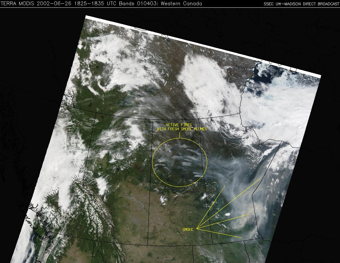
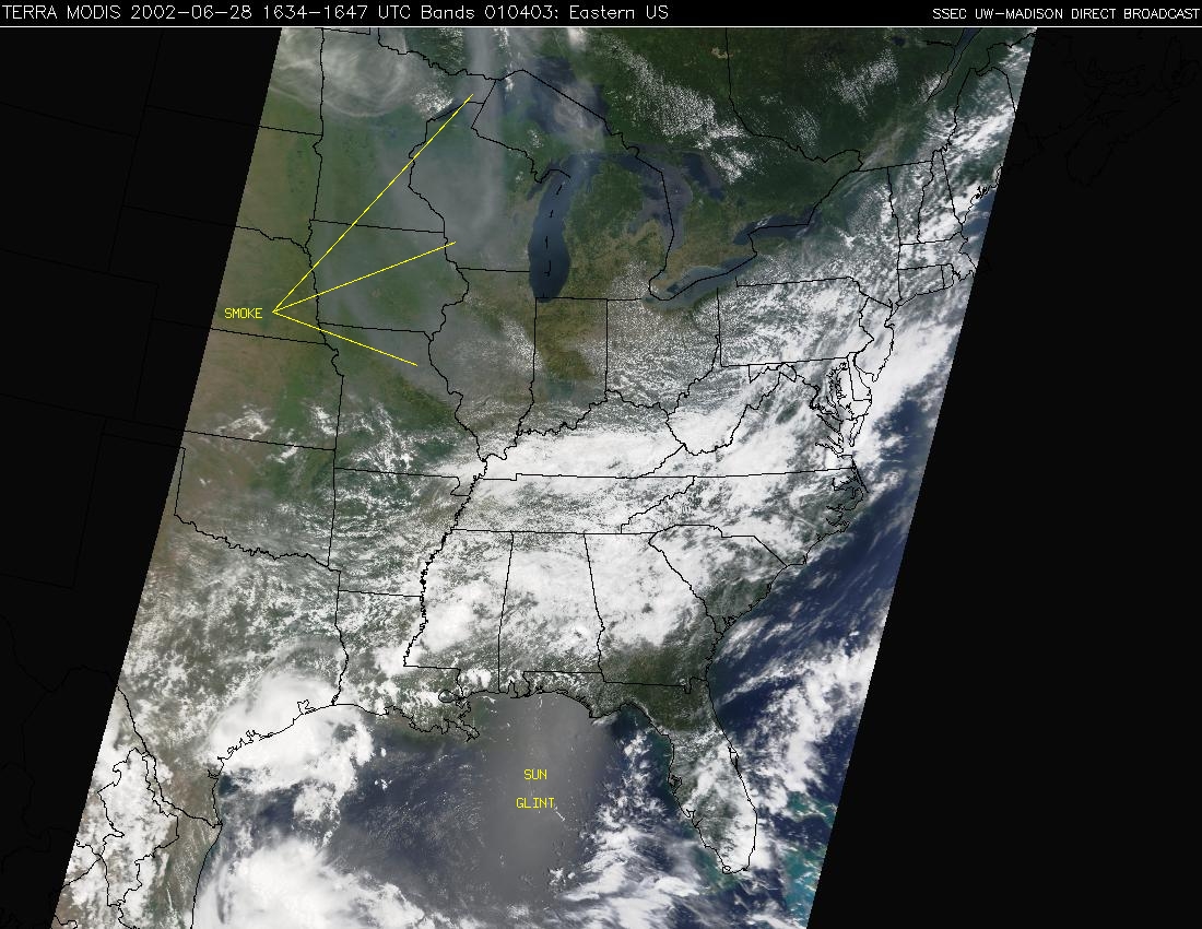
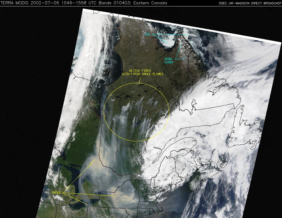
Wildfires in Canada (initially burning across northern Saskatchewan, and later across central Quebec) during late June and early July 2002 produced large amounts of smoke, with some of this smoke being transported southward across parts of the eastern US. Daily sequences of NASA Terra MODIS composite images (above) show the location and areal coverage of the smoke during this period. Large (1-2 MB file size) 250-meter resolution Terra MODIS composite images are available which show the wildfires over Saskatchewan on 22 June, 26 June, and 27 June, and also over Quebec on 08 July.
|
|
|
A large cluster of at least 85 fires was initiated by lightning across parts of central Quebec on 02-03 July. During the following few days, strong winds across the region helped the fires to grow rapidly (05 July | 06 July Wildfire ABBA product animations), producing several large smoke plumes. Much of this smoke was advected southward across the northeastern US during 06-08 July as a cyclone intensified over the Canadian Maritimes (850 hPa | 700 hPa | 500 hPa wind streamlines). GOES-08 visible imagery (above) shows the rapid development of the smoke plumes over Quebec on 06 July, and the subsequent transport of that smoke across much of the northeastern US and adjacent Atlantic Ocean on the following day. The current state of wildfire activity across Ontario and Quebec can be monitored using the GOES-08 Wildfire ABBA product.
