|
|
|
|
|
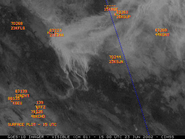
NOAA GOES-10 visible imagery (above, left) shows the evolution of multiple smoke plumes from the Rodeo (205,000 acres burned as of 23 June) and Chediski (100,000 acres burned as of 23 June) fire complexes in Arizona. Thick smoke had settled into the valleys overnight, and organized smoke plumes redeveloped as southwesterly winds increased during the daytime hours. The rapid intensification of the Rodeo/Chediski complex on June 20, 2002 was one of the most extreme examples ever documented with the GOES Wildfire Automated Biomass Burning Algorithm (WF_ABBA), as shown in this animation.
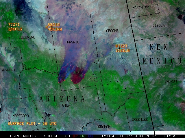
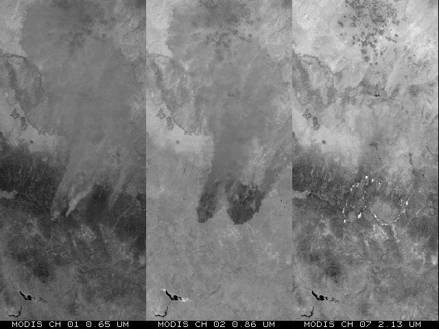
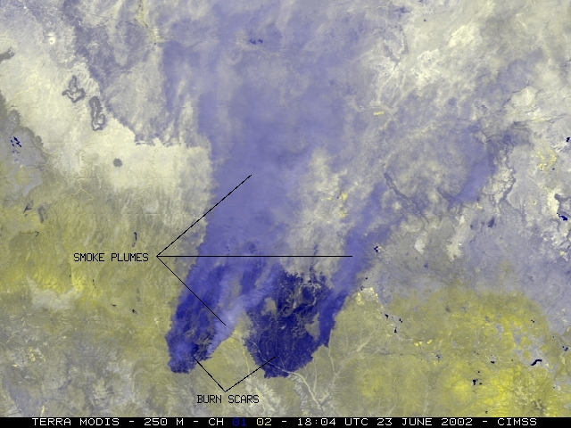
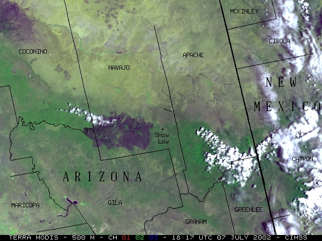
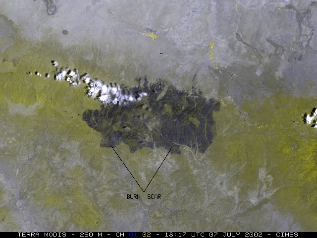
A 3-channel composite image using 500-meter resolution NASA Terra MODIS data (above, right) reveals the two very large burn scars (dark enhancement), with active fire hot spots (red enhancement) around the periphery of the burn scars, and thick smoke (light purple enhancement) drifting northeastward. Areas with significant vegetation (consisting mainly of pine and juniper trees) are enhanced green. These 2 large fires exhibited extreme behavior due to high winds on this particular day, and began to merge to the west of Show Low in southern Navajo county. A MODIS image composite using 250-meter resolution data shows the burn scars in greater detail. Additional MODIS 250-meter composite images can be found on the SSEC MODIS Image Gallery.
This fire ended up being the largest in Arizona history, consuming 468,638 acres and 467 homes. Note the larger size of the consolidated burn scar on these Terra MODIS composite images (500-meter resolution | 250-meter resolution), 2 weeks later on 07 July 2002.

