(- Animation, June 9, 2002 12:45 UTC - June 10, 2002 2:45 UTC -) |
|
|
|
(- Animation, June 9, 2002 12:45 UTC - June 10, 2002 2:45 UTC -) |
|
|
|
|
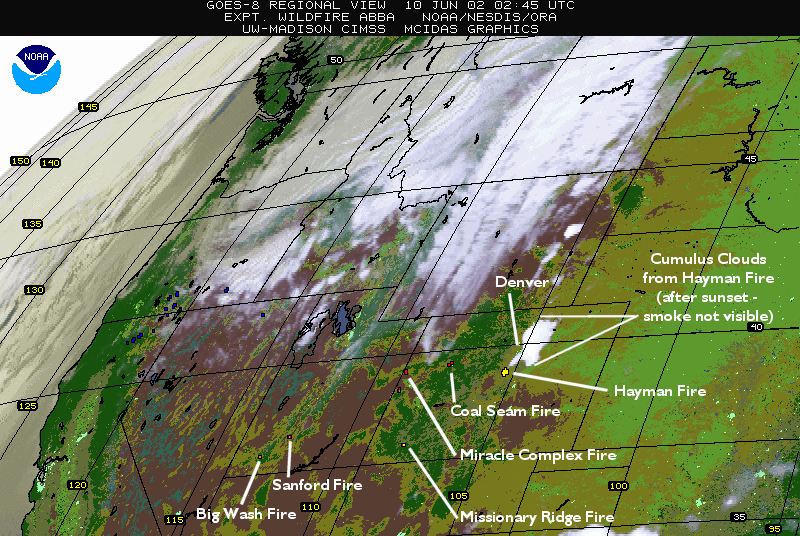
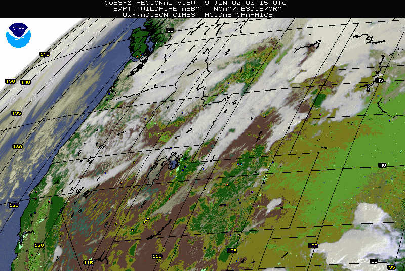
NOAA GOES-8 Wildfire Automated Biomass Burning Algorithm (WF_ABBA) imagery shows fires in the western US at 10:45 EDT (8:45 MDT) June 9, 2002. The WF_ABBA detects fires every half-hour over the western hemisphere and has been running experimentally and detecting fires half-hourly since August 2000. The product will be officially designated operational by NOAA in the mid to late 2002, though the realtime data is available now to those who need it.
(- Animation, June 10, 2002 12:00 UTC - June 10, 2002 22:15 UTC -) |
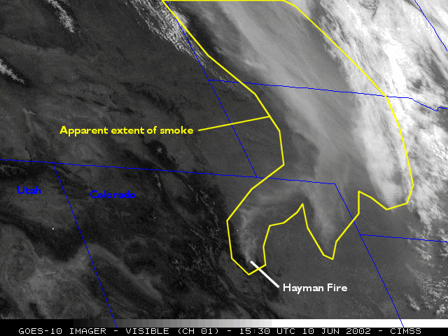
NOAA's GOES-10 has a good viewing angle for watching the smoke from the Hayman Fire in Colorado. The WF_ABBA modified alphablended imagery for GOES-8 do not see the smoke as well due to the viewing angle and the age of the satellite (the contrast against the surface of the Great Plains is low). The loop above shows the movement of the smoke plume during the afternoon of June 10, 2002.
|
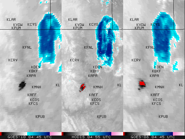
NOAA's GOES-8 and GOES-10 and the MODIS instrument on NASA's Terra spacecraft all imaged the Hayman Fire in the 3.9 micron band at about 4:45 UTC on June 10, 2002. Blue represents the coldest cloud tops, reds show the warmest surfaces with brightness temperatures of 330K and above (GOES-10 can only detect up to about 320K), and white to black represents progressively hotter temperatures in between. MODIS's 1 km per pixel resolution shows the shape of the fire better than the GOES (which are at 4 km per pixel resolution), but all three satellites obtained similar imagery and observed similar temperatures. The GOES satellites do well in resolving the shape of the fire and have the added advantage of being capable of monitoring the fires 24 hours a day, whereas MODIS images a given location twice a day, at most. The station label KDEN refers to the location of the Denver, Colorado weather monitoring station.
A long loop of WF_ABBA imagery for Colorado is available as an animated GIF here. This file is approximately
29 megabytes, containing almost 200 frames of 800x536 WF_ABBA imagery. User beware: some machines cannot handle animated GIFs of this size!! The loop runs from 0:15 UTC on June 9, 2002
to 6:15 UTC on June 13, 2002. The Hayman and other fires can be seen producing smoke plumes and "pyro-cumulus" as well as flaring up during the afternoons and dying down overnight.
This diurnal cycle has also been observed on the ground and is not merely a side-effect of satellite fire detection.
