|
|
|
|
|
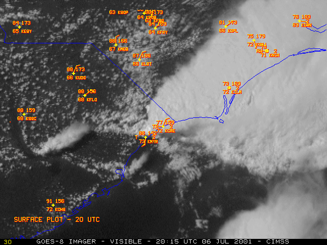
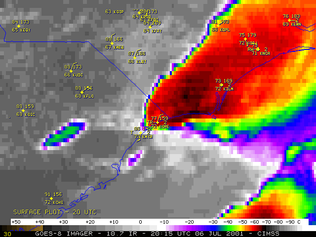
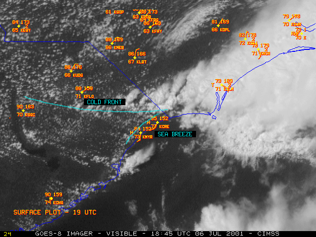
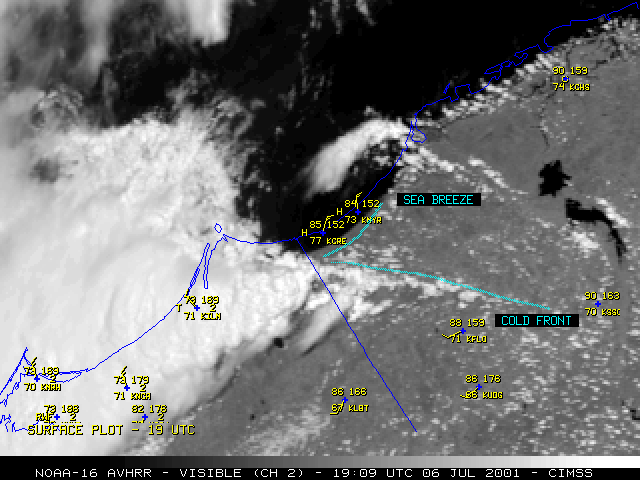
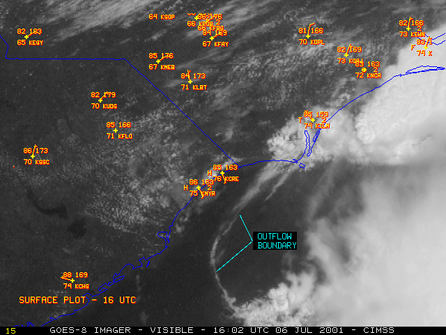
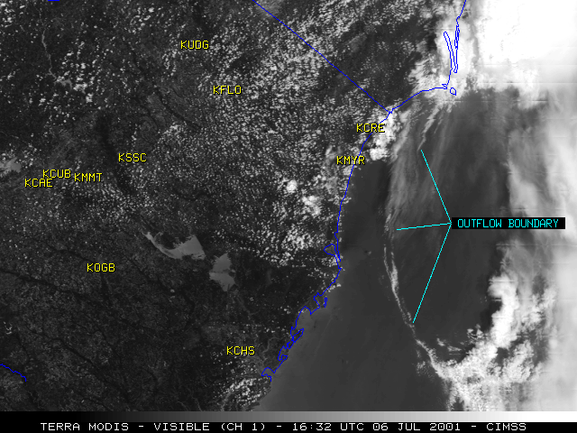
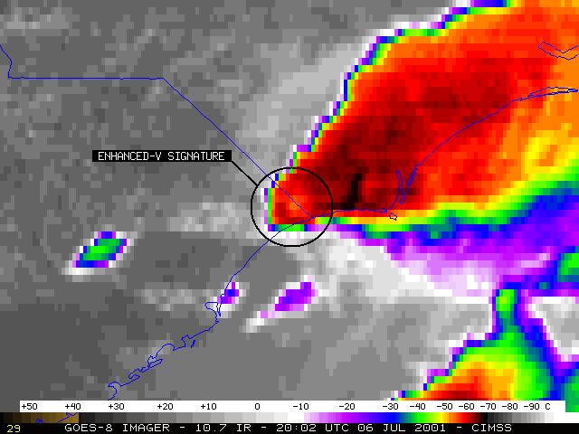
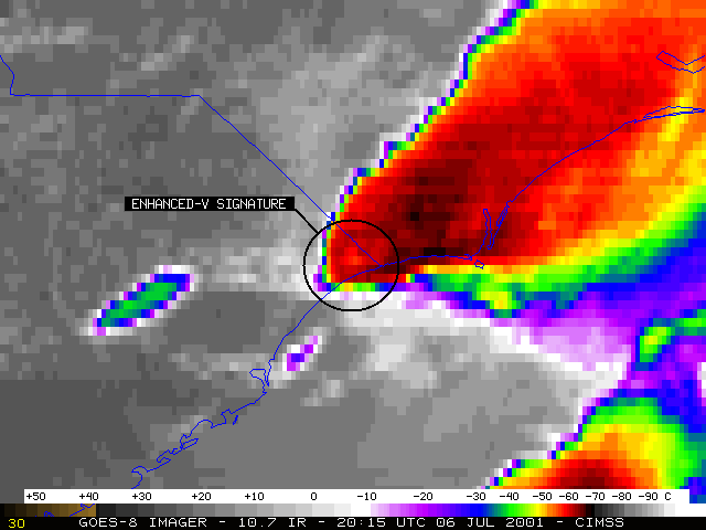
NOAA GOES-8 visible and InfraRed (IR) imagery (above) shows the development of convection which spawned one (or possibly two) tornadoes near Myrtle Beach, South Carolina around 20:25 UTC (4:25 PM EDT) on 06 July 2001. A cold frontal boundary and a sea breeze boundary are apparent on the visible imagery, and boundary interactions (GOES-8 | NOAA-16 AVHRR) likely played a role in the development and intensification of the convection. It is also possible that the sea breeze boundary was reinforced by an offshore convective outflow boundary (GOES-8 | Terra MODIS) that was moving toward the coast earlier in the day. An "Enhanced-V" cloud top signature was evident on the IR imagery (20:02 UTC | 20:15 UTC), which often indicates convection that will soon produce damaging winds, large hail or tornadoes. More information and damage photos are available from the Wilmington, NC National Weather Service.
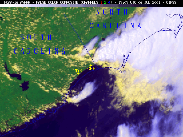
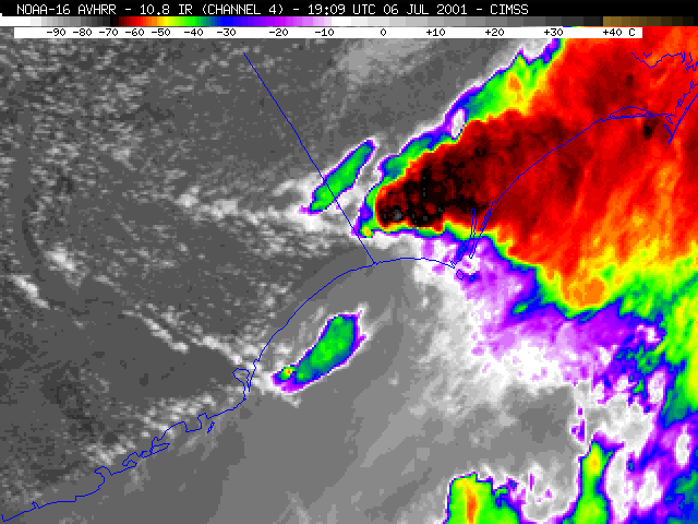
A 3-channel false-color composite and the corresponding visible (channel 2) and 10.8 micrometer IR (channel 4) image from an overpass of the NOAA-16 polar orbiting satellite are shown below. These images show the convection developing in southeastern North Carolina at 19:09 UTC (3:09 PM EDT), about an hour and 15 minutes before the Myrtle Beach tornadoes.
|

|
|
 (- Fade between NOAA-16 composite and IR images at 19:09 UTC-)
(- Fade between NOAA-16 visible and IR images at 19:09 UTC-)
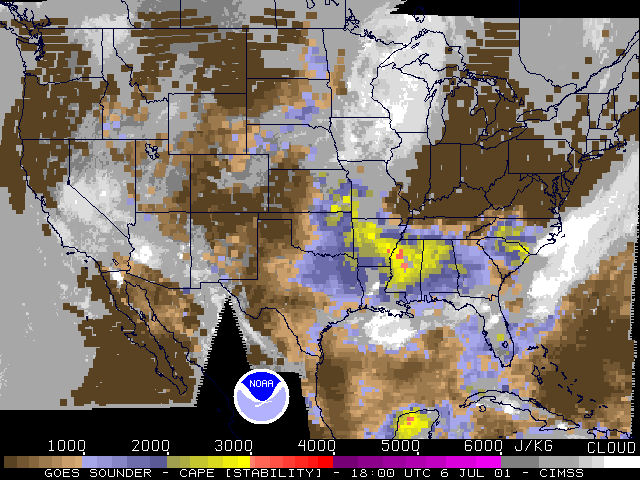
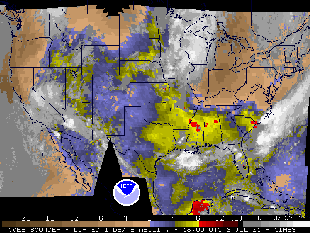
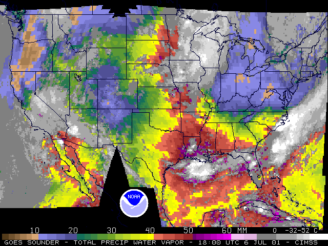
GOES-8 Sounder derived products of Convective Available Potential Energy (CAPE), Lifted Index (LI) and Precipitable Water (PW) (below) highlight the degree of instability and moisture in the pre-convective environment across eastern North and South Carolina on 06 July.
|
|
|

