
|

|
|
|
|
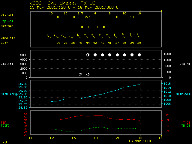
Strong winds in the southwestern quadrant of an intense southern Plains cyclone caused areas of blowing dust across parts of northwestern Texas and extreme southwestern Oklahoma on 15 March 2001. Winds gusted as high as 53 knots (61 mph) at Dalhart in the northern Texas panhandle, and surface visibility was reduced to 2.5 miles at Childress Texas (station identifier KCDS, in the northern portion of the images above). Pilot reports indicated that this blowing dust extended to heights of 7500-15000 feet above ground level.
The NOAA GOES-8 10.7-12.0 micrometer IR difference product (above, left) shows a subtle signature indicating airborne dust across parts of the southern Texas panhandle and northwestern Texas. The elevated dust appears to have increased in coverage during the 17-22 UTC time period. The Terra MODIS IR difference product at 17:31 UTC (above, right) showed greater areal coverage of the elevated regions of blowing dust, from the Texas panhandle region to the Texas/Oklahoma border.

