|
|

 (- Fade between GOES-8 visible and IR images at 23:25 UTC -)
|
|
|
(- Fade between GOES-8 visible and IR images at 23:25 UTC -)
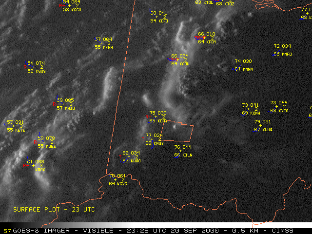
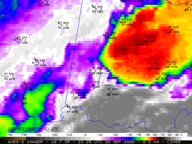
NOAA GOES-8 visible and InfraRed (IR) imager data (above) show the convection assocated with a squall line moving from Indiana into Ohio late in the day on 20 September 2000. A tornado touched down in Xenia, Ohio (in central Greene county - county outline shown) around 23:20 UTC (7:20 PM EDT), producing F4 damage.
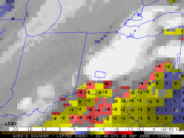
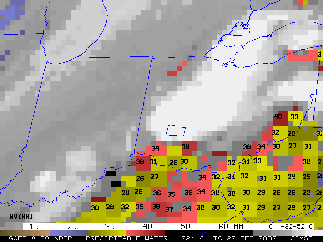
GOES-8 Sounder Lifted Index (LI) and Precipitable Water (PW) derived products (below) show that the air mass over southwestern Ohio was recovering from a convective outflow boundary earlier that afternoon. By 22:46 UTC (6:45 PM EDT), the LI values were -4 to -6 C (red enhancement) and the PW values were 34-38 mm / 1.4-1.5 inches (red enhancement) just south and southeast of the squall line.
|
|
