|
|
|
|
|
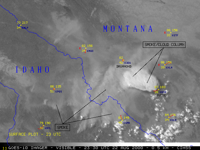
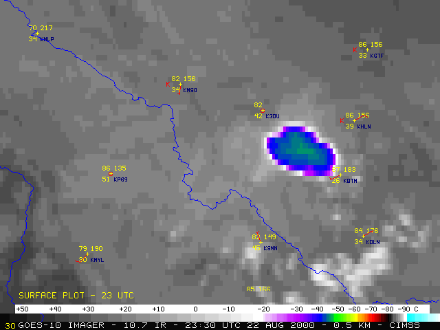
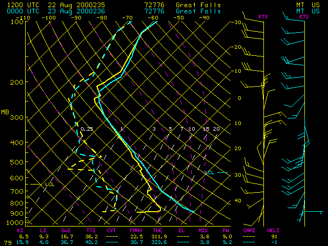
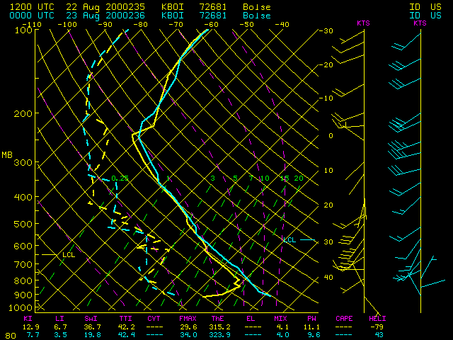
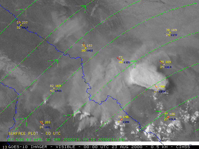
NOAA GOES-10 visible imagery (above, left) shows the development of a large smoke/cloud column over the 155,500 acre Valley Complex and the 33,500 acre Mussigbrod Complex fires in southwestern Montana late in the day on 22 Aug 2000. These particular fires had been burning since 31 July. GOES-10 InfraRed (IR) imagery (22:15 UTC | Animation) shows brightness temperatures associated with this smoke/cloud column quickly became as cold as -40 to -47.5 C (blue to light green enhancement), indicating that the top of this smoke/cloud column was near the 300 mb level (1-2 km below the tropopause on the Great Falls MT and Boise, ID rawinsonde reports). Southwesterly winds in the middle troposphere (500 mb streamlines) carried the smoke/cloud feature northeastward.
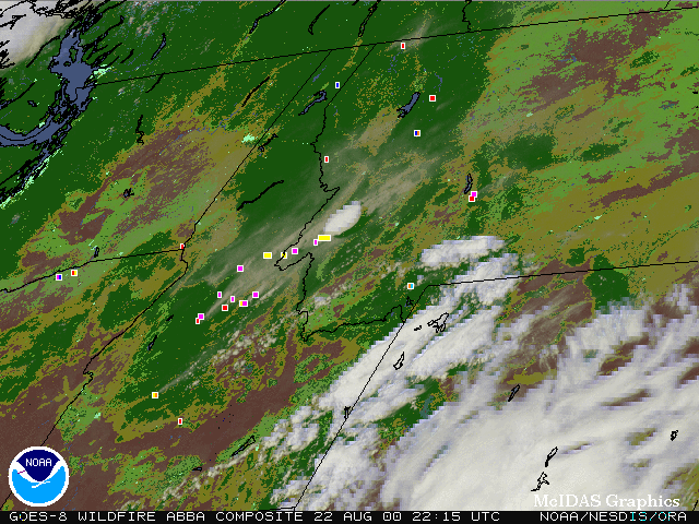
The experimental Wildfire Automated Biomass Burning Algorithm (ABBA) identified numerous fire pixels in GOES-8 imagery (above, right). Each image is an alpha-blended composite of GOES-8 multi-spectral imagery and a 1-km resolution global land cover characteristics ecosystem data base derived from 1-km Advanced Very High Resolution Radiometer (AVHRR) data. Saturated fires (yellow pixels) were evident over southwestern Montana from 19:45 to 23:15 UTC (1:45 PM to 5:15 PM CDT). These very hot fires were responsible for the large smoke/cloud column which formed around 21:15 UTC (3:15 PM MDT) and drifted northeastward across Montana. Smoke plumes are also visible from several other fires over Idaho and Montana.
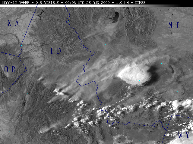
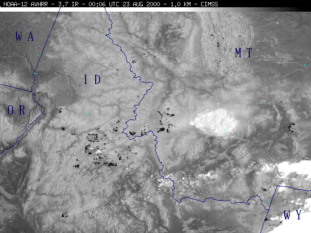
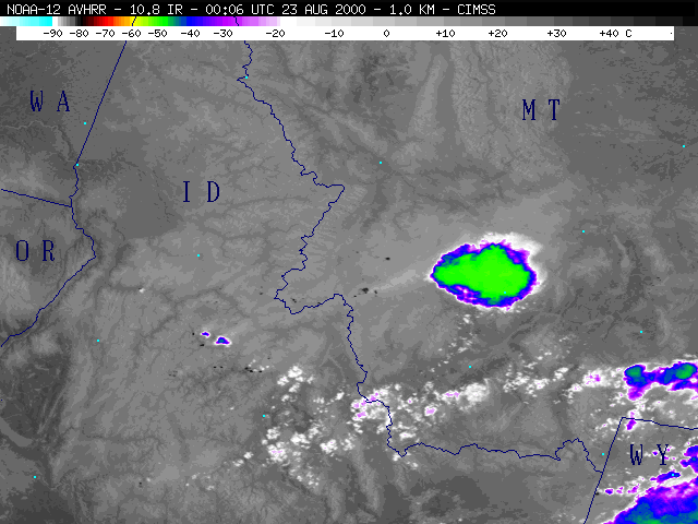
For comparison purposes, imagery from the 00:06 UTC (6:06 PM MDT) overpass of the NOAA-12 satellite are shown below. The 3.7 micrometer shortwave IR image shows several wildfire "hot spots" (black enhancement), including the very large cluster of hot spots in the region of southwestern Montana where the large smoke/cloud column formed. A similar smoke/cloud column was observed from the Valley Complex fires on August 6th.
|
|
|
 (- Fade between NOAA-12 visible, 3.7 IR, and 10.8 IR images -)

