|
|

|
|
|
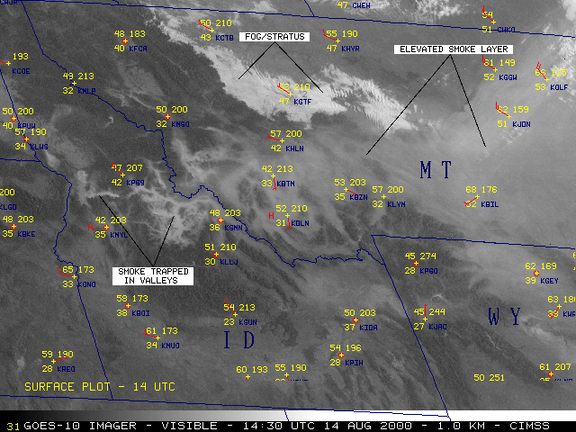
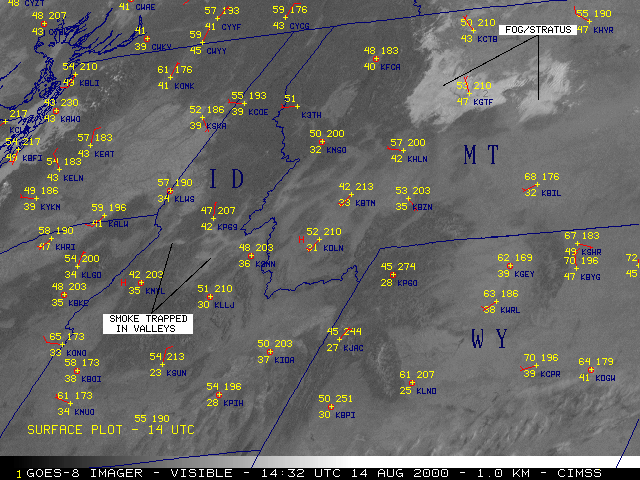
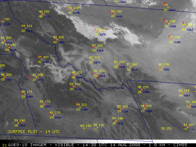
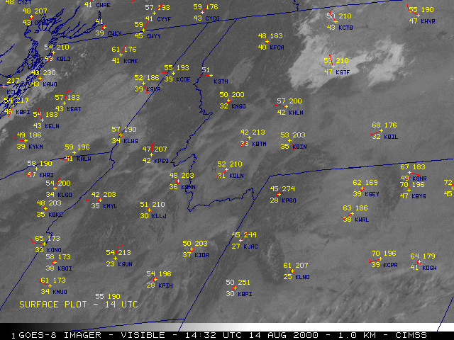
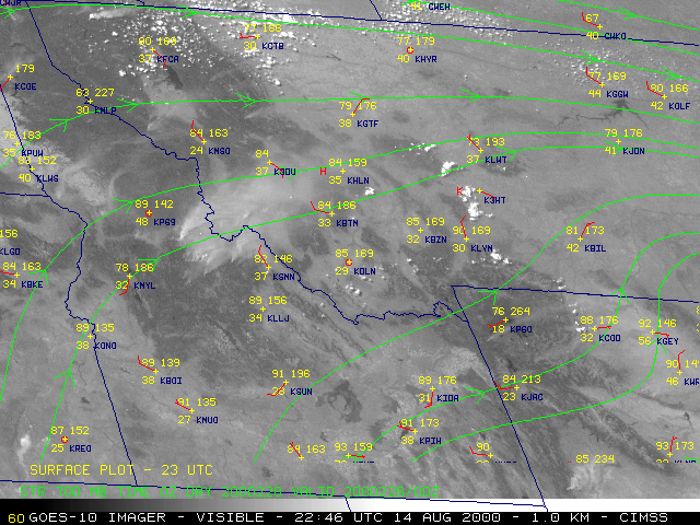
The NOAA GOES-10 and GOES-8 visible imagery (above) shows smoke from wildfires burning in parts of Idaho and Montana on 14 August 2000. Twenty-three large fires were burning in each of those states on that day, including the 129,000 hectare Clear Creek fire in Idaho and the 111,000 hectare Valley Complex fire in Montana.
During the morning hours, note that the thick smoke (hazy in appearance) over Idaho is restricted to the valleys -- calm winds during the overnight hours allowed the smoke from the previous day of burning to settle into these lower elevation areas. The smoke is more evident on GOES-10 than on GOES-8, primarily due to more forward scattering 1 of light which results from the larger sun-satellite viewing angle with GOES-10 early in the day (the visible detectors have also degraded over time on GOES-8, which is about 3 years older than GOES-10).
As wind speeds increased in response to daytime solar heating, the valley smoke was then ventilated and mixed upward into the boundary layer, where southwesterly winds transported the smoke northeastward across Montana. Rawinsonde data from Boise, ID showed the strong low-level temperature inversion in the morning (12:00 UTC), which helped to trap the smoke in the valleys. By afternoon (00:00 UTC), a deep boundary layer extended upward to just past the 700 millibar level [7.5 kft or 2.3 km above the surface]. Pilot reports from the area indicated that the top of the smoke layer was between 7-12 kft over Idaho, and 12-20 kft over Montana.
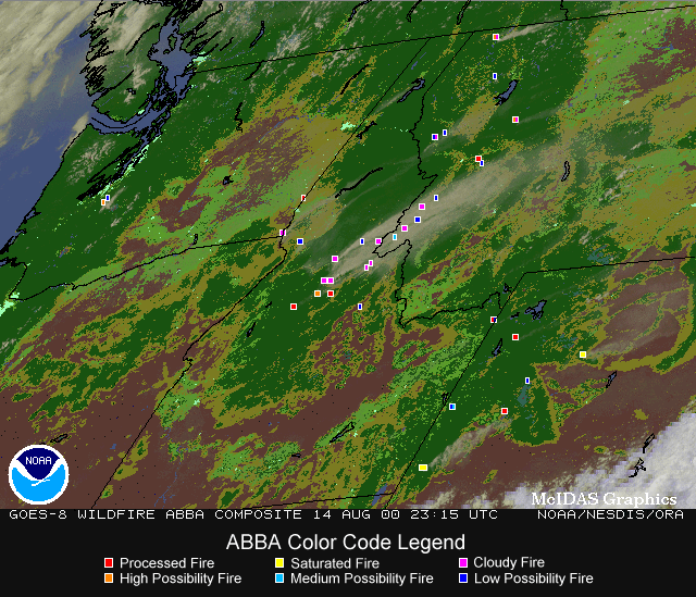
The experimental Wildfire Automated Biomass Burning Algorithm (ABBA) identified numerous fire pixels in GOES-8 imagery (below). The animation below of GOES-8 Wildfire ABBA composite products from 15:45 to 23:45 UTC shows an increase in fire activity throughout the day, especially in Idaho, Montana and Wyoming. Each image is an alpha-blended composite of GOES-8 multi-spectral imagery and a 1-km resolution global land cover characteristics ecosystem data base derived from 1-km Advanced Very High Resolution Radiometer (AVHRR) data.
|
References:
Some effects of the Yellowstone Fire Smoke Plume on Northeast Colorado at the End of Summer 1988, Segal, M., J. Weaver, and J. F. W. Purdom, Mon. Wea. Rev., 117, 2278-2284, 1989.
