This loop of GOES-10 10.7 micrometer InfraRed (IR) imagery shows the development of convection across southern Alberta on 14 July 2000. Rapid Scan Operations (RSO) were activated for GOES-10 that afternoon due to the potential of severe convection across Montana, so imagery is available at 5-minute intervals for much of this period.
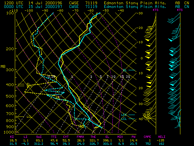
The Pine Lake (25 km southeast of Red Deer, station identifier CYQF) tornado occured from 23:45 to 01:15 UTC on 15 July ( 6:45 to 7:15 PM MDT on 14 July). At 23:11 UTC (5:11 PM MDT), the GOES-10 IR brightness temperature first became colder than -50 C (orange enhancement), which was close to the temperature of the tropopause (-51.5 C at 228 mb) on the Edmonton, Alberta rawinsonde report. A few images later (23:30 UTC/5:30 PM MDT, about 75 minutes prior to the Pine Lake tornado), an "Enhanced-V" cloud top signature became evident, which often indicates convection that is producing or will soon produce damaging winds, large hail, or tornadoes.