|
|
|
|
|
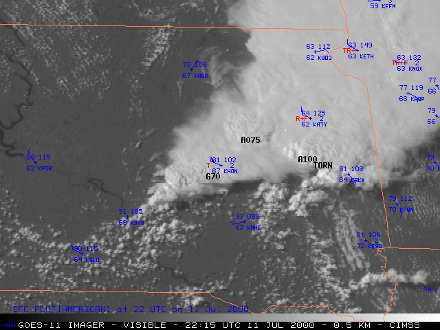
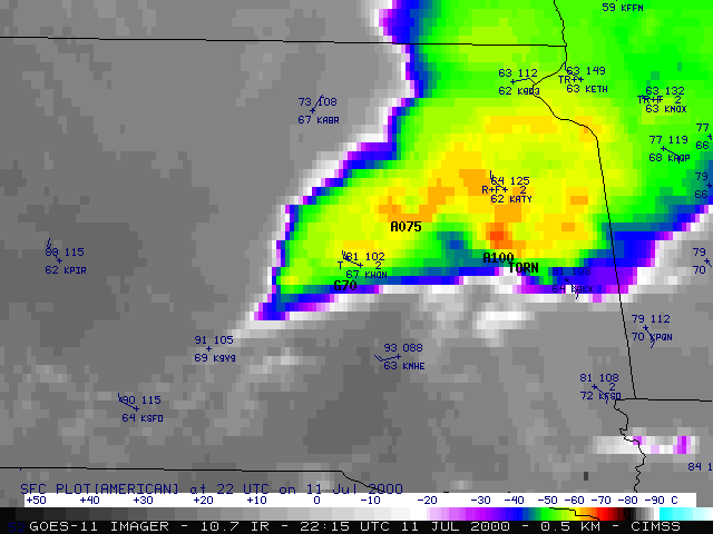
The recently-launched NOAA GOES-11 satellite is being evaluated during a 2-part Science Test during July and August 2000. The GOES-11 imager and sounder products shown here are from an outbreak of severe convection across eastern South Dakota on 11 July, which produced several tornadoes, large hail (up to 4 inches in diameter), and damaging winds (60-70 mph gusts). In addition, Aberdeen, SD set a daily precipitation record, receiving 1.95 inches of rainfall (in a 2-hour period). GOES-11 visible (above left) and 10.7 micrometer InfraRed (above, right) show the development of the convection along and ahead of a cold front that was moving southeastward across the region. Preliminary locations of severe weather at 22:15 UTC (+/- 5 minutes) are plotted on the static images above (TORN=tornado; A100=hail of 1.00 inch in diameter; G70=wind gust of 70 knots). Visible and IR features of interest are discussed on their respective Java animation pages (severe report locations will be added to the animation images soon...).
|
|
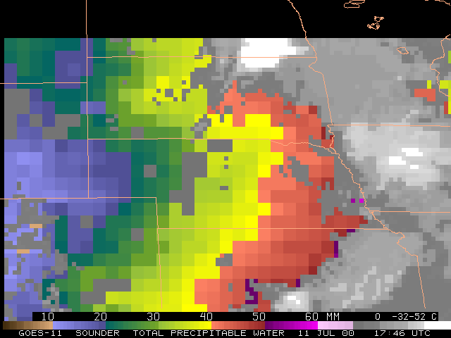
GOES-11 sounder Precipitable Water (above, left) shows that ample moisture (PW values greater than 40 mm [1.5 inches], red enhancement) was in place across eastern South Dakota during the afternoon hours. A moisture gradient associated with the developing warm frontal boundary in south-central South Dakota is also evident.
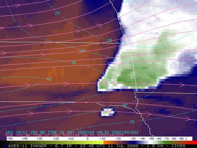
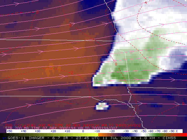
GOES-11 imager 6.7 micrometer IR, or "water vapor" imagery (above, right) shows warming/drying moving eastward across the region, associated with the advance of an upper-level jet streak (40 m s-1 at 250 mb). Upper level divergence ahead of the advancing jet streak indicated large-scale upward vertical motion across the region, which was favorable for convective development. Additional GOES-8 water vapor winds products for this event are available.


