|
|
|
|
|
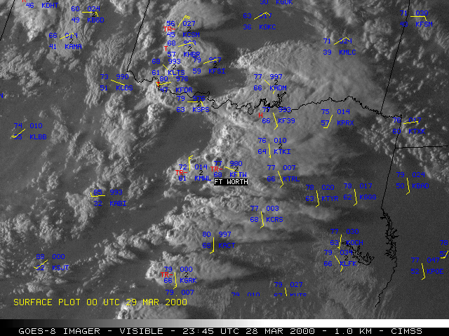
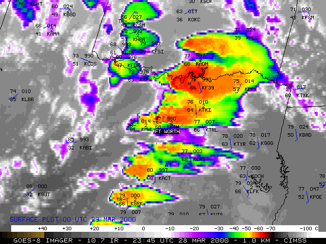
Several tornadoes occurred across northcentral and northeastern Texas on 28 March 2000, including an F2 tornado which moved through downtown Ft. Worth, Texas. NOAA GOES-8 visible and 10.7 micrometer InfraRed (IR) imagery (above) shows the development of strong convection ahead of a dry line which was moving eastward across Texas. Large hail was also reported with these storms across Texas, Oklahoma, and Louisiana, including hail of 4.5 inches in diameter at Ft. Worth TX, and 1.75 inches in diameter at Pruitt, OK and Bossier City, LA. The image fader shows that shadowing from overshooting cloud tops (visible) and an "enhanced-v" cloud top signature (IR) were evident about a half hour prior to the Ft. Worth tornado.
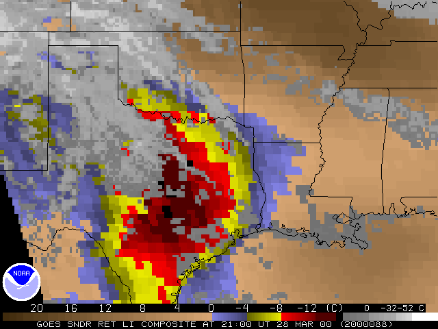
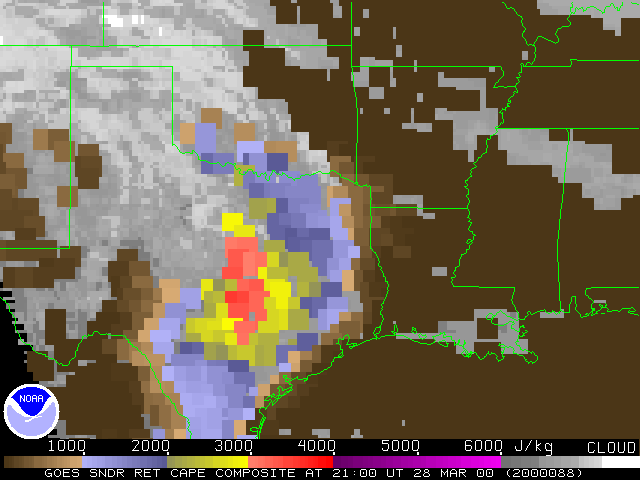
Derived products from the GOES-8 Sounder (below) show a large region of instability moving northward across eastern Texas during the late afternoon hours. Lifted Index (LI) values less than -8 C and Convective Available Potential Energy (CAPE) values of greater than 3000 J kg-1 were evident across this region. Ft. Worth rawinsonde reports showed the erosion of the low-level cap and the increase in lower tropospheric moisture during the afternoon hours. The trend of increasing lower-tropospheric moisture was also revealed by hourly GOES sounder precipitable water and GOES sounder temperature/moisture profiles.
|
|

