This website works best with a newer web browser such as Chrome, Firefox, Safari or Microsoft Edge. Internet Explorer is not supported by this website.

Archive: May 2019

Severe thunderstorms in Indiana and Ohio

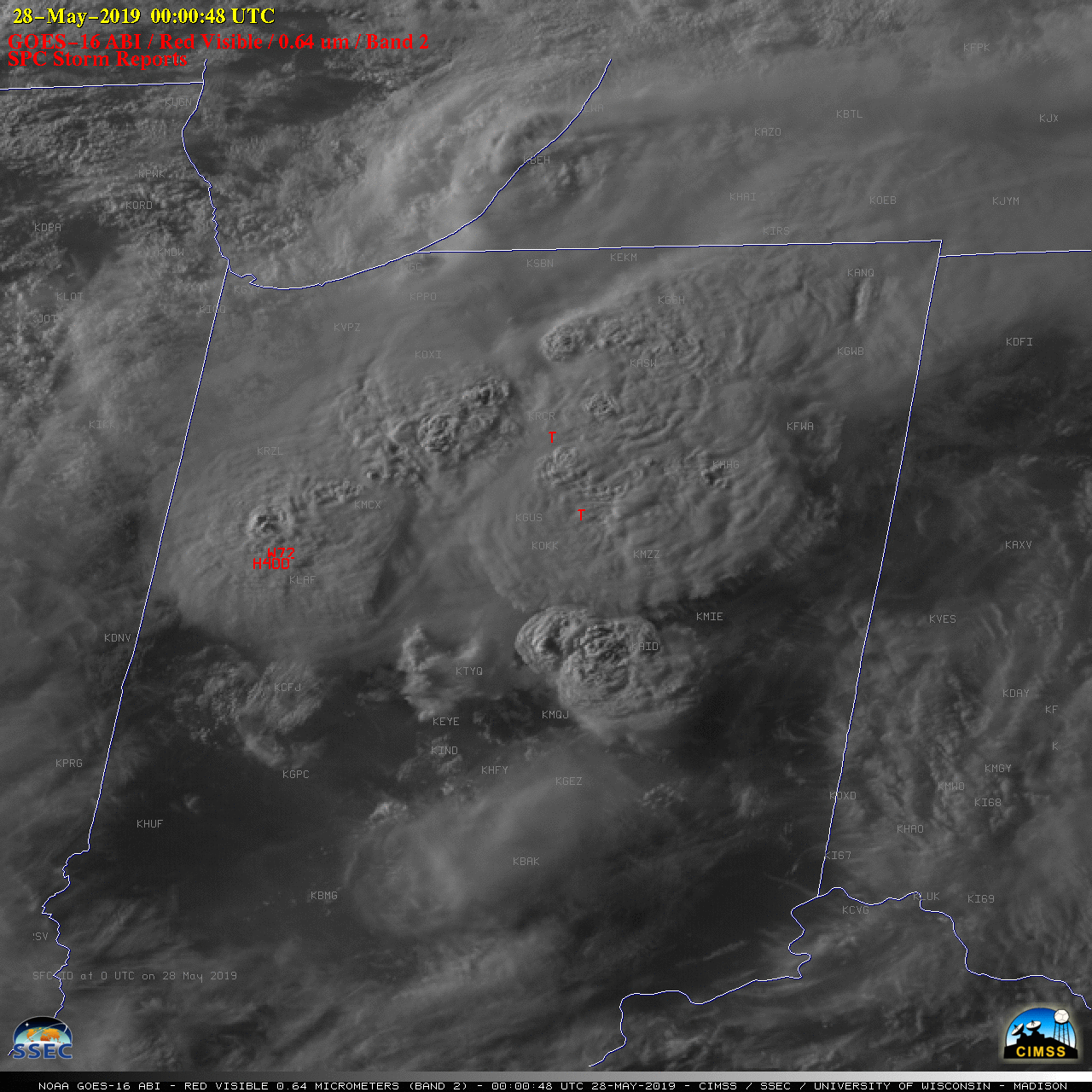
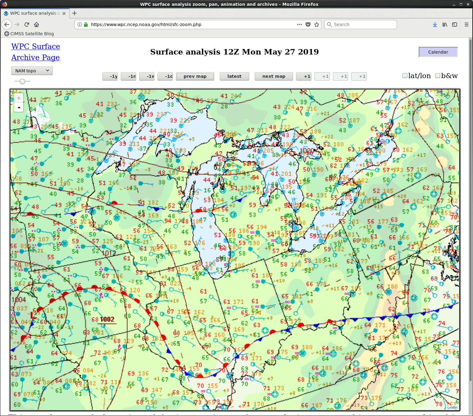
1-minute Mesoscale Domain Sector GOES-16 (GOES-East) “Red” Visible (0.64 µm) images (above) revealed supercell thunderstorms that developed within the warm sector of a midlatitude cyclone approaching from the Upper Midwest (surface analyses) — these thunderstorms produced a variety of severe weather (SPC Storm Reports | NWS Northern Indiana) across Indiana late in the day on 27 May 2019.Many of these storms... Read More

Severe thunderstorms across Oklahoma, Kansas and Missouri

1-minute Mesoscale Domain Sector GOES-16 (GOES-East) “Red” Visible (0.64 µm) images (above) showed the development of supercell thunderstorms that produced tornadoes, large hail and damaging winds (SPC Storm Reports) across parts of Oklahoma, Kansas and Missouri on 22 May 2019.GOES-16 “Clean” Infrared Window (10.35 µm) images (below) showed the storms as they persisted into the nighttime hours —... Read More