This website works best with a newer web browser such as Chrome, Firefox, Safari or Microsoft Edge. Internet Explorer is not supported by this website.

Archive: Jan 2014

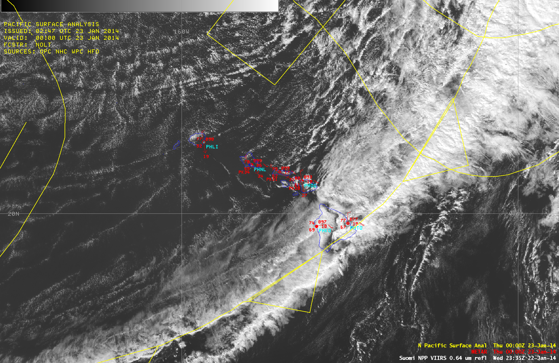
Strong cold front moves through the Hawaiian Islands

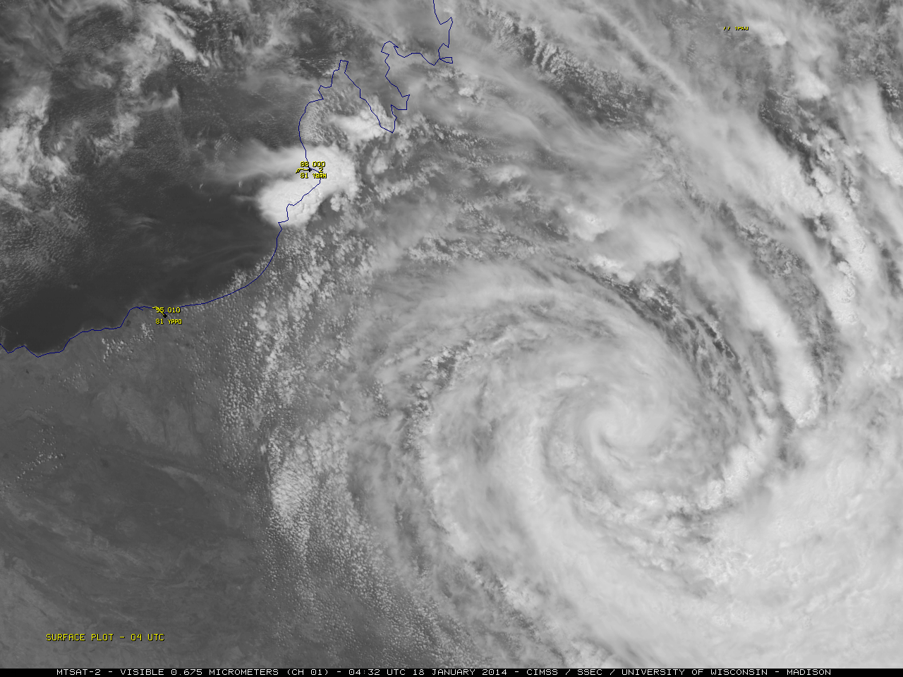
McIDAS images of 4-km resolution GOES-15 6.5 µm water vapor channel data (above; click images to play animation) showed the dramatic signature of rapid intensification of a very large mid-latitude cyclone over the eastern Pacific Ocean during the 20 January – 23 January 2014 time period.A comparison of AWIPS images... Read More

Mesoscale streaks of snow cover across Iowa and Missouri

A comparison of AWIPS images of Suomi NPP VIIRS 0.64 µm visible channel data with the corresponding false-color “snow-vs-cloud discrimination” Red/Green/Blue (RGB) product (above) revealed numerous northwest-to-southeast oriented mesoscale bands of snow on the ground (varying shades of red on the RGB image) across much of Iowa extending into northern... Read More