Short-term predictions of convective development
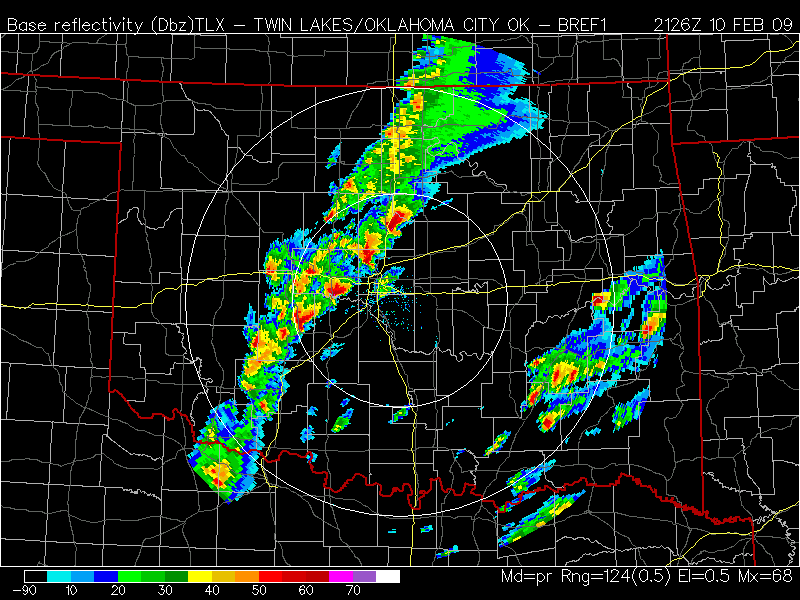
The 10 February 2009 tornado outbreak was noteworthy for the production of strong supercells in and around metropolitan Oklahoma City at a time of year when climatology argues against their presence. This tornado outbreak has been discussed previously on this blog, which includes visible and infrared satellite animations as well as TPW, LI and ozone products from the GOES sounder. The present blog entry discusses a... Read More
