Pyrocumulonimbus clouds in Brazil
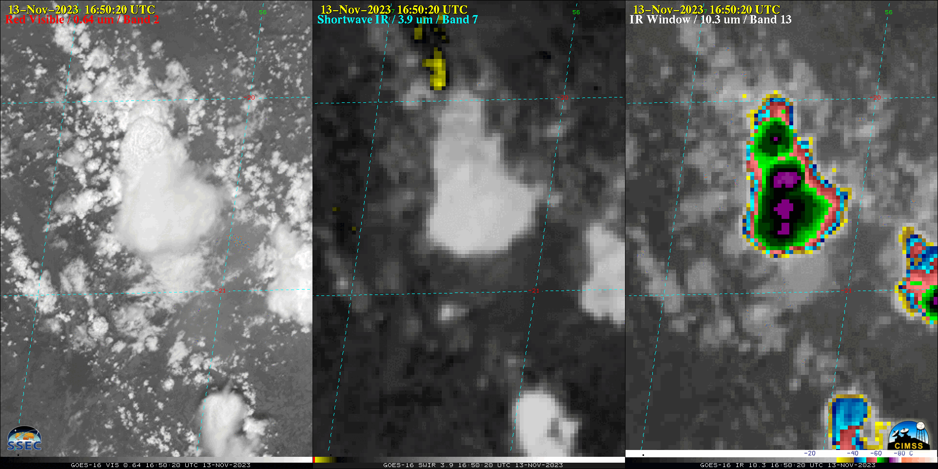
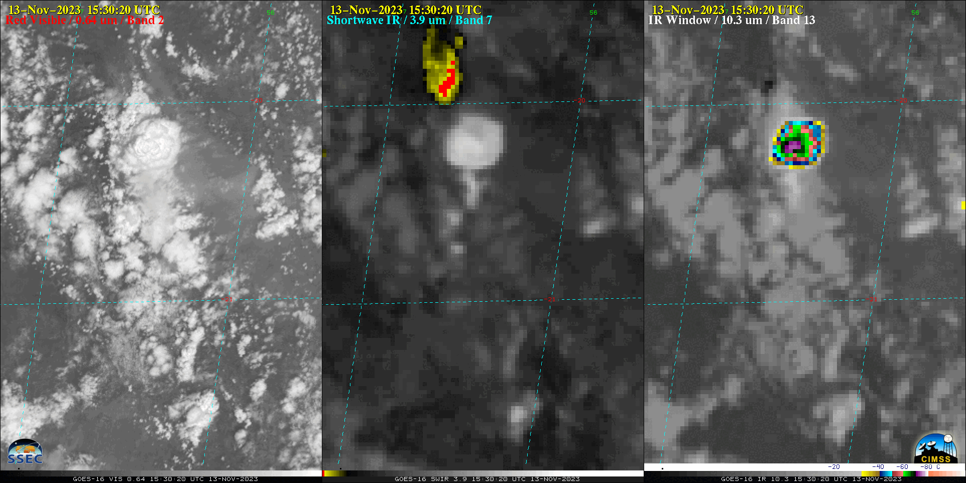
10-minute Full Disk GOES-16 (GOES-East) “Red” Visible (0.64 µm), Shortwave Infrared (3.9 µm) and “Clean” Infrared Window (10.3 µm) images (above) showed that a wildfire complex in southern Brazil produced a series of 4-5 pyrocumulonimbus (pyroCb) clouds on 13 November 2023. The coldest pyroCb cloud-top 10.3 µm brightness temperature was -74.4ºC at 1530 UTC.Regarding the wildfire... Read More
