In this lab, you will investigate the geometry between the sun and the earth. You will find links to 4 images taken from various strategic places on the earth's surface. The science objective is to understand how the solar zenith angle changes throughout the year at different locations. Please use sunearth.m as a means to justify some of the answers below. The Matlab objective is to take the existing sunearth.m script, decide what is useful, and write your own script. Note that sunearth.m was written using equations directly out of Ackerman's notes, so you can refer there for a description of the equations.
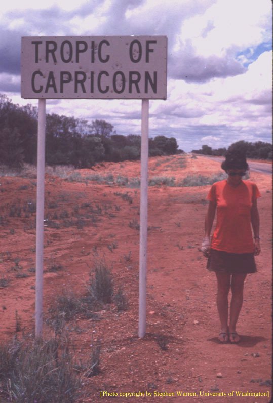
Image 1. Click on Image 1. This picture was taken in Australia. What time of day was it taken? Estimate the day of the year that it was taken. Use the information available in sunearth.m to determine the length of the day. Please turn in your script, even if it is only a few commands.
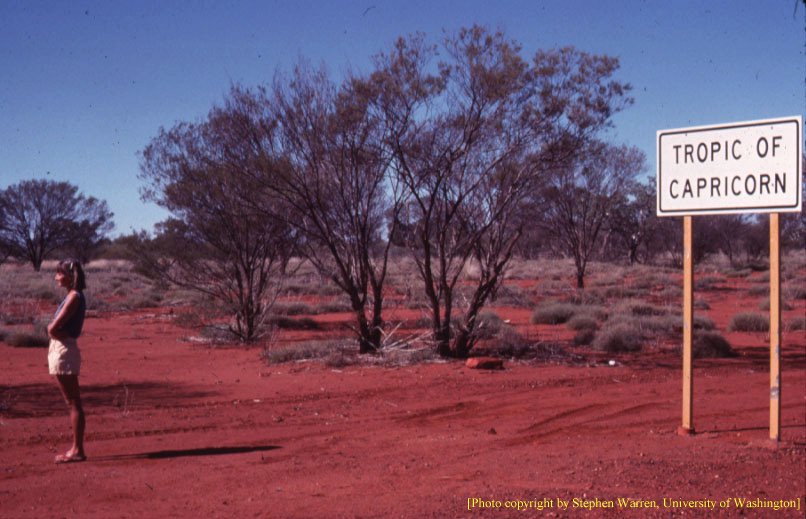
Image 2. Check out this image. It was also taken in Australia, but at a different time of year. How is this picture different from image 1? Again, estimate the day of the year that it was taken. You may need a ruler and some simple trigonometry to figure this out.
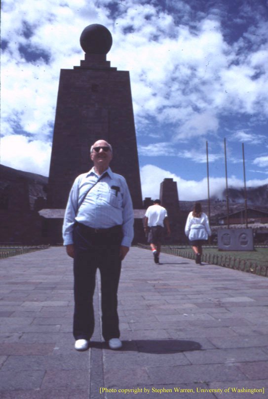
Image 3. This picture was taken at the equator (in Ecuador) at noon. The photographer was facing west. Estimate the day of the year that it was taken. Use the information available in sunearth.m to determine the solar zenith angle. Don't forget to turn in your Matlab script.
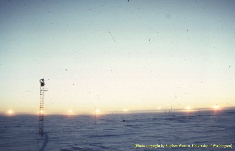
Image 4. This picture is actually many pictures in one. It is a multiple exposure taken at South Pole. What time of year was it taken? How long was this day (you don't need Matlab to answer this)?