 EXPLORE MORE!
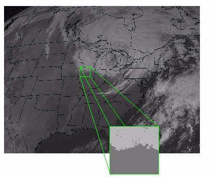 |
Click here or on the image to explore the properties of visible images. |
Visible satellite images depict sunlight scattered by objects
in the atmosphere or on Earth.
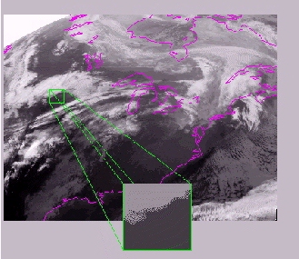 |
Click here or on the image to explore the properties of IR Images. |
Infrared (IR) satellite images depict radiation emitted by clouds, land or water.
|
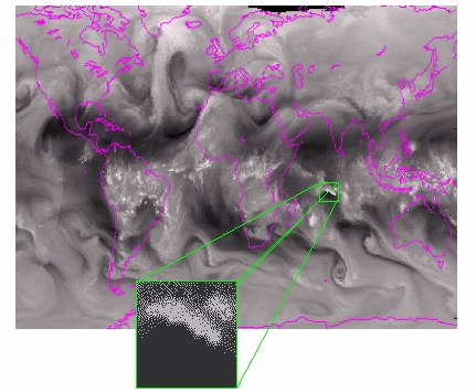
Click here or on the image to explore Water Vapor Images. |
On-line Satellite Curriculum:
For students: Satellite Meteorology for Grades 7-12
For science teachers G6-12: Satellite Applications in Geoscience Education
For students & teachers G9-16: Satellite Observations in Science Education
For students: Satellite Meteorology for Grades 7-12
For science teachers G6-12: Satellite Applications in Geoscience Education
For students & teachers G9-16: Satellite Observations in Science Education
Go BACK to the Explore the Atmosphere!